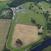
Scone Park
Temporary Camp (Roman)
Site Name Scone Park
Classification Temporary Camp (Roman)
Alternative Name(s) Scone Palace Policies
Canmore ID 28142
Site Number NO12NW 14
NGR NO 1044 2715
Datum OSGB36 - NGR
Permalink http://canmore.org.uk/site/28142
- Council Perth And Kinross
- Parish Scone
- Former Region Tayside
- Former District Perth And Kinross
- Former County Perthshire
NO12NW 14 1044 2715.
Dr St Joseph states that part of the NE side and the rounded N angle of a Roman temporary camp are visible at NO 104 272 on air photographs taken in 1952-3. A length of some 675ft of the NE side is visible, including a gate at which there is a tutulus, the remainder of the camp being concealed by a racecourse. (Inspection of the photographs suggests that St Joseph is referring to a dark cropmark extending from NO 1035 2724 to NO 1057 2715 as his 'NE side'.
J K St Joseph 1955.
Trial trenches dug in 1968-9 confirmed that most of the camp underlies the racecourse, but the whole of the W side, most of the S, and about half the N is known. The axial dimensions are 1,290ft N-S by more than 1,800ft. A gate is known in each of the N and S sides but their positions are not opposed, indicating that each of the two long sides has had two gates.
Size and plan leave no doubt that it belongs to the 63 acre class, and is therefore Severan.
J K St Joseph 1969; 1970.
Photographed by the RCAHMS.
Information from RCAHMS air photographs, PT 4668; PT 4716-7; flown 1976.
Field Visit (17 October 1963)
NO 1044 2715. No trace of the sides of this camp were seen on the ground but a slight dip was noticed at the fence line at NO 1056 2715. This agrees with the NE side of the camp as shown on the air photographs.
Visited by OS (W D J) 17 October 1963.
Field Visit (1 May 1975)
This site is in a low, flat field, at present under crop. Nothing is visible on the ground and no further information was obtained at the Estates Office.
Visited by OS (S F S) 1 May 1975.
Note (14 December 1992)
This Roman marching-camp whose existence was revealed by cropmarks detected from the air, lies on the level haughs of Scone Park on the left bank of the River Tay, about 400m S of the Roman temporary camp at Grassy Walls (NO12NW 8). A predominantly clay subsoil has restricted the amount of information to be gleaned from further aerial survey, the more so because most of the camp lies within the grounds of Perth Hunt Race Course (NO12NW 9.16). Trial excavation, however, has helped to confirm the whole of the camp's NW side and parts of the long NE and SW sides, demonstrating that the axial dimensions are about 395m by at least 600m. The position of three gates (each probably guarded by a traverse) has so far been identified, one in each of the long sides. The area occupied by the camp (at least 23.7 ha) and the relationship of the known gates to each other makes it evident that this was one of a series of bivouacs used by part of the army of the emperor Septimius Severus in AD 208-11.
Information from RCAHMS (JRS) 14 December 1992.
J K St Joseph 1955; J K St Joseph 1969; J K St Joseph 1970.
Publication Account (17 December 2011)
This camp was first discovered from the air by St Joseph in 1952 (St Joseph 1955: 87), lying on an area of flat ground east of the River Tay and now occupied by Perth Hunt Race Course. The camp of Grassy Walls lies about 300m to the north and the Roman fort of Bertha is situated across the Tay. Parts of three sides have been visible through cropmarks, and the camp measures at least 540m from WNW to ESE by 401m transversely, enclosing a minimum of 21.6ha (53 acres), and possibly some 25ha (63 acres). An entrance gap protected by a titulus is visible in the NNE side, and St Joseph recorded another in the SSW side (1969: 111), but this could not be identified from air photographs.
St Joseph placed a series of trenches through the SSW and NNE sides in 1968 and 1969, recording that the ditch was some 2.4m in width and about 1m in depth (RCAHMS St Joseph Collection: Notebook 5).
R H Jones.


