
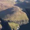
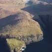
Mingulay; Lianamul; Bagh Na H-aoineig; Carnan


General View (Period Unassigned)
Site Name Mingulay; Lianamul; Bagh Na H-aoineig; Carnan
Classification General View (Period Unassigned)
Canmore ID 278954
Site Number NL58SW 13
NGR NL 549 836
Datum OSGB36 - NGR
Permalink http://canmore.org.uk/site/278954


- Council Western Isles
- Parish Barra
- Former Region Western Isles Islands Area
- Former District Western Isles
- Former County Inverness-shire

