Pricing Change
New pricing for orders of material from this site will come into place shortly. Charges for supply of digital images, digitisation on demand, prints and licensing will be altered.
Upcoming Maintenance
Please be advised that this website will undergo scheduled maintenance on the following dates:
Thursday, 9 January: 11:00 AM - 3:00 PM
Thursday, 23 January: 11:00 AM - 3:00 PM
Thursday, 30 January: 11:00 AM - 3:00 PM
During these times, some functionality such as image purchasing may be temporarily unavailable. We apologise for any inconvenience this may cause.
Lui Water
Kiln (Post Medieval), Township (Post Medieval)
Site Name Lui Water
Classification Kiln (Post Medieval), Township (Post Medieval)
Alternative Name(s) Mar Lodge Estate; Glen Lui; Wester Achavadie; Derry Lodge
Canmore ID 27761
Site Number NO09SE 5
NGR NO 050 926
Datum OSGB36 - NGR
Permalink http://canmore.org.uk/site/27761
- Council Aberdeenshire
- Parish Crathie And Braemar
- Former Region Grampian
- Former District Kincardine And Deeside
- Former County Aberdeenshire
NO09SE 5 050 926
Three-sided enclosure, 30m by 30m, abutting a three-partitioned longhouse 15m by 6m, with adjacent stone foundations. A longhouse with circular kiln on the bluff edge of 3m diameter, extremely well preserved and open to 2m depth. Longhouse 15m by 6m. Longhouses, 12m by 6m and 8m by 4m, each abutting a three-sided stone enclosure. Rig and furrow and many stone clearance heaps.
J S Smith 1987.
Footings of depopulated township on S- and SW-facing slope. Rectangular footings of structures with field banks, enclosures and areas of rig below head-dyke. Probably cleared c. 1776.
NMRS, MS/712/9.
Field Visit (24 June 1993)
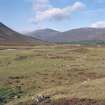
This is the most westerly of a group of five townships on the N side of the Lui Water. It consists of five buildings and a kiln set amongst a group of small enclosures on a terrace above the floor of the glen, with areas of rig cultivation to the NW and SE, all enclosed within a head dyke which continues the line of the dyke enclosing township NO09SE 4. On the hillside beyond the head dyke there are three more buildings.
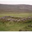
The five buildings in the main group (MAR93, 66-70), centred at NO 0505 9260, range from 5.5m to 11.6m in length and from 2.9m to 3.7m in breadth within faced-rubble walls up to 1m in thickness. The walls tend to be embanked with turf on the upslope (N) side, and where they are visible the corners are rounded. One building (MAR93 67) has a window, and another (MAR93 68) appears to have had a porch outside its entrance. A mound outside this building, and another outside a further building (MAR93 70), are probably middens. One building (MAR93 69) has been reduced to boulder footings, and may belong to an earlier phase, perhaps contemporary with two structures which are partly overlain by buildings MAR93 68 and 70. The kiln (NO 0503 9259; MAR93 65) stands at the SW edge of this group. Its circular bowl, set into the hillside, measures 1.6m in depth and 1.6m in diameter within a faced-rubble wall 1.4m in thickness. The flue is on the E side, where there is an attached barn 3.6m in length by 2.4m in breadth within walls 0.9m in thickness.
These buildings stand between, and around, two subrectangular enclosures, partly defined by stony banks. Immediately to the W and to the SE areas of hillside have been cleared of stone, that to the SE having traces of rig cultivation. A trackway leads NW from the buildings towards another area of ridging about 150m away, and rigs are visible on the haughland below the settlement to the SW.
The three buildings (MAR93 38-40) beyond the head-dyke are all set into the predominately S-facing slope, and aligned along the contour. Two are just beyond the dyke, while the third, (MAR93 40), is some distance up the hill at NO 0521 9270. They measure between 5.5m and 7.2m in length and from 2m to 2.1m in breadth within faced-rubble walls 0.8m in thickness. One building (MAR93 40) has square corners, but the other two have rounded corners and embanked walls.
A map of the Forrest of Mar by John Farquharson, dated 1703 (National Library of Scotland), indicates three settlements in this area of Glen Lui. The township may be that depicted on Roy's map (Roy 1747-55) as Achavadie, which may be Ach a' Mdadaidh in gaelic (Watson and Allan 1984). The 18th century estate rental lists an Easter and Wester Auchavrie (Aberdeen University Library, MS 3175), of which this must be Wester if NO 09SE 4 is Easter.
(MAR93 38-40, 65-70)
Visited by RCAHMS (SDB) 24 June 1993.


