Pricing Change
New pricing for orders of material from this site will come into place shortly. Charges for supply of digital images, digitisation on demand, prints and licensing will be altered.
Upcoming Maintenance
Please be advised that this website will undergo scheduled maintenance on the following dates:
Thursday, 9 January: 11:00 AM - 3:00 PM
Thursday, 23 January: 11:00 AM - 3:00 PM
Thursday, 30 January: 11:00 AM - 3:00 PM
During these times, some functionality such as image purchasing may be temporarily unavailable. We apologise for any inconvenience this may cause.
Castlelaw Hill
Trench (First World War)(Possible), Trench(S) (20th Century)
Site Name Castlelaw Hill
Classification Trench (First World War)(Possible), Trench(S) (20th Century)
Alternative Name(s) Woodhouselee Hill
Canmore ID 277346
Site Number NT26SW 138
NGR NT 23358 64337
NGR Description Centred NT 23358 64337
Datum OSGB36 - NGR
Permalink http://canmore.org.uk/site/277346
- Council Midlothian
- Parish Glencorse
- Former Region Lothian
- Former District Midlothian
- Former County Midlothian
NT26SW 138 centred 23358 64337
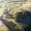
Extensive remains of practice trenches, probably dating to between the first and second world wars, and small areas of ground where the turf has been removed to form fox-holes or bivouacs, including some of very recent date, are visible in woodland and open fields on the E flank of Castlelaw Hill and on the S flank of Woodhouselee Hill. In addition, a concentration of craters, probably the result of mortar-bomb practice, is visible, though now enshrouded in gorse, at NT 23277 64481.
Visited by RCAHMS (AGCH), 7 June 2005.
Publication Account (2006)
There has been a military presence in this part of the Pentland Hills for about ninety years, following the requisition of the Dreghorn Estate by the War Department in 1914. The Dreghorn ranges, in the north part of the CDTA, were decommissioned and bull-dozed flat about 1985, and small-arms training was concentrated at Castlelaw, where two new ranges replaced the old single range. Traces of that range, including the 600 yard firing-line marker (fig 10), can still be seen in the pasture fields to the south of the modern ranges.
One of the features of training areas that were in use around the time of the Great War are practice trench systems, which were presumably dug by trainees in anticipation of undertaking real trench warfare. Formerly,there were several trench systems at Dreghorn, but these have largely been removed, leaving the system at Castle Knowe the best-preserved example in the CDTA. The surviving remains indicate that the trenches here, as well as at Dreghorn, were dug to designs set out in official manuals, including British Trench Warfare 1917–1918, which was published by the General Staff at the War Office and details the specifications for different forms of trench.
The practice trenches at Castlelaw (fig 11) enclose a roughly square area up to 120m across, and the trenches are visible as hollows little more than 1m in breadth and 0.2m in depth. The trenches forming the noth-east and south-west sides of the area form an ‘equal trench and traverse’ pattern, with further, short runs of trench branching off. These may be interpreted as practice front-line and support trenches. The trenches forming the northwest and south-east sides of the square, together with a third, which runs across the middle of the area from noth-east to south-west, probably mimic communication trenches. They are zigzag on plan and they also have short branches springing off them.
Information from 'The Royal Commission on Ancient and Historical Monuments of Scotland: Field Guide 2006'.
Project (March 2013 - September 2013)
A project to characterise the quantity and quality of the Scottish resource of known surviving remains of the First World War. Carried out in partnership between Historic Scotland and RCAHMS.


