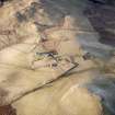
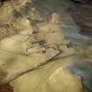
Accessibility

Font Size

100% 150% 200%

Background Colour

Default Contrast
Close Reset

Whitefield Castle

Farmstead (Medieval) - (Post Medieval)

Site Name Whitefield Castle

Classification Farmstead (Medieval) - (Post Medieval)

Canmore ID 27601

Site Number NO06SE 38

NGR NO 08921 61806

Datum OSGB36 - NGR

Permalink http://canmore.org.uk/site/27601

Ordnance Survey licence number AC0000807262. All rights reserved.
Canmore Disclaimer. © Bluesky International Limited 2025. Public Sector Viewing Terms

Toggle Aerial | View on large map

Digital Images

Whitefield Castle, NO06SE 38, Ordnance Survey index card, Recto
Whitefield Castle, NO06SE 38, Ordnance Survey index card, RectoOblique aerial view centred on the remains of the farmstead, buildings and tower-house, with the remains of the farmstead adjacent, taken from the NE.Oblique aerial view centred on the remains of the farmstead, buildings and tower-house, with the remains of the farmstead adjacent, taken from the SW.Oblique aerial view centred on the remains of the farmstead, buildings and tower-house, with the remains of the farmstead adjacent, taken from the E.Oblique aerial view centred on the remains of the farmstead, buildings and tower-house, with the remains of the farmstead adjacent, taken from the NE.Oblique aerial view centred on the remains of the farmstead, buildings and tower-house, with the remains of the farmstead adjacent, taken from the NW.Oblique aerial view centred on the remains of the farmstead, buildings and tower-house, with the remains of the farmstead adjacent, taken from the SW.Oblique aerial view centred on the remains of the farmstead, buildings and tower-house, with the remains of the farmstead adjacent, taken from the ESE.Oblique aerial view centred on the remains of the farmstead, buildings and tower-house, with the remains of the farmsteads adjacent, taken from the E.Oblique aerial view centred on the remains of the farmstead, buildings and tower-house, with the remains of the farmstead adjacent, taken from the SSE.Scanned image of oblique aerial view centred on the remains of the farmstead, buildings and tower-house, with the remains of the farmstead adjacent, taken from the SSE.

Administrative Areas

  • Council Perth And Kinross
  • Parish Kirkmichael (Perth And Kinross)
  • Former Region Tayside
  • Former District Perth And Kinross
  • Former County Perthshire

Activities

Field Visit (January 1989)

NO06SE 38 088 618.

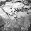
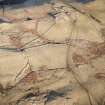
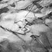
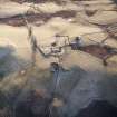
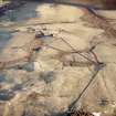
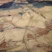
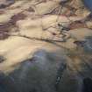
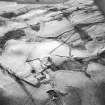
This farmstead is situated 110m N of Whitefield Castle and comprises three single compartment buildings, all reduced to their turf-covered wall-footings. Two of the buildings are set end-on to each other and measure 13.4m (10.3m over an outshot) by 5.8m and 7.7m by 4.6m overall respectively; the third building is set at right angles to them and measures 14m by 6.2m overall.

Visited by RCAHMS (PC) January 1989.

RCAHMS 1990

References

MyCanmore Image Contributions


Contribute an Image

MyCanmore Text Contributions