Pricing Change
New pricing for orders of material from this site will come into place shortly. Charges for supply of digital images, digitisation on demand, prints and licensing will be altered.
Craigsheal Burn
Field System (Prehistoric) - (Early Medieval), Hut Circle(S) (Prehistoric), Pitcarmick Building (Early Medieval)
Site Name Craigsheal Burn
Classification Field System (Prehistoric) - (Early Medieval), Hut Circle(S) (Prehistoric), Pitcarmick Building (Early Medieval)
Canmore ID 27373
Site Number NO05SE 16
NGR NO 07007 51552
Datum OSGB36 - NGR
Permalink http://canmore.org.uk/site/27373
- Council Perth And Kinross
- Parish Clunie
- Former Region Tayside
- Former District Perth And Kinross
- Former County Perthshire
Field Visit (6 February 1975)
Centred at NO 070 515 is a settlement of three hut circles ('A'-'C') within a contemporary field system marked by numerous stone clearance heaps and occasional lynchets and ruinous walls.
Hut 'A', c. 16.0m in diameter, is overlaid by a poorly preserved "longhouse" (21.0m E-W by 5.5m wide with bowed walls and rounded gables) which has totally destroyed the E arc of the hut.
'B' is a double-walled hut levelled into the W- facing slope in the same fashion as hut 'D' of NO 15 NE 10. It measures c. 10.5m internally and 20.5m N-S by 19.0m E-W between the centres of the outer wall. The entrance is in the S arc.
'C' is visible as a platform surrounded by traces of walling measuring 11.5m in diameter between its centres. A field wall joins the SE arc. Entrance not evident.
Surveyed at 1/10,000.
Visited by OS (AA) 6 February 1975
Field Visit (17 June 1987)
Situated on heather-covered SW-facing slopes and terraces there are the remains of three hut-circles surrounded by a field-system of small cairns and stony banks; one of the hut-circles is overlain by a large building.
1. NO 0721 5158 (OS 'A') This hut-circle is situated on a low rise towards the rear of a terrace. Its wall has been reduced to little more than an external scarp, which is boulder-faced on the SW. No trace of an inner wall-face or entrance is visible, the interior of the hut-circle largely being occupied by a long building. The overall diameter of the hut-circle is 16.7m, placing it within the size range of the double-walled hut-circle. The later building measures about 19.5m in length and varies in width from 3.7m at the NW end to 4.3m midway along its length and 3.2m at the SE end within a low heather-covered wall up to 0.9m in thickness and 0.2m in height. The entrance is in the SW side some 7m from the NW end.
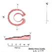
2. NO 0701 5155 (OS 'B') This double-walled hut-circle measures 10m in diameter within a poorly-preserved inner wall, and is levelled into a SW-facing slope. At the front the inner wall forms little more than a low bank, and at the rear a well-defined scarp some 0.3m high. Overall the hut-circle measures about 22m N-S by 18.8m transversely; on average the outer wall is 1.4m thick and 0.4m high, but immediately N of the entrance, which is on the SSW, it expands to a thickness of 4m. The entrance has an outward splay and is faced with boulders.
3. NO 0690 5153 (OS 'C') This poorly-preserved hut-circle measures about 9.3m in diameter within a low bank of boulders. The hut-circle was covered with a growth of heather on the date of visit and the entrance was not visible. Close to the SE side there is one of the stony banks of the surrounding field-system.
Visited by RCAHMS (JRS) 17 June 1987.
RCAHMS 1990


