
Following the launch of trove.scot in February 2025 we are now planning the retiral of some of our webservices. Canmore will be switched off on 24th June 2025. Information about the closure can be found on the HES website: Retiral of HES web services | Historic Environment Scotland
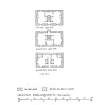
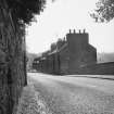
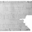
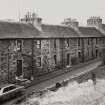
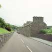
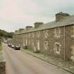
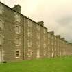
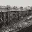
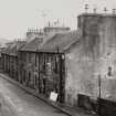
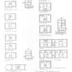
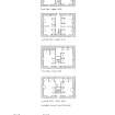
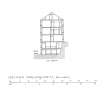
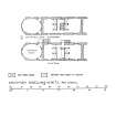
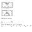
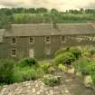
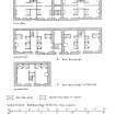
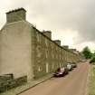
New Lanark, New Lanark Road, 7 Braxfield Row


Terraced House (18th Century)
Site Name New Lanark, New Lanark Road, 7 Braxfield Row
Classification Terraced House (18th Century)
Alternative Name(s) 92-94 New Lanark Road; New Lanark Mills; New Lanark Industrial Village
Canmore ID 268992
Site Number NS84SE 58.42
NGR NS 87842 42752
Datum OSGB36 - NGR
Permalink http://canmore.org.uk/site/268992


- Council South Lanarkshire
- Parish Lanark
- Former Region Strathclyde
- Former District Clydesdale
- Former County Lanarkshire
NS84SE 58.42 87842 42752
See also NS84SE 58.37-58.41 and NS84SE 58.43-58.45.
NS84SE 58.42 NS 87842 42752 7 Braxfield Row
Originally Part of:
NS84SE 58.13 NS 87887 42713 1 Braxfield Row

