
Dunning, St Serf's Church And Churchyard


Burial Ground (Early Medieval), Church (Early Medieval), Cross Slab (Early Medieval), Session House (Period Unknown), War Memorial (20th Century), Branks (Period Unassigned)
Site Name Dunning, St Serf's Church And Churchyard
Classification Burial Ground (Early Medieval), Church (Early Medieval), Cross Slab (Early Medieval), Session House (Period Unknown), War Memorial (20th Century), Branks (Period Unassigned)
Alternative Name(s) Dunning Parish Church, War Memorial
Canmore ID 26683
Site Number NO01SW 13
NGR NO 01905 14490
Datum OSGB36 - NGR
Permalink http://canmore.org.uk/site/26683


First 100 images shown. See the Collections panel (below) for a link to all digital images.
- Council Perth And Kinross
- Parish Dunning
- Former Region Tayside
- Former District Perth And Kinross
- Former County Perthshire
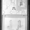
Dunning (St Serf), Perthshire, cross-slab
Measurements: H 1.18m, W 0.48m, D 0.14m
Stone type: sandstone
Place of discovery: NO 0190 1449
Present location:
Evidence for discovery: found in the later nineteenth century and recorded in ECMS as inside the church porch.
Present condition: one end broken and carving very worn.
Description
This slab may have been a recumbent gravestone with a cross at either end. Face A is carved with a ringed cross with small rounded armpits within a flatband border, and half of a similar cross exists at the other end. Narrow faces B and D bear a plait pattern.
Date: tenth century or later.
References: ECMS pt 3, 319.
Compiled by A Ritchie 2016
NO01SW 13.00 01905 14490
(NO 0190 1448) Church (NAT)
OS 6" map, (1959).
NO01SW 13.01 NO 0181 1439 Manse
The church of Dunning dedicated to St. Servanus, or St. Serf, has a Norman Tower, and the west gable wall, and part of the north and east walls are original. The church was first mentioned in AD. 1219. It originally possessed a chancel, remains of which were recently found. Attached to the wall outside the church is a Branks (Holland 1918), and inside the porch is a cross-slab sculptured on three faces.
D MacGibbon and T Ross 1896-7; J R Allen and J Anderson 1903; T H Holland 1918.
St. Serf's church, still in use, is as previously described.
The cross-slab is inside the church and measures 1.2m high by 0.5m x 0.1m. The branks are attached to the outside of the church yard wall, at NO 0188 1447.
Visited by OS (W D J) 5 November 1965.
Dunning (Dunblane) was granted to Inchaffray by Gilbert, Earl of Strathearn, shortly after its foundation in c. 1200; the church was confirmed to the canons in 1203. Corporal possession of the church had not been obtained in 1234, but must have been obtained shortly after, as a vicarage settlement takes place in 1239. Both parsonage and vicarage continued with the abbey at the Reformation, the cure being a vicarage pensionary.
I B Cowan 1967.
NO 0190 1448 A watching brief was undertaken in February 2001 during minor excavations at St Serf's Church (NMRS ) with reference to the laying in of waste water pipes. The site of the works consisted of an external staircase positioned against the N wall of the nave. The excavations took place below the stair in the space between the outer face of the nave and the external stair support wall, an area which appeared to be made up of loose infill deposits.
The work involved the excavation of the whole area below the stair to a depth ranging from 300-450mm. The site of the present excavations has obviously been heavily disturbed on more than one occasion, with the subsequent removal of topsoil levels.
Sponsor: Historic Scotland
D Stewart and G Ewart 2001.
NO 019 144 A watching brief was undertaken in March 2002 during the excavation of pipe trenches through the graveyard at the NW corner of St Serf's Church ( ). The trenches clearly cut through previously disturbed material. The structural elements comprised a ruined wall and broken step slab. It seems likely that the wall is part of a demolished boiler house known to have sat in the angle between the N transept and the external stair against the nave N wall. The rubbish surrounding the structure reflects the recent clearance of this end of the site. The slab seems an original step from the original external stair. It was probably left in situ due to its derelict state.
Archive to be deposited in the NMRS.
Sponsor: HS
G Ewart 2002.
NO 019 144 The installation of a small display board was monitored in August 2004. The board was located on the path,
towards the entrance to the graveyard enclosure, but nothing of archaeological interest was revealed within the shallow cutting required for its erection.
Archive to be deposited in the NMRS.
Sponsor: HS.
G Ewart 2004.
NO01SW 13.00 01905 14490
NMRS REFERENCE:
Dunning, St.Serf's Church.
Plans: Copies of plans in Scottish Record Office. HR560/1 - Plan of 1735 as divided by heritors.
- Plan of 1811 as divided by heritors.
- Plan of 1817 showing proposed new aisle.
NMRS Printroom.
W. Schomberg Scott Photograph Collection.
2 views, one of them duplicated. Acc no 1997/39.
EXTERNAL REFERENCE:
Scottish Record Office.
Dunning, St. Serf's Parish Church.
Letter calling a meeting to consider repairs to the Church. Receipt for said repairs.
1850, 1853. GD16/46/111.
Repair of the Parish Church.
Note of payments, amounting to #445.2.4 made by Lord Rollo at 'sundry times' for repair work.
1798-1812. GD 56/163/9.
Building of the Session House at the Church.
Note of payment to Matthew Lawson of Lord Rollo's proportion of the cost.
1838. GD56/163/6 page 36.
Photographic Survey (February 1957)
Photographic survey by the Scottish National Buildings Record/Ministry of Work in February 1957.
Excavation (1985)
Kirkdale Archaeology was called out to perform an excavation in advance of pipe laying and service installation for St Serf's Church. There was little sign of the Medieval presence on the site, either in terms of structures or artifacts. Most of the existing ground surface reflects late leveling associated with access to the East and North aisles of the Church.
G Ewart 1985
Sponsor: Historic Scotland
Kirkdale Archaeology
Watching Brief (15 February 2001 - 22 February 2001)
NO 0190 1448 A watching brief was undertaken in February 2001 during minor excavations at St Serf's Church with reference to the laying in of waste water pipes. The site of the works consisted of an external staircase positioned against the N wall of the nave. The excavations took place below the stair in the space between the outer face of the nave and the external stair support wall, an area which appeared to be made up of loose infill deposits.
The work involved the excavation of the whole area below the stair to a depth ranging from 300-450mm. The site of the present excavations has obviously been heavily disturbed on more than one occasion, with the subsequent removal of topsoil levels.
D Stewart and G Ewart 2001
Sponsor: Historic Scotland
Kirkdale Archaeology
Watching Brief (5 March 2002 - 19 March 2002)
NO 019 144 A watching brief was undertaken in March 2002 during the excavation of pipe trenches through the graveyard at the NW corner of St Serf’s Church (NO 01 SW 13.0). The trenches clearly cut through previously disturbed material. The structural elements comprised a ruined wall and broken step slab. It seems likely that the wall is part of a demolished boiler house known to have sat in the angle between the N transept and the external stair against the nave N wall. The rubbish surrounding the structure reflects the recent clearance of this end of the site. The slab seems an original step from the original external stair. It was probably left in situ due to its derelict state.
G Ewart 2002
Sponsor: Historic Scotland
Kirkdale Archaeology
Watching Brief (26 August 2004)
NO 019 144 The installation of a small display board was monitored in August 2004. The board was located on the path, towards the entrance to the graveyard enclosure, but nothing of archaeological interest was revealed within the shallow cutting required for its erection.
G Ewart 2004
Sponsor: Historic Scotland
Kirkdale Archaeology
Watching Brief (12 March 2009 - 24 March 2009)
Two visits were made to St Serf's Church, Dunning to monitor remedial works on a drain running under a path through the graveyard to the northwest of the church. The area had been much disturbed during the original installation of the drain and there were no finds or features of archaeological significance.
Information from OASIS ID: kirkdale1-249696 (C Casey) 2009
Excavation (6 August 2012 - 26 August 2012)
NO 0191 1453 and NO 0187 1457 A 10 x 5m trench (SS12.01) was excavated, 6–26 August 2012, against the N exterior churchyard wall of St Serf’s Parish Church on Kirk Wynd. This was placed to assess the origins of the curvilinear enclosure of the churchyard specifically, and the nature of surviving medieval deposits in general. The area was found to be severely disturbed by modern settlement, including dumping of demolition debris as levelling for the road. The foundations of a 20th-century roadworkers’ shed built with reused railway sleeper beams was revealed in plan. Discrete spreads of coal and sand were also associated with this structure and later use of this area as storage yards for the adjacent builders who currently own this strip of land. No certain trace of the roofed structure depicted in this position on the 1st Edition OS map was found, and the shallow stratigraphy of irregular pits dug into the natural gravel indicates severe truncation of archaeological deposits in this area since the 19th century. Patches of potentially undisturbed ground revealed two large pits, >1m deep, were filled with alternating layers of a loose silty clay, one with a long, thin stone slab placed upright along the N side. These may relate to their use in the weaving industry which was associated with this area of the village. A medieval/post-medieval stone spindle whorl was found here which supports this interpretation.
Trench SS12.02 was opened 11m to the E along the churchyard wall, revealing an unmortarted stone wall surviving up to two courses, with sterile ground to the W and pits full of charcoal and modern midden material to the E. These remains were all covered by a layer of dumped stone and clay levelling material, from which a small fragment of early medieval cross slab bearing a distinct key pattern, similar to that found on stones at nearby Forteviot, was recovered. This is the second known piece of early medieval sculpture from Dunning.
Trench SS12.03 was located 65m N of St Serf’s Church in the back garden of Castle Cottage. This open area is adjacent to Dunning Primary School (NO01SW 88) where excavations in 2007 revealed a possible monastic vallum ditch dated to the 8th/9th century. Trench 03, a 2 x 3m test pit, was placed on the line of this enclosure. A cobbled surface and possible drain were recorded at a depth of 0.75m, indicating potential surviving medieval deposits in this area.
Archive: University of Glasgow and RCAHMS (intended)
Funder: Historic Scotland and University of Glasgow
Adrián Maldonado, University of Glasgow
2012
Excavation (15 June 2013 - 5 July 2013)
NO 01905 14490 Three trenches were excavated, 15 June – 5 July 2013, along Kirk Wynd outside the N and W boundary wall of St Serf’s Parish Church to find evidence of the suspected early medieval origins of the site. This area was formerly the site of a 20th-century Scout Hut, and before this, the village midden and outbuildings or sheds visible on the 1st Edition OS map. The churchyard wall in this area encloses the late 19th-century graveyard extension.
Trench 04 was a narrow slot along the N face of this wall, adjacent to the findspot of a fragment of early medieval cross slab found by SERF excavations in 2012. This trench revealed that the churchyard wall had been rebuilt at least twice on the same alignment, and the lowest courses consisted of coursed dry stone boulders with smaller pinning stones in the interstices. These lower courses abutted a series of linear arrangements of boulders set at right angles to the wall, which seem to represent the footings of early modern structures similar to those found in 2012. These structures and the churchyard wall foundations rested on a layer of rich garden soils containing abraded fragments of medieval ceramic including redwares and Scottish White Gritty Ware. Sealed by this layer was a massive N–S wall of unmortared sandstone blocks up to 0.75m wide and 0.86m long, standing up to three courses high (0.8m) and resting directly on bedrock. This was backed to the W by a layer of rubble and clay with larger blocks of sandstone probably representing the slighted remains of the massive wall. To the E, facing toward the Dunning Burn, was a layer of loose river gravel containing occasional fragments of gritty ware ceramic. The wall would appear to be a revetment against the floodwaters of the Dunning Burn.
Trench 05 to the E towards the Dunning Burn revealed a shallow stratigraphy beneath the Victorian midden layer. Spreads of coal and fence posts seem to relate to the outbuildings depicted in this area on 19th-century maps. Sealed by the midden layer were sterile river gravels, shallow spreads of medieval cultivation soils, and the heavily truncated corner of a dry stone structure similar to those seen in Trench 04.
Trench 06 was a narrow evaluation trench running from the churchyard wall to the Dunning Burn, exposing the modern embankment of the river and the artificial raising of ground in this area. Trial trenching also continued in the back garden of Castle Cottage to locate the supposed 8th-century monastic vallum ditch discovered in Dunning Primary School in 2008. Two test pits and a longer slot trench confirmed the position of a large cut feature in line with the supposed vallum, but this could not be fully excavated.
Archive: University of Glasgow and RCAHMS (intended)
Funder: Historic Scotland
Adrián Maldonado, University of Glasgow, 2013
(Source: DES)
Excavation (20 June 2013 - 3 July 2013)
NO 01896 14491 A very small exploratory trench (3 x 1m) was excavated, 20 June – 3 July 2013, on the N side of the tower of St Serf’s church, at the angle between the tower and the church, which is dated to the early to mid-12th-century on art historical grounds. The area chosen does not contain modern burials, it has been a pathway since the re-modelling of the church in c1810, and was constrained to the N by service trenches.
The excavation had two main aims. The first was to investigate the chronological relationship between the tower and the church, as the junction had been obscured by stone decay and later repointing. Some early church towers in this area (eg Dunblane) were originally free-standing, and possibly of earlier date than the main body of the church. Exposure of the unweathered stonework rapidly showed that the tower and church were contemporary structures, as the ashlar blocks were bonded together. The tower therefore, like the church, can be dated to c1150. The trench also revealed details of the substantial foundations, with a simple unchamfered plinth (double-stepped on the church wall), and a mortar layer on top of a deep foundation of river boulders. The tower measured 5.5m2 externally, and the roughly coursed ashlar had diagonal toolmarks. The unweatherd stones had been above ground level before 1810, so most of the severe stone decay seen in the church has taken place in the last two centuries, presumably due to acid rain from industrial pollution.
The second objective was to look for evidence of a pre-Romanesuqe church, as Dunning is reputed to be the site of a foundation by the 8th-century St Serf, and has 9th- to 10th-century sculptured stones, as well as a dated vallum ditch. Evidence for a stone structure was uncovered at the W end of the trench. This consisted of a large foundation block (of different form to the tower foundations) which was set at an angle to the tower. The foundations of the structure consisted of a shallow trench filled with gravel, and were very different from those of the tower. The structures foundations were cut by the 12th-century foundations and a crude attempt had been made to integrate the earlier foundations into the plinth of the tower. Due to the limited nature of the excavation there was no indication of whether this early structure was part of a church, an earlier tower, or another ecclesiatical building, but it is a very rare example of pre-Romanesque stone building in Scotland.
No direct dating material was obtained from any of the deposits, but a number of burials were encountered, which will be datable. The earliest of these burials ran underneath the early structure (on a different alignment), showing there was an earlier focus of sanctity before the stone structure was built. This may have been a wooden church. The grave in turn incorporated disturbed earlier human remains, showing a high density of early medieval burial over an extended period of time. The foundations of the 12th-century tower also included human remains disturbed by the construction of the Romanesque church. Dates from these burials should give an indication of when the early medieval cemetery was in use.
A number of later medieval burials were also recorded in the trench. An adult was inhumed alongside the tower foundations, but post-dating them, and the grave contained numerous disturbed human remains from earlier burials. On top of this burial were two infant burials, probably dating to the early post-medieval period.
Archive: University of Glasgow and RCAHMS (intended)
Funder: Historic Scotland and University of Glasgow
Ewan Campbell, University of Glasgow, 2013
(Source: DES)
Archaeological Evaluation (26 May 2021)
Three trial trenches were opened by Derek Hall Archaeologist and Ceramic Specialist on 26th May 2021 to complete an 8% evaluation of the proposed site of a new house, garage and soakaway. Trench A located the top and face of a stone revetment wall that marks the continuation of a feature located in Trench 4 of SERF’s excavations of 2013. This may represent the early boundary around the Pictish monastery on the site of St Serf’s church. Trenches B and C both located natural gravel and stone at 0.40m below modern ground level nothing of archaeological interest was located. The only find was from Trench A and was half of a glass linen smoother of Post Medieval date.
Information from: Derek Hall Archaeologist and Ceramic Specialist, 1 June 2021
OASIS ID: derekhal1-421379

