
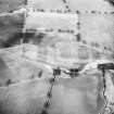
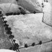
Strageath


Rig And Furrow (Medieval) - (Post Medieval)
Site Name Strageath
Classification Rig And Furrow (Medieval) - (Post Medieval)
Canmore ID 25327
Site Number NN81NE 48
NGR NN 8960 1770
NGR Description Centred NN 8960 1770
Datum OSGB36 - NGR
Permalink http://canmore.org.uk/site/25327


- Council Perth And Kinross
- Parish Muthill
- Former Region Tayside
- Former District Perth And Kinross
- Former County Perthshire
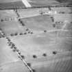
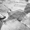
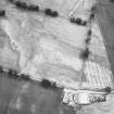
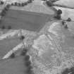
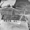
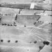
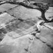
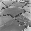
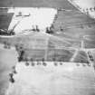
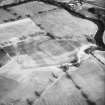
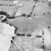
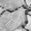
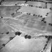
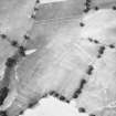
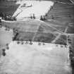
Aerial Photographic Interpretation (5 December 1997)
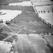
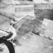
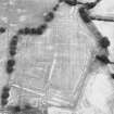
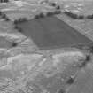
NN81NE 48 centred 8960 1770
Cropmarks and soilmarks on oblique aerial photographs (RCAHMSAP 1985) reveal a block of slightly curving rig, aligned approximately from NNE to SSW, and measuring about 8m to 10m between furrows.
Information from RCAHMS (DCC) 5 December 1997.

