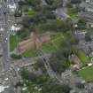
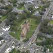
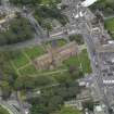
Kirkwall, Broad Street, Tankerness House Museum
House (15th Century), Museum (20th Century)
Site Name Kirkwall, Broad Street, Tankerness House Museum
Classification House (15th Century), Museum (20th Century)
Alternative Name(s) 35, 37, 39 Broad Street; Tankerness House
Canmore ID 2531
Site Number HY41SW 22
NGR HY 44850 10869
Datum OSGB36 - NGR
Permalink http://canmore.org.uk/site/2531
- Council Orkney Islands
- Parish Kirkwall And St Ola
- Former Region Orkney Islands Area
- Former District Orkney
- Former County Orkney
HY41SW 22.00 44850 10869
HY41SW 22.01 4484 1086 Pictish Symbol Stone
HY41SW 22.02 4484 1086 Pictish Symbol Stone
HY41SW 22.03 4484 1086 Urban Excavation
Used as a museum. Housed here is a pictish symbol stone found at the Knowe of Burrian, a supposed broch, see HY31NW 2.
(Undated) information in NMRS.
HY 448 109 Tankerness House Museum. A sequence of floors from the 17th-19th centuries overlay 13th-14th century tipped material revetting a stone structure and sealing an earlier jetty and platform of red freestone.
N McGavin and J Wordsworth (SUAT), 1979.
HY 4511 1119 Orkney Archaeological Trust were contracted to examine the footprint of the Groattie House (built in 1730 as a summerhouse) once it had been removed from its original site in the yard behind Tod's Bakery, off Bridge Street in Kirkwall. A watching brief was then conducted at Tankerness House Museum Gardens, off Broad Street, Kirkwall, HY 4480 1089, during the excavation of the foundation trench prior to the reconstruction of the house here.
No features of great archaeological importance were disturbed or destroyed. The work at the Tod's Bakery site was commendably shallow, whilst that at Tankerness Gardens did not go deeper than post-mediaeval land reclaimation deposits.
P Sharman January 2005.
Desk Based Assessment (18 May 1971)
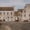
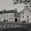
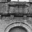
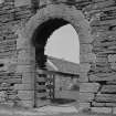
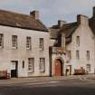
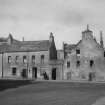
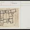
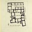
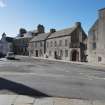
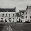
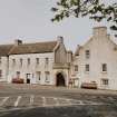
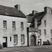
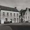
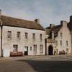
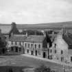
Tankerness House. A composite building, the earliest part dating from the 16thc. It is built round an almost rectangular courtyard and entered from the street through a heavily moulded round arched gateway above which is an armorial panel dated to 1561. In the 18th century the 'L' shaped W wing was re-modelled if not entirely rebuilt. The S and E wings with the offices on the N are of later date.
Information from OS (WDJ) 18 May 1971
RCAHMS 1946. Visited 1929; D MacGibbon and T Ross 1892.
Publication Account (1981)
Two of the famous townhouses of the burgh were the Inns down on the Rampart and Tankerness House on Broad Street. The Inns was a popular name for a house built by Sir David Sinclair of Swinbrucht in the last half of the fifteenth century. Tankerness House, on the other hand, dates from the sixteenth century and is built around a rectangular courtyard. The house itself was entered from Broad Street through a heavily moulded archway which carries the date '1561' on an armorial panel. The west wing of the structure was remodelled, if not entirely rebuilt in the eighteenth century (RCAM, 1946, II, 148). Today, Tankerness House houses Kirkwall museum.
Tankerness House is probably the oldest domestic dwelling in the burgh and several others on Palace Street are perhaps of the same sixteenth century date.
Information from ‘Historic Kirkwall: The Archaeological Implications of Development’ (1977).
Publication Account (1996)
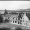
This attractive building is widely regarded as one of the finest early town houses surviving in Scotland, and it has been restored and converted into a museum without losing its essential character. Its present name originated in the 17th century when it became the town residence of the Bailkie family of Tankerness, but in the previous century it was the subchantry and archdeanery for St Magnus Cathedral, and the initials of an archdeacon appear on the armorial panel over the entrance gateway: M G F for Master Gilbert Fulzie.
This gateway and the north wing of the house are of 16th-century date, and the panel over the gateway bears the date 1574, and the initials of Fulzie's wife, Elizabeth Kinnaird. The jambs and arch a reheavily moulded and the armorial panel is set into a corbel led parapet. The north wing has two storeys and an attic, and the original spiral stair is housed in a small projecting tower just inside the gateway. Subsequent additions and modifications have created the harmonious courtyard house of today, its almost square courtyard entirely enclosed by buildings. On the west side of the house is a peaceful garden, which is graced by a large architectural fragment from the cathedral.
Information from ‘Exploring Scotland’s Heritage: Orkney’, (1996).
Watching Brief (11 March 2013 - 25 March 2013)
A watching brief was undertaken by ORCA for the ground breaking works associated with the installation of an electricity cable to the rear of Tankerness House. Two trenches were excavated that began at the staff entrance to the museum aligned south-westwards and terminated at the boundary wall for the Royal Bank of Scotland. Structural remains associated with Tankerness House as well as post-medieval garden soils and levelling deposits were encountered. Some residual activity of prehistoric activity was also apparent.
L. Somerville & J Strickland
(Source: OASIS ID: orkneyre1-175096)
Watching Brief (3 September 2019 - 15 January 2020)
HY 44859 10842 An archaeological watching brief was undertaken by ORCA Archaeology during works to replace road and footway surfaces in Kirkwall town centre, undertaken as part of the Kirkwall Townscape Heritage Initiative project. the works were divided into three Areas; this entry covers Area 3. The groundworks on Broad Street exposed a series of substantial remains interpreted as being those shown on the First Edition (1882) Ordnance Survey map. The buildings depicted have been regarded as surviving remnants of the Cathedral precincts which once occupied the area bounded by St Magnus Cathedral, the Bishop's Palace and the sea, and now occupied by the north end of Victoria Street and Palace Gardens. The largest single structure exposed occupied the footprint of one building depicted both on the Ordnance Survey map and a view of Broad Street dating from 1780, and has been interpreted as the remains of the Chaplain's Chamber and sub-Dean's Manse.
Structural remains. matching the footprint of those buildings on early Ordnance Survey maps, were also identified along Palace Road, but it is unclear if these related to structures contemporary with those of the Cathedral precinct. Further structures were also exposed and a number of these were clearly drains, particularly those around the frontages of Tankerness House Museum and 32 Broad Street. The deposits exposed throughout the groundworks clearly represented the complex history of the site and were a mix of natural tills, former land surfaces, dumped and redeposited material, and modern truncations. The archaeological features exposed remain in-situ underlying the modern road surface and make up layers.
Information from Orkney Research Centre for Archaeology (ORCA).


