Grainbank
Souterrain (Prehistoric)
Site Name Grainbank
Classification Souterrain (Prehistoric)
Alternative Name(s) Grain Earth House; Hatston; Savrock
Canmore ID 2527
Site Number HY41SW 19
NGR HY 44125 11615
Datum OSGB36 - NGR
Permalink http://canmore.org.uk/site/2527
- Council Orkney Islands
- Parish Kirkwall And St Ola
- Former Region Orkney Islands Area
- Former District Orkney
- Former County Orkney
Field Visit (17 June 1929)
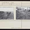
Earth-house, Grainbank. This monument, sometimes described as a "Gallery Grave," is situated in the corner of a field on the farm of Grainbank about 300 yds NE of the farm buildings and nearly 400 yds NW of Ayre Mill, on the main Kirkwall-Stromness road. It was first discovered about the year 1827, but was closed after discovery and was not reopened until 1857, when it was explored by Farrer. Of the investigation then made Petrie has left the following brief and imperfect description: "On turning up the soil at the spot where the Chamber was believed to have been found, remains of walls running in various directions were discovered, also a large pit, full of ashes containing great quantities of fragments of charred wood, and bones of several of the domestic animals and shells of the limpet, whelk, and other of the edible mollusca. Beneath this debris a wall was found and broken through, and an opening thereby obtained into a long curved passage about 26 feet long, 2 feet 6 inches wide, and about 3 feet high. This passage led by a gentle descent to a chamber 13 feet long, about 6 feet wide and 6 feet 6 inches in greatest height. The chamber was lined as usual by a stone wall and was in good preservation but no relic of any kind was found in it either then or on its previous discovery" (Large Notebook No. 4). The structure was finally taken into the custody of HM Office of Works in 1908.
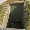
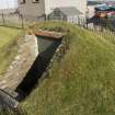
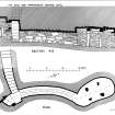
The plan and section show that the earth-house is of a normal type although it possesses certain peculiar features. Thus, the approach to the entrance passage was by way of a stair, the upper part of which, as now existing, has been restored by HM Office of Works, while the lower part is original. No doubt the stair was made necessary by the depth at which the earth-house was constructed, the soil being 7 ft. 6 in. deep above the passage and 6 ft. 6 in. deep over the chamber. Again, at the junction of stair and passage there are two recesses, one of which is partially blocked by two heavy slabs stretching across it, while four massive upright stones have, for no apparent reason, been inserted in the masonry of the walls. The passage, 15 ft. 6 in. long by 2 ft. 6 in. wide by about 3 ft. high, dips gently from the foot of the stair to the chamber, following, on plan, a regular curve*. The floor is apparently unpaved. The chamber is bean-shaped, with the major axis lying almost due N and S; it is approximately 12 ft long by 6 ft 3 in wide, with a maximum height of 5 ft 6 in. The walls are substantially and carefully built with little or no trace of convergence, and the roof is supported, as at RCAHMS 1946 No. 325 [Rennibister, Canmore ID 2081], on four free-standing upright stones, on two of which "eke" stones have been set to increase the height.
RCAHMS 1946, visited 17 June 1929.
OS 6” map (1903) unnoted
*A trench has been cut along its length, probably during the work of restoration, and no doubt in order to provide easier access to the chamber.
Measured Survey (1931)
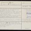
RCAHMS surveyed the souterrain at Grainbank c.1929. The plan and section were redrawn in ink and published at a reduced size (RCAHMS 1946, fig. 232).
Field Visit (5 April 1964)
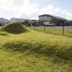
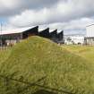
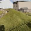
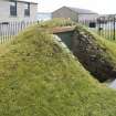
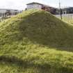
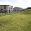
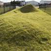
The roof of the curving passage and chamber of this earth house at HY 4413 1161 protrudes 0.2m above the surface. At the southern end a mound has been raised to incorporate the modern entrance.
Surveyed at 1/2500
Visited by OS (NKB) 5 April 1964.
Desk Based Assessment (10 March 1964)
HY41SW 19 4413 1161.
Earth-house, Grainbank was first discovered about 1827. It was re-opened in 1857 (see The Orcadian, August 3rd 1857) and taken into the custody of the Ministry of Works in 1908. The structure is approached by a stair which enters a passage 15ft 6in long and 2ft 6in wide by 3ft high. The roof of the chamber is supported on four free-standing upright stones. When opened in 1857 the chamber contained charred wood, bones of domestic animals, and shell fish.
Information from OS (SW) 10 March 1964
Sources: RCAHMS 1946., No. 409; AMs Scot 1961, 32
Publication Account (1996)
This earth-house has remained in excellent condition, probably because it was constructed so deeply underground. Some 2m of earth separates its roof from the ground-surface, and a flight of steps leads down into the passage (the upper part of the stair is modern but the lower part is original). The passage curves in a gentle arc, lined with drystone walling and roofed by flat lintels at a height of about 0.9m, so that it is impossible to walk upright, but it opens into a well-built oval chamber which is just high enough, at 1.6m, for most people to move about upright or almost upright. As a cellar for storing food supplies, comfort was not an important factor. The flat lintelled roof is supported on four free-standing pillars of stone.
When it was discovered in the 19th century, the earth-house was empty, but clear evidence was found of there having been a domestic settlement it ground-level: the basal courses of walls and a large pit full of ash, burnt good, animal bones and shells. In 1982 a second smaller earth-house was discovered about 6m to the west [Canmore ID 2535], which presumably belonged to the same settlement, but this is no longer visible.
Information from ‘Exploring Scotland’s Heritage: Orkney’, (1996).
Orkney Smr Note
See also OR 2329 [HY41SW 24] for adjacent earth-houses
Information from Orkney SMR [n.d.]


