Pricing Change
New pricing for orders of material from this site will come into place shortly. Charges for supply of digital images, digitisation on demand, prints and licensing will be altered.
Upcoming Maintenance
Please be advised that this website will undergo scheduled maintenance on the following dates:
Thursday, 9 January: 11:00 AM - 3:00 PM
Thursday, 23 January: 11:00 AM - 3:00 PM
Thursday, 30 January: 11:00 AM - 3:00 PM
During these times, some functionality such as image purchasing may be temporarily unavailable. We apologise for any inconvenience this may cause.
Doune, Roman Fort And Annexe
Fort Annexe (Roman)(Possible), Roman Fort (Roman)
Site Name Doune, Roman Fort And Annexe
Classification Fort Annexe (Roman)(Possible), Roman Fort (Roman)
Alternative Name(s) Castle Hill; Castle Of Doune; Doune Roman Fort; Doune Primary School
Canmore ID 24767
Site Number NN70SW 36
NGR NN 72721 01265
NGR Description Centre
Datum OSGB36 - NGR
Permalink http://canmore.org.uk/site/24767
- Council Stirling
- Parish Kilmadock
- Former Region Central
- Former District Stirling
- Former County Perthshire
NN70SW 36 centred 7272 0130
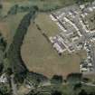
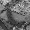
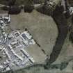
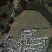
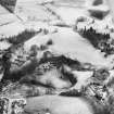
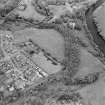
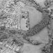
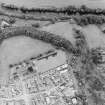
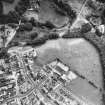
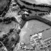
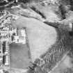
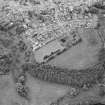
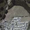
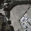
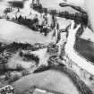
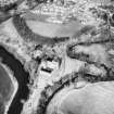
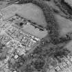
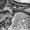
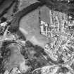
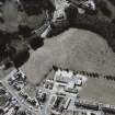
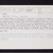
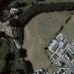
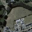
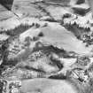
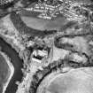
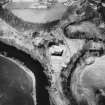
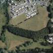
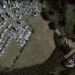
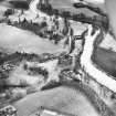
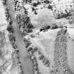
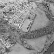
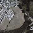
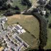
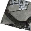
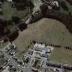
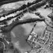
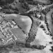
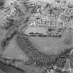
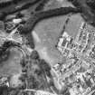
'Aerial reconnaissance in 1983 located a Roman fort on Castle Hill between the town and the Castle of Doune overlooking a covenient crossing-place on the river Teith.
Final excavation has confirmed that the fort was guarded on the E by a triple-ditch system whose terminals curved inwards in a form characteristic of Flavian structures elsewhere in N Britain. Its size
is probably not more than 2.6ha with in the ditches, but the position of the western defences has still to be confirmed. The site, which appears to have undergone a single period of occupation, may indicate the place at which the main Roman road from the isthmus to the north crossed into Caledonia.'
G S Maxwell 1984.
Further aerial reconnaissance shows that over the ramparts the dimensions of this fort are c 160m NE-SW by 140m, an area of 2.25ha (5.6 acres). A crop-mark extending from the W angle towards the River Teith may indicate an annexe. (Information from G S Maxwell).
S S Frere 1985.
For newspaper accounts of discovery see under 'Archaeological Organisations - RCAHMS' (File of newscuttings etc)
(Undated) information in NMRS.
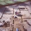
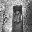
NN 727 013 An archaeological excavation was undertaken in the playing fields of Doune Primary School, which is located within the site of Doune Roman fort. The intervallum way was identified in the form of a gravel-built road. The complete ground plans of two buildings were recovered as well as the partial foundations of several others. These may represent the hospital block. Several large pits were identified and excavated; it is likely that these formed part of the demolition of the fort once it went out of commission. Five bread ovens were identified, built into the back of the rampart. Pottery associated with the investigated features appears to date to the 1st century AD. This conforms with the Flavian date previously attributed to the site.
Sponsor: Stirling Council.
C Moloney 1999.
Scheduled as 'Doune Roman Fort... 60m S of Doune Primary School... the buried remains of a Roman fort, visible from the air as cropmarks...'
Information from Historic Scotland, scheduling document dated 26 April 2011.
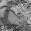
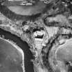
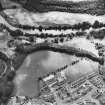
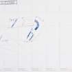
Aerial Photographic Transcription (19 May 1999 - 14 June 1999)
An aerial transcription was produced from oblique aerial photographs. Information from Historic Environment Scotland (BM) 31 March 2017.
Watching Brief (24 May 1999 - 19 August 1999)
Watching briefs were maintained at two sites in the vicinity of Doune Castle during the Forth Valley Sewer Renewal Project, undertaken by East of Scotland Water. The areas affected were the driveway leading southwards to the Castle itself, and an area to the W of Doune Fire Station, in the vicinity of the Flavian fort discovered in 1984 by aerial reconnaissance.
Four trenches, each measuring c.2 x 2m, were opened along the driveway, to remove the existing sewer and to install a new pipeline. The trenches revealed recently disturbed horizons associated with the fitting of the earlier sewer, although the southernmost trench, nearest the castle, revealed possible evidence for a denuded earthen bank or platform.
A single trench of c.150m length and up to 2m wide was excavated to the W of the Fire Station, along the top of a steep slope down to a small tributary of the River Teith. Nothing of archaeological significance was revealed, and the site of the Roman fort was not affected. The slope was demonstrated to be a natural profile, with some recent landscaping associated with the construction of the modern housing scheme to the E.
Sponsor: Historic Scotland
G Ewart and A Dunn 1999
Kirkdale Archaeology
Excavation (7 February 2008 - 22 February 2008)
NN 72770 01340 A 10 x 8.5 m area was excavated in advance of construction of an extension to Doune Primary School, which lies within the interior of the Roman fort. Foundations of a timber building were partially revealed, which is provisionally interpreted as a barracks block. A layer of burnt material overlying the foundation trenches, which may relate to the destruction of the building, produced a small finds assemblage which appears consistent with the Flavian date previously assigned to the fort at Doune. Two other foundation trenches on a different alignment are thought to represent an earlier phase of buildings associated with the fort.
Information from: Andrea Smith - Headland Archaeology
Excavation (26 July 2010 - 27 August 2010)
NN 7280 0136
An excavation was carried out 26–27 August 2010 in a garden to the E of Doune Primary School, in advance of a proposed development by Stirling Council. The
majority of the excavated remains relate to a Roman fort that dates to the Flavian occupation of Scotland between AD 80 and 86–7. Some features, including a ditch and postholes, predate the fort and are thought to be prehistoric. A full section through the defences on the NE side of the fort was exposed, revealing three ditches and remains of the turf rampart. Cobbled surfaces relating to the intervallum road were recorded. A group of shallow pits between the road
and the rampart contained evidence for metalworking. In the interior of the fort, part of a timber building was excavated which is interpreted as a cavalry barracks block. Numerous large pits were excavated inside the building and between it and the rampart. The pits inside the building probably post-date its main phase of occupation, and may represent gravel quarrying or improvised latrines, pointing
to a partial abandonment of the fort.
Archive: RCAHMS
Funder: Stirling Council
P Masser 2010
OASIS ID: headland1-84578
Project (2010)
NN 727 012
Resistance and magnetic surveys were conducted on the parts of the Roman fort which have not been built upon, along with an external area to the E. The data obtained was partly obscured by interference from modern features, such as fences, pipes, paths and a cricket square, but a reasonable view was obtained.
The work revealed the SW and NW gates, to add to the known SE gate and although the remaining (NE) gate could not be covered, it was possible to extrapolate its position to beneath the main entrance gate to Doune Primary School. Past aerial and excavated indications that the fort had a triple ditch system were confirmed and, unusually, this now seems likely to have passed around all four sides. Moreover, the NW gate had a so-called ‘parrot beak’ ditch break, to parallel that already known at the SE gate. The SW gate was located approximately one third of the way along the fort’s long axis from the E, which suggests that the praetentura lies in the E and that the fort faces SE, down the Teith valley. Sections of the rampart were visible in the magnetic data, and appeared to show inward turns at the gates, so that the gates themselves would have lain at the end of rampart re-entrants. This seems to be becoming a regular feature of forts with parrot beak ditch breaks and makes sense as a defence mechanism; since the ever narrower funnel produced would disrupt an attacking formation. Inside the fort, areas of what seemed to be the internal street grid could be identified. A series of circular features immediately behind the rampart were probably ovens. A radar timeslice (15 x 15m) and profile (25m) in the SE corner of the fort confirmed the line of an internal street and a section of the intervallum road. Outside the fort, a small group of ring features at the top of a steep bank that slopes down to the Ardoch Burn may represent roundhouses.
Archive: RCAHMS and The Roman Gask Project
Funder: Historic Scotland
DJ Woolliscroft and O O'Grady 2010
Magnetometry (2010)
NN 727 012
Magnetometry survey.
Archive: RCAHMS and The Roman Gask Project
Funder: Historic Scotland
DJ Woolliscroft and O O'Grady 2010
Resistivity (2010)
NN 727 012
Resistivity survey.
Archive: RCAHMS and The Roman Gask Project
Funder: Historic Scotland
DJ Woolliscroft and O O'Grady 2010
Watching Brief (15 May 2012)
On 15th May 2012 Alder Archaeology undertook a watching brief (Alder code DE01) on the site of excavations required for a buried low voltage cable and associated new wooden pole and stay. The site was considered to have archaeological potential due to its close proximity to the 14th century Doune Castle and the nearby Roman Fort. Spoil from the excavation was scanned for finds with a metal detector. A fragment of a medieval spur and some pieces of leather were recovered from the excavation for the stay pit. Apart from the spur, nothing of archaeological significance was found during the watching brief. The work was fully funded by Scottish and Southern Energy.
Information from Oasis (alderarc1-127375) 2 September 2013
Watching Brief (2 February 2021 - 24 February 2021)
NN 7287 0126 An archaeological watching brief was conducted during the upgrade and widening of a 95m length of existing core path and formation of a new stepped ramp at Doune Castle and Roman Fort, Stirling.
Excavation of the pathway to Doune village reached a maximum depth of 0.15m, removing only topsoil that yielded several modern iron objects and one Scottish bawbee coin upon metal detecting. Footpath formation along the Doune Castle driveway encountered the former road surface atop natural subsoil at a depth of 0.30m. The construction of a stepped ramp excavated into the embankment, east of the Roman fort. The section comprised heavily bioturbated topsoil atop natural subsoil to a maximum height of 2.1m. No significant archaeological features or deposits were observed or disturbed.
Information from CFA Archaeology Ltd 2021.
OASIS ID: cfaarcha1-417198
Note (22 November 2022)
The location, classification and period of this site have been reviewed and changed from FORT ANNEXE (ROMAN)(POSSIBLE), ROMAN FORT (ROMAN), AMPHORA (ROMAN), BEAD (ROMAN), BLADE (ROMAN), BOTTLE (ROMAN), BRACELET (ROMAN), BROOCH (ROMAN), COIN (ROMAN), CRUCIBLE (ROMAN), HARNESS FITTING (ROMAN), NAIL (ROMAN), ORGANIC MATERIAL (ROMAN), POT (ROMAN.


