Mid Lix
Cup And Ring Marked Stone (Neolithic) - (Bronze Age)
Site Name Mid Lix
Classification Cup And Ring Marked Stone (Neolithic) - (Bronze Age)
Alternative Name(s) Middle Lix 1
Canmore ID 24093
Site Number NN52NE 1
NGR NN 55140 29875
Datum OSGB36 - NGR
Permalink http://canmore.org.uk/site/24093
- Council Stirling
- Parish Killin
- Former Region Central
- Former District Stirling
- Former County Perthshire
NN52NE 1 5513 2987.
A low, triangular, pyramidal stone, about 100 yards S of the railway and 20 yards E of the Glenogle road, has 21 cups on the W face, one ringed. D Haggart 1883; C G Cash 1912.
NN 5513 2987. A cup and ring marked rock, as described.
Surveyed at 1:10,000.
Visited by OS (B S) 12 September 1975.
Field Visit (June 1978)
Middle Lix 1 NN 551 298 NN52NE 1
An earthfast boulder bearing cup-marks and one cup-and-ring mark.
RCAHMS 1979, visited June 1978
Allen 1883, 145; Cash 1912, 267-8.
Field Visit (8 April 2016)
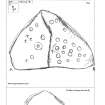
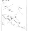
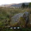
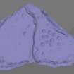
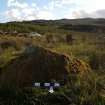
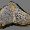
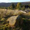
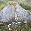
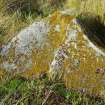
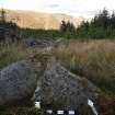
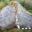
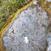
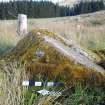
This cup and ring marked boulder is situated about 50m E of the A85 road on a low rise within a small clearing in recently harvested woodland. The stone is shaped like a triangular prism, measuring 1.4m by 1.4m by 1.6m at the base, and about 0.6m high. The triangular SSW face is dissected into two panels. The ESE panel bears 19 cup marks, and what may be a fragment of a ring at the upper right edge, while the WNW panel bears 6 cups and one ring.
Visited by HES Survey and Recording (GG, AW) 8 April 2016
Note (15 October 2018)
Date Fieldwork Started: 15/10/2018
Compiled by: Callander
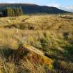
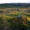
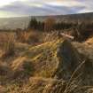
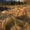
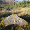
Location Notes: The Mid Lix stone is about 50m NE of a bend in the A85, on a slightly flatter area of ground beyond which the forested terrain slopes downhill, Northwards towards Killin & Loch Tay. There is a prominent crescent-shaped embankment between the area where the stone is located and the A85. It is in an area of felled timber, which has been re-planted but the immediate area around the stone has been left clear of the planting. There are wide views all around, especially Westwards to Sgiath Chuill above Glen Dochhart and Northwards to the Tarmachan Ridge & Ben Lawers.
The stone is in an area where the bedrock is the Loch Tay limestone series, but it may be a glacially transported boulder of another rock type.
As described by others, the stone is a low pyramid in form with one disproportionately larger triangular face on which the carvings sit. This face has a Southern aspect and its larger axis is aligned roughly W-E. The face is essentially split into since it abruptly shelves by about 5cm - the higher area being on the E side. Both sides have carvings but the best defined and deeper carved are on the E side whilst those on the W side are much less well defined and highly denuded. This suggests maybe that the shelving is due to differential weathering, with the rock on E side is being harder than that on the W. One might speculate that both sides of the rock were originally decorated equally but now the W carvings are mostly weathered away.
Panel Notes: The carvings on this stone can be grouped into those to the E, which are generally well defined and those on the W, which are very weathered and far more indistinct.
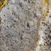
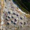
On the E side of the panel 18 cupmarks were counted in the field, with almost certainly another cup on the edge of the shelf, but this is partly eroded away and so appears to grade into the shelf, and may be just a natural feature. There is also the suggestion of a partial ring around the W half of one of the cups. The 12 or so very distinct, deeper cups in the central grouping cups almost look like craters, as they have the suggestion of slightly raised rims. This may be because they were originally enhanced by having the area between them slightly carved away to exaggerate their profile. This may account also for the apparent partial ring around one of the outer W cups in the grouping. Two of the cups in the centre of the panel appear conjoined, but this could be due to the weathering away of the thin ridge between them, rather than an original feature.
On the W side of the panel, field identification of cups was more problematic. There are 5 definite cups (approximately 5.0 x 0.5 - 1 cm), one of which has a ring around it. In addition there are a least 4 other possible, very shallow cups and maybe others which, if genuine, are now so weathered to appear as natural surface gradations.
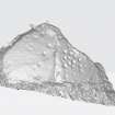
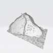
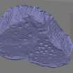
Additional motifs identified from 3D model: the suspected partial ring on the E half of the panel is also apparent on the 3D model. Also on this side, the 18 cupmarks identified in the field are obvious and the suspected collapsed cup on the panel appears to be definite. A further depression on the bottom E corner is most likely natural, but could be a possible weathered cup mark.
On the W side, the 4 possible cups appear slightly more definite but still ambiguous. There are a couple more depressions that are probably natural but have the suggestion of being ghost cup marks.


