|
Prints and Drawings |
DC 14982 CO |
|
Copy of 'Plan of Fort William 1745' with elevations (from copy held in Map Room, National Library of Scotland, Edinburgh) |
1990 |
Item Level |
|
|
Photographs and Off-line Digital Images |
D 80067 NC |
General Collection: Newscuttings |
View of fort before demolition - newspaper cutting insc: 'Where Glencoe's Doom Was "Sealed" A view of the Old Fort at Fort-William as it was before the railway company acquired the site. The dwelling-houses, which are to be demolished, include the Governor's House, in a room of which was signed the historic document ordering the Massacre of Glencoe. There is a possibility that the building may be preserved.' |
c. 1930 |
Item Level |
|
|
Photographs and Off-line Digital Images |
IN 899 |
Papers of Erskine Beveridge, antiquarian, Dunfermline, Fife, Scotland |
View of fort before demolition |
1/9/1883 |
Item Level |
|
|
Photographs and Off-line Digital Images |
A 39281 PO |
|
General view (sketch) of Ben Nevis and Fort William. Photocopy of original drawing.
|
c. 1780 |
Item Level |
|
|
Prints and Drawings |
IND 14/1 |
|
Map of town & Estuary showing position of Fort.B
Board of Ordnance |
c. 1800 |
Item Level |
|
|
Prints and Drawings |
IND 14/2 |
|
Plan showing town & remains of fort - Governors House.
HM Office of Works |
c. 1930 |
Item Level |
|
|
Prints and Drawings |
IND 14/3 |
General Collection |
Plan & short description of Fort as Existing in 1689 with design for new Fort, inscr;
'Innerlochie of Obrian Fort, in Lochabor
This Fort formerly contributed much to keep the Highlands in subjection to the Government, and in an intire Peace amongst themselves. The Parrapets of it are all demolished, but the Rampart is allmost intire.'
|
1689 |
Item Level |
|
|
Print Room |
IND 14/4 |
|
View of Fort & Town from S.W.
Pub. Robt. Sayer & H. Overton. |
|
Item Level |
|
|
Photographs and Off-line Digital Images |
IND 14/5 |
|
Plan, with elevations. Sections, Plans of new barracks, & necessary House.
Board of Ordnance Plan. |
1745 |
Item Level |
|
|
Photographs and Off-line Digital Images |
XSD 380/600 |
Survey of Private Collections. Blair Adam Drawings. |
Photographic copy of drawing showing view of town. |
|
Item Level |
|
|
Prints and Drawings |
D 73205 |
|
Plan showing town & remains of fort - Governors House.
HM Office of Works |
c. 1930 |
Item Level |
|
|
Photographs and Off-line Digital Images |
SC 707627 |
|
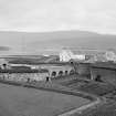
Photographic copy of Blair Adam Drawing BA613 'West View of Fort William' Blair Adam Collection
pen & ink, wash, 130 x 260 |
|
Item Level |
|
 |
On-line Digital Images |
SC 746274 |
Papers of Erskine Beveridge, antiquarian, Dunfermline, Fife, Scotland |
View of fort before demolition
|
1/9/1883 |
Item Level |
|
|
Photographs and Off-line Digital Images |
SC 1025148 |
Survey of Private Collections |
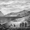
Photographic copy of watercolour showing fort and its surroundings, July 1820.
Written on reverse: 'Former church on parade where Duncansburgh church is now'. |
c. 2000 |
Item Level |
|
 |
On-line Digital Images |
DP 050588 |
|
View of Fort William |
1835 |
Item Level |
|
|
Photographs and Off-line Digital Images |
SC 1395562 |
|
Plan showing town & remains of fort - Governors House.
HM Office of Works |
1930 |
Item Level |
|
 |
On-line Digital Images |
DP 229324 |
Records of the Royal Commission on the Ancient and Historical Monuments of Scotland (RCAHMS), Edinbu |
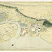
Plan of Fort William |
c. 1800 |
Item Level |
|
 |
On-line Digital Images |
DP 253046 |
Records of the Royal Commission on the Ancient and Historical Monuments of Scotland (RCAHMS), Edinbu |
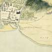
Cropped plan of Fort William |
c. 1800 |
Item Level |
|
 |
Digital Files (Non-image) |
WP 005071 |
Historic Environment Scotland |
Digital copy of Archaeology InSites feature regarding Fort William artillery fort - Fort William, Lochaber, Highland |
1/1/2017 |
Item Level |
|
 |
On-line Digital Images |
SC 2386257 |
Records of the Ordnance Survey, Southampton, Hampshire, England |
Fort William, Fort And Governor's House, NN17SW 1, Ordnance Survey index card, Recto |
c. 1958 |
Item Level |
|
 |
On-line Digital Images |
SC 2386258 |
Records of the Ordnance Survey, Southampton, Hampshire, England |
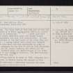
Fort William, Fort And Governor's House, NN17SW 1, Ordnance Survey index card, page number 1, Recto |
c. 1958 |
Item Level |
|
 |
On-line Digital Images |
SC 2386259 |
Records of the Ordnance Survey, Southampton, Hampshire, England |
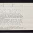
Fort William, Fort And Governor's House, NN17SW 1, Ordnance Survey index card, page number 2, Verso |
c. 1958 |
Item Level |
|
 |
On-line Digital Images |
SC 2386260 |
Records of the Ordnance Survey, Southampton, Hampshire, England |
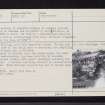
Fort William, Fort And Governor's House, NN17SW 1, Ordnance Survey index card, page number 3, Recto |
c. 1958 |
Item Level |
|
 |
On-line Digital Images |
SC 2386261 |
Records of the Ordnance Survey, Southampton, Hampshire, England |
Fort William, Fort And Governor's House, NN17SW 1, Ordnance Survey index card, page number 4, Recto |
c. 1958 |
Item Level |
|