Pricing Change
New pricing for orders of material from this site will come into place shortly. Charges for supply of digital images, digitisation on demand, prints and licensing will be altered.
Bothan Na Dige, Stronmilchan
Fortified Manor House (Medieval)(Possible)
Site Name Bothan Na Dige, Stronmilchan
Classification Fortified Manor House (Medieval)(Possible)
Canmore ID 23651
Site Number NN12NE 3
NGR NN 1537 2785
Datum OSGB36 - NGR
Permalink http://canmore.org.uk/site/23651
- Council Argyll And Bute
- Parish Glenorchy And Inishail (Argyll And Bute)
- Former Region Strathclyde
- Former District Argyll And Bute
- Former County Argyll
NN12NE 3 1537 2785
(NN 1537 2785) Bothan na Dige (NR) (site of)
OS 1:10,000 map, (1977)
A residence of McGregor of Glenstrae, in Stronmilchan, was close to White House and was made of wattles with a surrounding moat and drawbridge.
NSA 1845.
The manor house of Stronemeloquhan is mentioned in 1554 and in the 17th century Tradition identifies two different sites. (See NN12NE 1 for the other site.)
Orig Paroch Scot 1854.
Bothan na Dige was a building which was supposed to have been fortified by a ditch and Mr Duncan Dewar of Dalmally (one of three local authorities) has repeatedly turned over large stones in cultivating the field.
Name Book 1870.
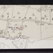
The site falls in a pasture field on a shelf of nearly level ground above the river. There is no trace of a building. There is, however, a raised platform up to 1.5m high, approximately 70.0m E-W by 25.0m N-S. The platform is surrounded by a narrow strip of damp, reed-grown ground, which may indicate the site of a moat or defensive ditch. These irregularities in the ground may, however, be completely natural.
Visited by OS (G H P), 28 April 1962.
No change to previous field report. The undulations around the platform are probably natural.
Visited by OS (D W R), 19 March 1973.
There are no visible remains of this structure, which was demolished early in the 19th century.
RCAHMS 1975, visited 1967.
Field Visit (September 1967)
NN 153 278. There are no visible remains of this structure, which is said to have been a residence of the MacGregors of Glen Strae (cf. Nos. 283 and 335). The building is reputed to have comprised a clay and wicker superstructure resting upon stone foundations, and surrounded by a moat; it was demolished early in the 19th century.
RCAHMS 1975, visited September 1967.
Geophysical Survey (23 July 2012 - 24 July 2012)
NN 16764 27516 and NN 1537 2785 A geophysical survey was carried out 23–24 July 2012 on two sites with a close archaeological and historical association with Clan Gregor, as part of the Clan Gregor Glen Orchy survey project. At site one, Dalmally Parish Church, a GPR survey was carried out to look for evidence of previously disturbed burials and/or earlier churches. At site two, Bothan na Dige, a combination of GPR and resistivity survey was carried out to look for traces of an alleged medieval moated enclosure, associated with Clan Gregor. A topographic survey undertaken at site two was used to place the results of the geophysical survey into its wider context.
The results at Dalmally Parish Church suggest that there may be traces of an earlier church preserved within the footprint of the current church and that anomalies recorded at the E end may relate to earlier burials. The results at Bothan na Dige show traces of extant structures on and adjacent to the site. Some of these can be clearly related to buildings on 19th- and early 20th-century maps, but other features cannot and may be earlier in date. The results also suggest the presence of a large ditch to the N of the site, and possibly other structural remains along the main ridge which runs E–W through the site.
Archive: RCAHMS
Funder: Clan Gregor Society
Charlotte Francoz, Northlight Heritage
Olly O’Grady,
Gavin MacGregor,
2012


