Following the launch of trove.scot in February 2025 we are now planning the retiral of some of our webservices. Canmore will be switched off on 24th June 2025. Information about the closure can be found on the HES website: Retiral of HES web services | Historic Environment Scotland
Loch Awe, Innis Chonnel Castle
Castle (Medieval)
Site Name Loch Awe, Innis Chonnel Castle
Classification Castle (Medieval)
Alternative Name(s) Ardchonnel Castle; Ardconnel Castle; Connel Castle
Canmore ID 23162
Site Number NM91SE 2
NGR NM 97678 11916
Datum OSGB36 - NGR
Permalink http://canmore.org.uk/site/23162
- Council Argyll And Bute
- Parish Kilchrenan And Dalavich
- Former Region Strathclyde
- Former District Argyll And Bute
- Former County Argyll
NM91SE 2 97678 11916.
(NM 9767 1192) Castle (NR)
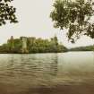
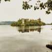
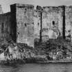
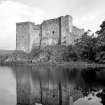
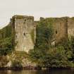
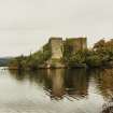
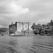
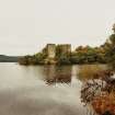
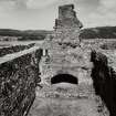
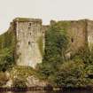
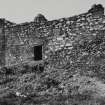
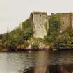
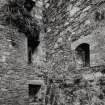
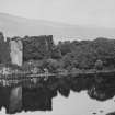
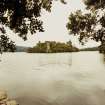
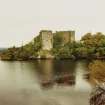
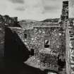
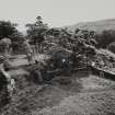
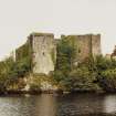
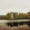
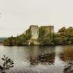
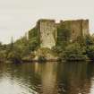
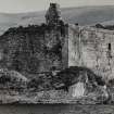
Innis Chonnel Castle stands on a small, rocky island in Loch Awe opposite the village of Dalavich. The castle, which occupies almost all the island above the shore line, was, until the late 15th century the chief strong hold of the Campbells.
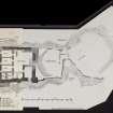
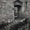
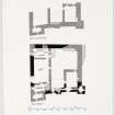
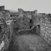
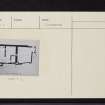
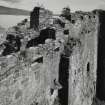
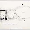
The general plan incorporates an outer bailey to the east, separated from a smaller, middle bailey by an entrance-gatehouse, and, to the west, the main structure of the castle with its inner bailey. The existing buildings belong to several different periods, the earliest surviving building being the inner bailey which was erected in the first half of the 13th century as a small, rectangular castle of enceinte. Within this, a number of buildings were grouped round a small, central courtyard. The inner bailey was extensively remodelled during the 15th century, but its present plan and overall dimensions - 25.7 by 25.1 metres - correspond closely with those of the 13th century structure. The entrance gateway is on the east side and is of 15th century date, though the original entrance probably occupied a similar position.
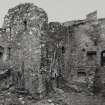
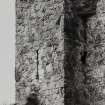
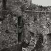
The south range and SE tower contain much early work, the south elevation in particular being mainly 13th century in character, but the existing courtyard buildings of the south range are predominantly of 15th century date. They comprise a substantial four-storeyed block, which occupies the SE corner of the courtyard, together with an adjacent three-storeyed block of much smaller size.
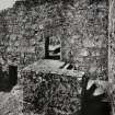
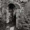
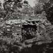
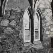
The west range, as reconstructed during the 15th century comprised a hall and kitchen set over a range of vaulted cellars, including a small prison, together with a tower at the SW angle containing a series of small private rooms.
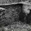
The north curtain wall, except at its extremities, appears to be of 13th century date and evidence for the existence of contemporary, internal buildings can be seen towards the west end.
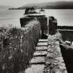
The wall of the middle bailey, mainly of 15th century date, is best preserved on the south and east sides where it rises to a maximum height of 2.4 metres. The gatehouse appears to have been a single storey structure and was equipped with parapet wall-walks on the north and south sides overlooking the entrance doorway below.
The wall of the outer bailey is now ruinous and incomplete, the remains being of 15th century date.
The castle has little recorded history, but it is known to have been ruinous by 1806.
RCAHMS 1975; D MacGibbon and T Ross 1889.
As described.
Surveyed at 1:2,500.
Visited by OS (DWR) 16 October 1971.
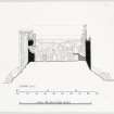
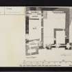
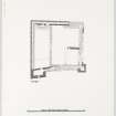
Measured Survey (August 1969)
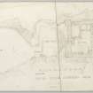
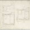
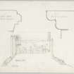
RCAHMS undertook measured survey at Innis Chonnell in 1969. The original pencil drawings were redrawn in ink and published at a reduced scale (RCAHMS 1975, figs. 197-204). The final published drawings included a general plan and plans of the inner bailey (first, second and parapet) along with details including mason's marks, profile mouldings, the window and gun-loop in SE tower and the arrow-slit in the SE tower.
Field Visit (August 1969)
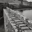
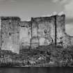
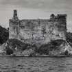
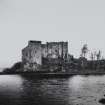
This castle (Pl. 66A, C, E) takes its name from a small rocky island situated close to the SE shore of Loch Awe, about 14 km NE of Ford and directly opposite the village of Dalavich. The island is approximately hour-glass shaped on plan (Fig. 197), and the castle occupies almost the entire area above the shoreline, an outer bailey to the E being separated from middle and inner baileys to the W by an entrance-gatehouse which straddles the narrow central neck of the island.
SYNOPSIS
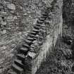
The existing buildings belong to several different periods, the main stages in the architectural evolution of the castle apparently being as follows. The earliest surviving building is the inner bailey, which was erected in or about the first half of the 13th century as a small rectangular castle of enceinte having one or more square angle-towers of shallow projection. Within the interior of this castle there were a number of buildings grouped round a small central courtyard, the entrance-doorway probably being situated on the E side (the cardinal points of the compass are used for convenience of description. The true indication of the building is indicated in Fig. 197). Sometime during the first half of the 15th century the castle was drastically remodelled, a new SW tower and courtyard-buildings, including a spacious first-floor hall, being erected; at the same time a new entrance-doorway was formed in the E curtain and the NW and NE corners of the enceinte were rebuilt without angle-towers. The wall head was crowned with an almost continuous parapet walk reached from the courtyard by means of a stone fore stair rising against the N curtain-wall.
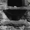
The last main series of building-operations appears to have been carried out at some time during the 17th century, when the service-area of the 15th-century hall was remodelled to incorporate a new kitchen-fireplace, while musketry-loops were formed in the S parapet and elsewhere, and a stone forestair was constructed to replace a timber forestair giving access from the courtyard to the entrance in the E curtain. After it became unoccupied in the 18th century the structure was allowed to deteriorate, and when MacGibbon and Ross visited the site shortly before 1889 many features were evidently obscured by debris and vegetation (cf. the account in Cat. And Dom. Arch., iii, 87-90). This damage was relatively superficial, however, and as a result of a programme of clearance and consolidation, apparently carried out early in the present century, the inner bailey, at least, is now in fairly good repair, although little remains of the gatehouse, or of the middle and outer baileys. Considerable clearance of ivy was carried out by the Commission's officers before the present survey was begun.
See RCAHMS 1975 (pp. 223-231, No. 292, figs. 197-204, plates 66-8) for a full architectural description and historical note.
RCAHMS 1975, visited August 1969.


