
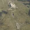
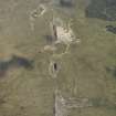
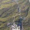
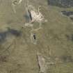
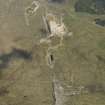
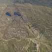
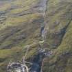
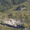
Strontian, Whitesmith Mine


Lead Mine (Period Unassigned)
Site Name Strontian, Whitesmith Mine
Classification Lead Mine (Period Unassigned)
Alternative Name(s) Strontian, Lead Mines
Canmore ID 23121
Site Number NM86NW 3.01
NGR NM 832 658
Datum OSGB36 - NGR
Permalink http://canmore.org.uk/site/23121


- Council Highland
- Parish Ardnamurchan
- Former Region Highland
- Former District Lochaber
- Former County Argyll
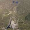
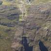
NM86NW 3.01 832 658
NM 832 658 and NM 837 658 Two smiddies.
Sponsor: Forest Enterprise Lochaber
J E Kirby 1995

