
Eigg, Chleith Mhor


Hut Circle(S) (Prehistoric)
Site Name Eigg, Chleith Mhor
Classification Hut Circle(S) (Prehistoric)
Canmore ID 22169
Site Number NM48NE 9
NGR NM 4745 8747
Datum OSGB36 - NGR
Permalink http://canmore.org.uk/site/22169


- Council Highland
- Parish Small Isles
- Former Region Highland
- Former District Lochaber
- Former County Inverness-shire
Field Visit (7 May 1972)
NM48NE 9 from 4744 8747 to 4745 8746.
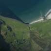
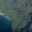
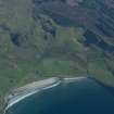
At NM 4746 8744 is a circular stone-walled hut measuring about 10.0m in diameter. The W arc is visible as a scarp where the hut is set into the slope. The entrance is in the E and is ill-defined. Attached to the W side of the hut at a higher level, above the back scarp, is an oval platform measuring 3.5m N-S by 2.5m and marked by a similar back scarp. Some 10.0m to the NW of the hut is a smaller hut marked by a heavily peat-covered wall spread to 2.5m and measuring 5.5m between its centres. A gap in the E arc may be the entrance. There is no trace of cultivation contemporary with the huts.
Surveyed at 1/2500.
Visited by OS (ISS) 7 May 1972
Field Visit (7 June 2001)
Two hut-circles are situated to the N and E of Abhainn a’ Cham Loin and W of Chleith Mhór and the road that runs across the island. The first (287) is set into a slope on the W side to a depth of 0.6m and measures 8m by 1.5m within a stony bank 1.5m in thickness and 0.4m in height. Several internal and external facing stones are visible except in the SE, where the arc is indistinct. The entrance is on the E. A platform extends 2.8m to the W and measures 2.8m square.
To the NW, a second hut-circle is located at the top of a knoll, and it measures 4m in diameter within a stony bank 1.2m in thickness and 0.4m in height. The entrance is on the E side.
There are extensive fields of rig and furrow immediately to the E, on the E side of the road.
EIGG01 287-288
Visited by RCAHMS (MFTR) 7 June 2001
R Rushbrooke et al 1986 (MS.), No.3.3

