
Following the launch of trove.scot in February 2025 we are now planning the retiral of some of our webservices. Canmore will be switched off on 24th June 2025. Information about the closure can be found on the HES website: Retiral of HES web services | Historic Environment Scotland
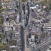
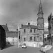
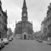
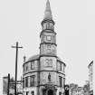
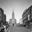
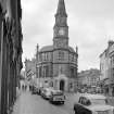
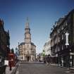
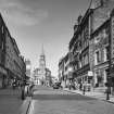
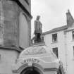
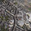
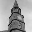
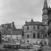
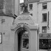
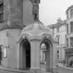
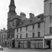
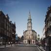
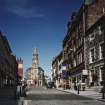
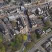
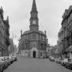
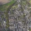
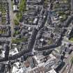
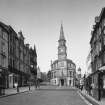
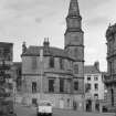
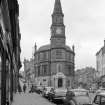
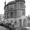
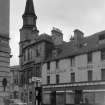
Stirling, 65-67 King Street, Burgh Buildings


Club (19th Century)
Site Name Stirling, 65-67 King Street, Burgh Buildings
Classification Club (19th Century)
Alternative Name(s) 2 Corn Exchange Road; Atheneum; New Town House
Canmore ID 221070
Site Number NS79SE 392
NGR NS 79567 93444
Datum OSGB36 - NGR
Permalink http://canmore.org.uk/site/221070


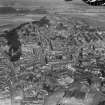
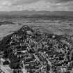

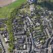
- Council Stirling
- Parish Stirling
- Former Region Central
- Former District Stirling
- Former County Stirlingshire
NMRS NOTES:
Architect: William Stirling
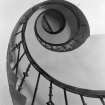
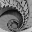
Photographic Survey (October 1963)
Photograhic survey by the Ministry of Works/Scottish National Buildings Record in October 1963.

