Pricing Change
New pricing for orders of material from this site will come into place shortly. Charges for supply of digital images, digitisation on demand, prints and licensing will be altered.
Mull, Mingary
Standing Stone(S) (Prehistoric)
Site Name Mull, Mingary
Classification Standing Stone(S) (Prehistoric)
Alternative Name(s) Quinish; Ach' Nan Carragh
Canmore ID 22081
Site Number NM45NW 5
NGR NM 4135 5524
Datum OSGB36 - NGR
Permalink http://canmore.org.uk/site/22081
- Council Argyll And Bute
- Parish Kilninian And Kilmore
- Former Region Strathclyde
- Former District Argyll And Bute
- Former County Argyll
NM45NW 5 4135 5524.
(NM 4135 5524) Standing Stones (NR)
OS 1:10000 map (1976)
Stone Circle (remains of): 'These three large stones, one standing, the other two lying, are the remains of a Druidical Circle.'
Name Book 1878
The stones at this site were in a similar condition to that described by the RCAHMS, when seen in April 1972. There is no evidence that they formed a circle.
Surveyed at 1:10560.
Visited by OS (DWR) 24 April 1972
Said to be a lunar alignment dating to the 2nd millennium BC.
A Thom 1979.
Standing Stones, Mingary. The RCAHMS, quoting Ordnance Survey Name Book (ONB), erroneously state that the ONB records that in the mid-19th century there was a group of five standing stones, three of which were erect and the other two recumbent.
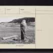
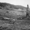
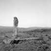
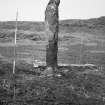
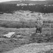
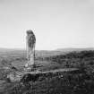
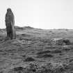
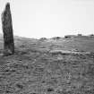
The site is a level terrace on the W side of the track leading to Mingary. At the present time only a single stone, measuring 2.7m high and 0.7m by 0.6m at the base, is still erect; aligned N and S and leaning slightly it rises with straightish sides to a rounded top. Some 3m to the NE is a fallen stone 3.6m long, 1.1m broad and 0.5m thick. Both these stones are of basalt. At a distance of 8m to the NE there is the stump of another stone, while various fragments of stones, doubtless from the same group, are visible round about.
RCAHMS 1980, visited 1972
Scheduled as 'Ach'nan Carragh, standing stones... a number of standing stones of prehistoric date. One of the stones is visible as an upstanding monument, the others are recumbent or fragmentary'.
Information from Historic Scotland, scheduling document dated 10 February 2003.
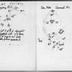
Field Visit (1 July 1943)
This site was included within the RCAHMS Emergency Survey (1942-3), an unpublished rescue project. Site descriptions, organised by county, vary from short notes to lengthy and full descriptions and are available to view online with contemporary sketches and photographs. The original typescripts, manuscripts, notebooks and photographs can also be consulted in the RCAHMS Search Room.
Information from RCAHMS (GFG) 10 December 2014.


