|
Photographs and Off-line Digital Images |
A 77670 |
Records of the Ordnance Survey, Southampton, Hampshire, England |
General view from South. |
1972 |
Item Level |
|
 |
On-line Digital Images |
DP 027319 |
RCAHMS Aerial Photography Digital |
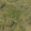
Oblique aerial view centred on the remains of the burial-ground, taken from the SSE. |
26/4/2007 |
Item Level |
|
 |
On-line Digital Images |
DP 027320 |
RCAHMS Aerial Photography Digital |
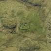
Oblique aerial view centred on the remains of the burial-ground, taken from the E. |
26/4/2007 |
Item Level |
|
 |
On-line Digital Images |
DP 027321 |
RCAHMS Aerial Photography Digital |
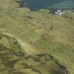
General oblique aerial view centred on the remains of the crofting township, lazy beds and rig with the remains of the burial-ground adjacent, taken from the NW. |
26/4/2007 |
Item Level |
|
 |
On-line Digital Images |
SC 2381686 |
Records of the Ordnance Survey, Southampton, Hampshire, England |
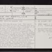
Ulva, Cille Mhic Eoghainn, NM33NE 1, Ordnance Survey index card, Recto |
c. 1958 |
Item Level |
|
 |
On-line Digital Images |
SC 2381687 |
Records of the Ordnance Survey, Southampton, Hampshire, England |
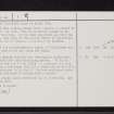
Ulva, Cille Mhic Eoghainn, NM33NE 1, Ordnance Survey index card, page number 1, Recto |
c. 1958 |
Item Level |
|
 |
On-line Digital Images |
SC 2381688 |
Records of the Ordnance Survey, Southampton, Hampshire, England |
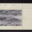
Ulva, Cille Mhic Eoghainn, NM33NE 1, Ordnance Survey index card, page number 2, Verso |
c. 1958 |
Item Level |
|
 |
On-line Digital Images |
SC 2381689 |
Records of the Ordnance Survey, Southampton, Hampshire, England |
Ulva, Cille Mhic Eoghainn, NM33NE 1, Ordnance Survey index card, Recto |
c. 1958 |
Item Level |
|
 |
On-line Digital Images |
SC 2381690 |
Records of the Ordnance Survey, Southampton, Hampshire, England |
Ulva, Cille Mhic Eoghainn, NM33NE 1, Ordnance Survey index card, Recto |
c. 1958 |
Item Level |
|
 |
On-line Digital Images |
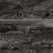
SC 2526369 |
Records of the Ordnance Survey, Southampton, Hampshire, England |
General view from South. |
1972 |
Item Level |
|
|
All Other |
551 166/1/1 |
Records of the Ordnance Survey, Southampton, Hampshire, England |
Archaeological site card index ('495' cards) |
1947 |
Sub-Group Level |
|


