|
Manuscripts |
MS 595/6 |
|
Coastal erosion and archaeological monuments in the southern isles, Outer Hebrides: survey report 1991: southern Barra and Sandray. |
1991 |
Item Level |
|
 |
On-line Digital Images |
SC 2380588 |
Records of the Ordnance Survey, Southampton, Hampshire, England |
Sandray, NL69SW 4, Ordnance Survey index card, Recto |
c. 1958 |
Item Level |
|
 |
On-line Digital Images |
SC 2380589 |
Records of the Ordnance Survey, Southampton, Hampshire, England |
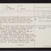
Sandray, NL69SW 4, Ordnance Survey index card, Recto |
c. 1958 |
Item Level |
|
 |
On-line Digital Images |
SC 2380590 |
Records of the Ordnance Survey, Southampton, Hampshire, England |
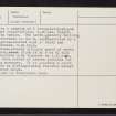
Sandray, NL69SW 4, Ordnance Survey index card, page number 2, Verso |
c. 1958 |
Item Level |
|
 |
On-line Digital Images |
SC 2380591 |
Records of the Ordnance Survey, Southampton, Hampshire, England |
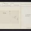
Sandray, NL69SW 4, Ordnance Survey index card, Recto |
c. 1958 |
Item Level |
|
|
All Other |
551 166/1/1 |
Records of the Ordnance Survey, Southampton, Hampshire, England |
Archaeological site card index ('495' cards) |
1947 |
Sub-Group Level |
|