Barra, Dun Mhic Leoid
Island Dwelling (Medieval), Tower House (Medieval)
Site Name Barra, Dun Mhic Leoid
Classification Island Dwelling (Medieval), Tower House (Medieval)
Alternative Name(s) Castle Sinclair; An Caisteal; Iain Garbh's Castle; Castle St Clair
Canmore ID 21394
Site Number NL69NW 2
NGR NL 64767 99611
Datum OSGB36 - NGR
Permalink http://canmore.org.uk/site/21394
- Council Western Isles
- Parish Barra
- Former Region Western Isles Islands Area
- Former District Western Isles
- Former County Inverness-shire
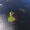
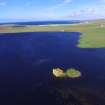
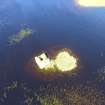
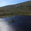
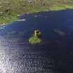
An Caisteal or Dun Mhicleoid, possibly mid-15th century Small, unvaulted tower on the site of an earlier dun in Loch Tangasdale, also known as Iain Garbh's Castle or Castle St. Clair. It was described c.1620 as 'a little toure of stone and lyme builded in ane litle Illand in the midst of this Logh'.
Taken from "Western Seaboard: An Illustrated Architectural Guide", by Mary Miers, 2008. Published by the Rutland Press http://www.rias.org.uk
NL69NW 2 64767 99611.
(NL 64759960) Dun Mhic Leoid (NAT) (Ruins of) (NAT).
OS 6"map, Inverness-shire, 2nd ed., (1904)
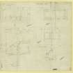
Castle Sinclair, or Dun Mhic Leoid, is a tower, 18 1/2 ft. by 18 ft. over walls 4 1/2 ft. thick, and was originally of three storeys. In 1924 it stood only 15 ft. high. MacGregor (A A MacGregor 1949) describes and illustrates the remains. There is no history or tradition concerning the castle.
RCAHMS 1928; A A MacGregor 1949.
These remains are as described above. The small island on which the remains stand appears to be artificial. There are vague traces of a possible causeway, now submerged, running from the castle to the S. shore of Loch St. Clair. According to Robins (Mr Robins, Schoolmaster, Castlebay, Barra) this is "Dun Mhic Leoid", a 'dower' castle, and not Castle Sinclair - a name given to it by a 19th. c. French romantic.
Visited by OS (W D J), May 1965.
T233: Traces of a substantial roundhouse underlie the late medieval tower.
K Branigan and P Foster 1985.
Field Visit (9 August 1924)
Castle Sinclair (O.S. Dun Mhic Leoid).
Built on an islet at the upper end of Loch Tangusdale, otherwise Loch St Clair, which lies beneath Ben Tangaval, 1 ½ miles north-west of Castlebay, the ruin of a small square tower, Dun Mhic Leoid, occupies the south-west corner of the site and touches the water on two sides. The tower, originally of three storeys, stands only to a height of 15 feet. It measures 18 ½ by 18 feet over walls 4 ½ feet thick. The walls are built of polygonal rubble in lime mortar, and the lower 4 feet of the walling has been pointed. The floors have been of wood, and there are no fireplaces and no stair. The entrance, which faces north, is at first floor level, and opens on a chamber 9 ½ by 8 ½ feet with a three-inch light to the south and the remains of larger windows set within wide embrasures to east and west. The upper floor is demolished; the basement has only a four-inch window at the south-east corner.
The structure is in bad repair.
RCAHMS 1928, visited 9 August 1924.
OS map: Barra lxiv.


