Following the launch of trove.scot in February 2025 we are now planning the retiral of some of our webservices. Canmore will be switched off on 24th June 2025. Information about the closure can be found on the HES website: Retiral of HES web services | Historic Environment Scotland
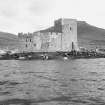
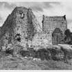
Barra, Kiessimul Castle
Tower House (15th Century)
Site Name Barra, Kiessimul Castle
Classification Tower House (15th Century)
Alternative Name(s) Kisimul Castle; Caisteal Chiosmuil; Castlebay; Kiessamul Castle; Castle Bay; Bagh A' Chaisteil
Canmore ID 21390
Site Number NL69NE 3
NGR NL 66519 97944
Datum OSGB36 - NGR
Permalink http://canmore.org.uk/site/21390
First 100 images shown. See the Collections panel (below) for a link to all digital images.
- Council Western Isles
- Parish Barra
- Former Region Western Isles Islands Area
- Former District Western Isles
- Former County Inverness-shire
Kisimul Castle
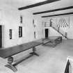
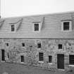
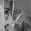
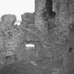
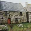
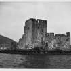
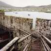
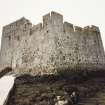
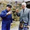
Probably early-mid 15th century; recreated 1956-70 by Robert Lister MacNeil The former seat of Clan MacNeil and the best preserved castle in the Western Isles, Kisimul comprises a main tower and later structures within an enclosing curtain wall - an arrangement that continues the form of the Gàidhealtachd stronghold into the late medieval period. One of the castles associated with an under-lordship of the Lords of the Isles, it parallels Breachacha, its contemporary on the Isle of Coll, and may have been built by the same master mason. The enclosure surrounds a small island occupied since prehistoric times. It is entered via steps up from the water through a wide, late 16th/early 17th-century gateway with a slot-machicolation and yett, the two-leaved gate having been removed from the castle and taken to Eoligarry, Balelone, Kilmuir Kirk to Kisimul in 1939. This gateway replaced two 15th-century entrances - one to the east, blocked by the later Watchman's House (which no longer survives), and a postern gate on the north-west curtain wall, blocked-up since the 17th century. Beside the main entrance stands the earliest identifiable building - a plain, three-storey unvaulted residential tower of local gneiss rubble, its parapet raised, probably at the same time as the curtain walls, in the 16th century. A stone forestair leads up to the curtain wall-walk, from which a bridge flies out to a platform cantilevered out from the tower entrance. The door is located between the first and second floors, to which it is connected by mural stairways. These floors contained separate lodgings with latrine closets in the walls, the second floor, lit by windows on all sides but with no fireplace, being the laird's private apartment. The unlit ground floor, from which access to the floors above was via a trap door, was entered by a low doorway reached by a stone forestair. The building on the north-west side was the hall (with two sea-flushing garderobe projections), which would have been thatched and lit by a central hearth. It acquired an upper floor and was extended south west in the 17th century, blocking the postern gate. The rounded internal tower, built into the north corner of the enclosure and later raised, contained the pit prison and latrine below a guard room; this and the hall were substantially rebuilt in the 1950s, when the building on the north east was reinvented as a mortuary chapel. Other buildings of c.1500 included the Watchman's House (foundations survive), Tanist (heir's) House (now rebuilt), and kitchen (now re-roofed). Only a fragment survives of the late 16th-century crew or boat house, which stood outside the walls south of the tower. Putlog holes indicate the position of the former wooden wall-walks, which would have been intended principally as viewing platforms. It is doubtful that the aim of this castle was primarily defensive, and evidence for external hoardings is weak, although as late as 1675 the MacNeil was using 'hagbutts, guns and pistols' to fend off a party of government officials who had arrived to serve a writ, and earlier that century Ruairidh the Tartar's piracy resulted in the castle being captured by 20 men with 'swerdis, gantillatis, plaitslevis, bowis, darlochis, durkis, targeis, Lochaber aixes, tuahandit swerdis, and othuris wapponis invasive'. Kisimul was abandoned in the early 18th century, and burnt out in 1795. During the herring boom, stone was taken for ballast and much of the curtain wall and other buildings was destroyed. The 20thcentury rebuild was largely conjectural, making liberal use of concrete and cement render. In 2000, the present chief, Iain R. MacNeil, made Kisimul over to Historic Scotland on a 1,000 year lease, the annual rent being £1 and a bottle of whisky. (Open to public; guidebook available)
Taken from "Western Seaboard: An Illustrated Architectural Guide", by Mary Miers, 2008. Published by the Rutland Press http://www.rias.org.uk
NL69NE 3 66519 97944
(NL 6651 9791) Kiessimul Castle (NR) (Remains of).
OS 6" map, Inverness-shire, 2nd ed., (1904)
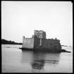
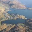
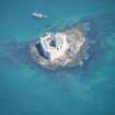
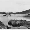
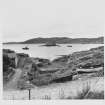
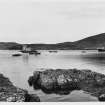
Kiessimul Castle stands on a low rock rising a few feet above high water mark, 200 yds. from the shore of Castle Bay.
The Commission (RCAHMS 1928) dates the tower and curtain wall to the 15th c. with later buildings of the 17th and 18th c. MacGibbon and Ross (D MacGibbon and T Ross 1889), however, date the original buildings to the 13th c. and are supported by Toy (S Toy 1966), who points out that "since there is no note of its existence before the early part of the fifteenth century it has been assumed that it belongs to that period, despite its obviously more ancient character", He notes the ommission of the prow on the south side of the keep from the commission plan and draws attention to the addition of a fourth storey at a later period. Cruden (S Cruden 1960) says the south "wall face is perfectly flat" and disagrees with Toy (S Toy 1966) that there is a prow.
D MacGibbon and T Ross 1889; RCAHMS 1928; S Cruden 1960; S Toy 1966.
Non-Guardianship Sites Plan Collection, DC28149- DC28153, 1957-- 1958 & 1966.
EXTERNAL REFERENCE:
Scotland's Magazine, February 1960 p.53 - photograph of castle partially restored
(Undated) information in NMRS.
Generally as described above. According to Mr Robins (Schoolmaster, Castlebay, Barra) the original buildings are 13th. century with later additions from 15th to 18th c. Toy's assertion (S Toy 1966) that there is a prow on the S wall of the keep is incorrect, and hence the plan supplied by the commission (RCAHMS 1928) (which agrees with Cruden {S Cruden 1960}) is accurate. The castle has been, and is in the process of being restored. It is occupied by The MacNeil of Barra.
Visited by OS (N K B), 24 May 1965.
Scheduled as Kisimul Castle, Castlebay, Barra.
Information from Historic Scotland, scheduling document dated 17 January 2001.
NL 6651 9791 An integrated programme of archaeological work, documentary research and a building survey were undertaken with the aim of informing Historic Scotland's future conservation and management of the newly acquired monument (NMRS NL69NE 3).
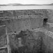
Twelve test trenches were excavated by hand in the courtyard, the basement of the tower and the pit prison revealing, in places, up to 1.2m of sediments. In the W part of the courtyard a series of medieval/post-medieval levelling deposits containing bone, shell and construction debris were encountered. In the tower and around the Gockman's house, floor surfaces and other deposits associated with their use and abandonment survived. Evidence for metalworking was found associated with the later phases of the Gockman's house, and a part-waterlogged floor deposit survived in the basement of the tower. A decorated gold object, thought to be a lace tag from the early 12th century, was recovered from this deposit.
The test trenches also revealed evidence for extensive prehistoric occupation which includes pottery, flint and cereal remains. The finds were associated with buried soils and are consistent with a Bronze Age or Neolithic presence on the island. The exact nature and duration of this occupation is unclear at present.
The building survey indicated that the initial phase of building included a great hall for public ceremony and a tower reserved for more private life, but there is very little evidence in the fabric of the building that provides an indication of the date of foundation. However, both negative and positive documentary evidence points to the establishment of the MacNeill's control of Barra, and the construction of the castle, in the first half of the 15th century. The glazed wares recovered from the excavations include nothing obviously earlier than the 15th century and therefore support this date.
Full details lodged with the NMRS.
Sponsor: Historic Scotland
J Morrison 2001.
Field Visit (6 August 1924)
Kiessimul Castle, Castlebay.
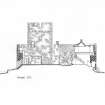
On a low rock rising but a few feet above high-watermark 200 yards from the shore of Castle Bay stands Kiessimul Castle, the largest and most imposing secular building in the Outer Hebrides. The nucleus of this castle is a 15th-century tower set at the south-east angle of the site; from the tower run curtains to form an irregularly shaped enclosure, measuring internally 100 feet from north-east to south-west by 68 feet from north-west to south-east. At two places, the north and north-eastern angles of the enclosure, the curtains rise above the general level to form vantage points 33 feet above the rock. Against the curtains are subsidiary structures, one within the northern angle being original and the remainder considerably later, i.e. 17th-18th century. The original entrance to the enclosure, which is now built up, adjoins the north-east angle of the tower; it is covered by a machicolation. In front of the entrance is a harbour protected by an outwork built on a spur of rock. (Figs. 1, 183.)
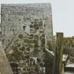
Throughout the castle the masonry is rubble built of local stone in shell lime mortar; in places slabs are bedded on edge, a peculiarity noticed also at Calvay Castle. The voids are mainly confined to the upper walls. The tower, oblong on plan and measuring 33 feet from north to south by 28 ¾ feet from east to west over walls 6 feet in average thickness, is 49 feet high, and rises sheer from a steeply battered basecourse of 1 ¼ feet projection to the parapet, which like that of the curtain has no overhang, being a continuation of the wall below. The parapets of tower and curtains are crenellated, and beneath the crenellations are a series of openings like windows, while at the level of the parapet walks are ‘weep holes’ for drainage. (Fig. 185)
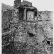
The tower walls are practically complete, but the lower part of the structure is filled with soil, and there may be another storey beneath the three now visible below the parapet; each storey contains a single chamber. The tower has been entered from a forestair rising along the north wall to the curtain parapet ; from that level another stair or possibly a movable ramp or ladder rose to the entrance, above which is a machicolation (Fig. 184). The entrance, 18 feet from the ground, is 2 ½ feet wide ; it opens on a lobby within the thickness of the wall from which a narrow stair descends to the basement, while another ascends to the chamber beneath the walk ; from this room a stair, entered from the embrasure of the north window, ascends to the parapet walk. The floors have been of timber. As in most of the houses in the islands, the roof rested on the inner face of the walls, but in this building the space between the roof-rest and the parapet is utilised as a parapet walk, and, since the parapet rose 9 feet above the walk, its lower part was provided with ‘windows’, while the crenellations above were apparently reached from a narrow scarcement on two walls, steps on the west wall leading up to the higher level.
The room immediately beneath the roof, like the other chambers, has no fireplace. There are windows furnished with aumbries in the ingoings, to north and south; another window to the east, from which the stair leads down to the entrance, has a small opening, possibly a shot hole, in the breast. The room below this has no openings and must have been entered from a hatch; while the lower chamber has a window on the east now built up, and what seems to have been a door to the west. Externally on the south wall of the tower two flues or chutes appear, which cannot be traced inside; these may be latrine flues, but a similar opening is found in the little outwork at the harbour.
The small tower at the northern angle of the courtyard is not unlike one at Calvay. The lower part, which measures 10 ½ by 6 ½ feet internally, is called the ‘dungeon’, and is quite likely to have been a ‘pit’, for it is unlighted and was entered from a ceiling trap; it contains two aumbries. Above this was a chamber of the same size entered from the curtain wall and containing a latrine.
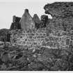
Against the north-west curtain there has apparently been a building older than the present structure, for there seems to have been a side gate at the base of the turret projecting near the pit ; at the other end of the curtain there are traces of a second turret, which rose only one storey and had a domical roof; this may have been a latrine. The present building is a two-storeyed house, and was probably divided by a transverse partition; the masonry is rubble and the gables are tabled. The curtain has been thickened, and the wall heads and the roof-rest are curiously corbelled out with slabs on edge. Against the southern gable has been placed an addition with a crowstepped gable, and recessed into this new outer gable is the well, which has had a domical top. Against the west wall of the tower are the remains of a two-storeyed building, and between this and the well is a fragment of another. Against the north and north-eastern curtains there have been two one-storeyed buildings almost entirely demolished. The castle buildings were repaired within recent years, and the present condition of the buildings is satisfactory.
HISTORICAL NOTE. The erection of the castle in its oldest form is probably to be dated after 1427, when the island became the chief patrimony and home of the MacNeills (1). If existing in the second half it could scarcely have escaped notice in Fordun's list of castles in the islands: it is not mentioned even by Fordun's continuator just before the middle of the fifteenth century: yet both have ‘Benwevil’ (cf. RCAHMS 1928 Introd., p. xxiv) in Uist. In the Description (1577-1595) it is said of ‘McN eill Barra’ that ‘His principal dwelling-place there is callit Keissadull, quhilk is ane excellent strenth’ (2). In Dean Monro's work (1599) the name is ‘Kiselnin’. Martin's account (c. 1695) is as follows : ‘The little island Kismul lies about a quarter of a mile from the south of this isle. It is the seat of Macneil of Barray; there is a stone wall round it two stories high, reaching the sea, and within the wall there is an old tower and a hall, with other houses about it. There is a little magazine in the tower, to which no stranger has access. I saw the officer called the Cockman, and an old cock he is; when I bid him ferry me over the water to the island, he told me that he was but an inferior officer, his business being to attend in the tower ; but if (says he) the constable, who then stood on the wall, will give you access I'll ferry you over. I desired him to procure me the constable's permission, and I would reward him; but having waited some hours for the constable's answer, and not receiving any, I was obliged to return without seeing this famous fort. Macneil and his lady being absent was the cause of this difficulty, and of my not seeing the place. I was told some weeks after that the constable was very apprehensive of some design I might have in viewing the fort, and thereby to expose it to the conquest of a foreign power, of which I supposed there was no great cause of fear’ (3). The writer in the Statistical Account (1794) (4) observes, ‘It has always been the residence of the Lairds of Barry, till the beginning of the present century’.
RCAHMS 1928, visited 6 August 1924.
OS map: Barra lxiv
(1) RCAHMS 1928 Introd. p. xx. (2) Skene, vol. iii., p. 430. (3) Description of the Western Islands, by Martin Martin, p. 91. (4) Vol. xiii., p. 335.
Publication Account (1985)
Kisimul Castle instantly impresses the visitor entering Castle Bay by feny; the fortress rises forbiddingly from its rock in the sea and, even before restoration, was fairly well preserved. It was for four centuries the stronghold of the MacNeils, who held Barra from the Lord of the Isles from the early 15th century.
The oldest part of the building is the tower, which, together with most of the curtain wall, may be ascribed to the early 15th century, and was the primary dwelling, consisting of three storeys: a cellar with living accommodation over, the upper of the two rooms being the hall. Staircases within the thick walls connect these two rooms and the parapet above, the cellar being entered from the courtyard, and entrance to the tower itselfby a bridge from the parapet walk on the curtain wall. The parapet and the two upper rooms are provided with garderobes. The parapet walls of both tower and curtain wall were raised by several feet some time after the original building, and this necessitated the reorganisation of the walks on the tower and the construction of a timber walk on the curtain wall. Other buildings ranged against this wall surround an open courtyard. Opposite the keep is a smaller tower with a curved internal wall; the ground floor was used as a prison and could be entered only by a hatch from the floor above. The hall was probably built at the same time as the curtain wall and small tower, and a building traditionally identified as a chapel. The hall was originally a single-storey building, but in the 17th century it was raised, and a two-storey building was added at the south-west end, covering the well and blocking the postern gate.
Not long after these buildings were completed, others were erected: the kitchen, adjacent to the main tower, the Tanist (or heir's) house, and the Gokman's (watchman's) house. The latter was later enlarged in a way that blocked off the original main gate of the Castle, and a new entrance was created beside the corner of the tower.
At one time there was also a secondary structure outside the tower, beside the boat-landing, but this, together with the Tanist house, the Gokman's house and part of the curtain wall were removed in the 19th century to provide ballast for the herring fleets.
Despite its strong defensive position, the castle is known to have been taken once, during a family disagreement in the 17th century, by twenty men. Major restoration by the late R L MacNeil of Barra was completed in 1970.
Information from ‘Exploring Scotland’s Heritage: Argyll and the Western Isles’, (1985).
Project (2000 - 2001)
NL 6651 9791 An integrated programme of archaeological work, documentary research and a building survey were undertaken with the aim of informing Historic Scotland's future conservation and management of the newly acquired monument (NMRS NL 69 NE 3).
Twelve test trenches were excavated by hand in the courtyard, the basement of the tower and the pit prison revealing, in places, up to 1.2m of sediments. In the W part of the courtyard a series of medieval/post-medieval levelling deposits containing bone, shell and construction debris were encountered. In the tower and around the Gockman's house, floor surfaces and other deposits associated with their use and abandonment survived. Evidence for metalworking was found associated with the later phases of the Gockman's house, and a part-waterlogged floor deposit survived in the basement of the tower. A decorated gold object, thought to be a lace tag from the early 12th century, was recovered from this deposit.
The test trenches also revealed evidence for extensive prehistoric occupation which includes pottery, flint and cereal remains. The finds were associated with buried soils and are consistent with a Bronze Age or Neolithic presence on the island. The exact nature and duration of this occupation is unclear at present.
The building survey indicated that the initial phase of building included a great hall for public ceremony and a tower reserved for more private life, but there is very little evidence in the fabric of the building that provides an indication of the date of foundation. However, both negative and positive documentary evidence points to the establishment of the MacNeill's control of Barra, and the construction of the castle, in the first half of the 15th century. The glazed wares recovered from the excavations include nothing obviously earlier than the 15th century and therefore support this date.
Full details lodged with the NMRS.
Sponsor: Historic Scotland
J Morrison 2001.
Excavation (10 September 2013 - 11 September 2013)
NL 6652 9796 A small excavation was carried out, 10–11 September 2013, to assess the extent of possible damage caused by recent landscaping activity. The area was considered sensitive as work in 2001 by Headland Archaeology Ltd had recovered a significant amount of flint from this area. The landscaping was found to be relatively superficial, with undisturbed slate located in the SW of the trench 180mm below the modern turf.
Archive: RCAHMS (intended)
Funder: Historic Scotland
David Murray, Kirkdale Archaeology, 2013
(Source: DES)
OASIS Id: kirkdale1-311437
Standing Building Recording (31 March 2014 - 20 June 2014)
NL 66519 97944 An investigation was undertaken, 31 March 20 June 2014, on the mortar of the upstanding buildings of the Isle of Barra. The work aimed to explore changes in source materials, material sources and lime burning techniques. Buildings investigated included Kisimul Castle, the chapel sites of Cille Bharra and St Michael’s/Brendan’s (Borve), the mill above Northbay, and a number of ruined croft houses in the township of Balnabodach.
As with the rest of the Western Isles, the medieval lime mortars of Barra were manufactured by the burning of sea shells with peat fuel, and here this is almost exclusively cockleshell. Within Kisimul Castle, the lime mortars surviving from all four main historic constructional phases, from the early 15th to the 17th centuries, are cockleshell-lime mortars. The primary phase mortars of all three surviving chapels at Cille Bharra, and evidence from St Brendan’s/ St Michael’s (Borve) are also cockleshell-limes. Peat fired cockleshell-lime mortars are also evident within many of the post-medieval buildings surveyed, including many ruined croft houses.
Limestone-lime mortar, displaying large fine-grained limestone/marble inclusions and a variety of non-peat fuel evidence, is also evident within various contexts around Castle Kisimul, including within the tower house, curtain wall and crew house. However, this mortar material is only
apparent in secondary contexts, overlaying primary shelllime cores, and not overlaid by shell-lime bound mortar itself.
Other masonry evidence suggests this late limestone-lime probably dates from the 19th or early 20th century and this late date accords well with other limestone-lime evidence within surviving buildings elsewhere on Barra, such as a secondary phase at St Mary’s (Cille Bharra) and the water mill above Northbay.
Twentieth century cement mortars are also evident in some contexts at Kisimul, often directly overlying the limestonelime or earlier shell-lime mortars. A three layered mortar stratigraphy (shell-lime/limestone-lime/cement) is apparent in many masonry contexts, and is exemplified in the E parapet of the curtain wall.
Archive: Historic Scotland, RCAHMS and University of Edinburgh (intended)
Funder: University of Edinburgh
Mark Thacker – University of Edinburgh
(Source: DES)


