Burleigh
Cursus (Neolithic)(Possible), Rig And Furrow (Medieval) - (Post Medieval)
Site Name Burleigh
Classification Cursus (Neolithic)(Possible), Rig And Furrow (Medieval) - (Post Medieval)
Canmore ID 205782
Site Number NO10SW 113
NGR NO 13004 04226
Datum OSGB36 - NGR
Permalink http://canmore.org.uk/site/205782
- Council Perth And Kinross
- Parish Orwell
- Former Region Tayside
- Former District Perth And Kinross
- Former County Kinross-shire
NO10SW 113 NT 13004 04226
Field Visit (22 March 2023)
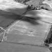
NO 13004 04222 and NO 13090 04035 An area of linear cropmarks running NNW/SSE in the NW and SW quadrants of the development area is visible in aerial photographs. These appear to show rig and furrow cultivation roughly following the alignment of track) and cursus monument. The earthworks were not visible during the walkover survey but an increase of heat fractured stone was noted in the area.
Information from D Bowler - Alder Archaeology Ltd.
OASIS ID: alderarc1-518134
Field Visit (22 March 2023)
NO 13069 04094 to NO 12976 04328 Potential Neolithic or Bronze Age Cursus evident as 2 parallel ditches running NNW/SSE. Approx 220m long and 50m apart, visible as cropmarks in the NW quadrant of the development area in aerial photos. Their alignment is similar to cropmark further NW which may be related, as well as rig and furrow and the W extent of Burleigh House. Not visible during the walkover survey
Information from D Bowler - Alder Archaeology Ltd.
OASIS ID: alderarc1-518134


