
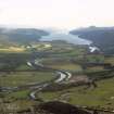
Caledonian Canal, Loch Darroch Weir


Weir (Period Unassigned)
Site Name Caledonian Canal, Loch Darroch Weir
Classification Weir (Period Unassigned)
Alternative Name(s) Caledonian Canal, River Ness Weir
Canmore ID 197180
Site Number NH63NW 29.11
NGR NH 6143 3978
NGR Description NH 6123 3952 to NH 6151 3994
Datum OSGB36 - NGR
Permalink http://canmore.org.uk/site/197180


- Council Highland
- Parish Inverness And Bona
- Former Region Highland
- Former District Inverness
- Former County Inverness-shire

