 |
On-line Digital Images |
SC 1012826 |
Records of Aberdeen Aerial Surveys, Aberdeen, Scotland |
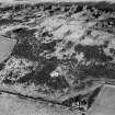
Oblique aerial view centred on the remains of the enclosure at Hill of Keir, looking to the NW. |
30/12/1980 |
Item Level |
|
 |
On-line Digital Images |
SC 1012827 |
Records of Aberdeen Aerial Surveys, Aberdeen, Scotland |
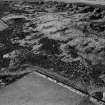
Oblique aerial view centred on the remains of the enclosure at Hill of Keir, looking to the NW. |
30/12/1980 |
Item Level |
|
 |
On-line Digital Images |
SC 1333075 |
Records of the Royal Commission on the Ancient and Historical Monuments of Scotland (RCAHMS), Edinbu |
400dpi scan of DC44348 RCAHMS plan of Hill of Keir enclosure |
26/6/2000 |
Item Level |
|
 |
On-line Digital Images |
DP 234446 |
Records of the Royal Commission on the Ancient and Historical Monuments of Scotland (RCAHMS), Edinbu |
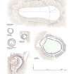
Comparative page of forts in Donside: Hill of Newleslie; Hill of Keir; Barmkyn of North Keig; Maiden Castle; Barra Hill; Mither Tap o' Bennachie |
2007 |
Item Level |
|
 |
On-line Digital Images |
SC 1698508 |
RCAHMS Aerial Photography |
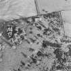
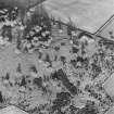
Oblique aerial view of Hill of Keir centred on the remains of an enclosure, with rig adjacent. Taken from the W. |
30/10/1998 |
Item Level |
|
 |
On-line Digital Images |
SC 1698509 |
RCAHMS Aerial Photography |
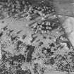
Oblique aerial view of Hill of Keir centred on the remains of an enclosure, with rig adjacent. Taken from the SW. |
30/10/1998 |
Item Level |
|
 |
On-line Digital Images |
SC 1698510 |
RCAHMS Aerial Photography |
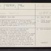
Oblique aerial view of Hill of Keir centred on the remains of an enclosure, with rig adjacent. Taken from the SE. |
30/10/1998 |
Item Level |
|
 |
On-line Digital Images |
SC 2376755 |
Records of the Ordnance Survey, Southampton, Hampshire, England |
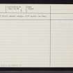
Hill Of Keir, NJ80NW 1, Ordnance Survey index card, page number 1, Recto |
c. 1958 |
Item Level |
|
 |
On-line Digital Images |
SC 2376756 |
Records of the Ordnance Survey, Southampton, Hampshire, England |
Hill Of Keir, NJ80NW 1, Ordnance Survey index card, Verso |
c. 1958 |
Item Level |
|
 |
On-line Digital Images |
SC 2376757 |
Records of the Ordnance Survey, Southampton, Hampshire, England |
Hill Of Keir, NJ80NW 1, Ordnance Survey index card, Recto |
c. 1958 |
Item Level |
|


