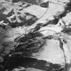
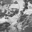
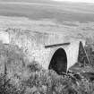
Accessibility

Font Size

100% 150% 200%

Background Colour

Default Contrast
Close Reset

Glencally Farm

Farmstead (Period Unassigned)

Site Name Glencally Farm

Classification Farmstead (Period Unassigned)

Canmore ID 192714

Site Number NO36SE 17

NGR NO 35620 63085

Datum OSGB36 - NGR

Permalink http://canmore.org.uk/site/192714

Ordnance Survey licence number AC0000807262. All rights reserved.
Canmore Disclaimer. © Bluesky International Limited 2025. Public Sector Viewing Terms

Toggle Aerial | View on large map

Digital Images

Oblique aerial view centred on the remains of buildings and enclosures with road bridge, rig and farmsteading adjacent, taken from the NW.
Oblique aerial view centred on the remains of buildings and enclosures with road bridge, rig and farmsteading adjacent, taken from the NW.Oblique aerial view centred on the remains of rig with buildings, enclosures, road bridge and farmsteading adjacent, taken from the NW.General view.

Administrative Areas

  • Council Angus
  • Parish Cortachy And Clova
  • Former Region Tayside
  • Former District Angus
  • Former County Angus

References

MyCanmore Image Contributions


Contribute an Image

MyCanmore Text Contributions