Accessibility

Font Size

100% 150% 200%

Background Colour

Default Contrast
Close Reset

Pricing Change

New pricing for orders of material from this site will come into place shortly. Charges for supply of digital images, digitisation on demand, prints and licensing will be altered. 


Upcoming Maintenance

Please be advised that this website will undergo scheduled maintenance on the following dates:

Thursday, 9 January: 11:00 AM - 3:00 PM

Thursday, 23 January: 11:00 AM - 3:00 PM

Thursday, 30 January: 11:00 AM - 3:00 PM

During these times, some functionality such as image purchasing may be temporarily unavailable. We apologise for any inconvenience this may cause.


Dundee, General

General View

Site Name Dundee, General

Classification General View

Canmore ID 185633

Site Number NO43SW 360

NGR NO 4040 3034

Datum OSGB36 - NGR

Permalink http://canmore.org.uk/site/185633

Ordnance Survey licence number AC0000807262. All rights reserved.
Canmore Disclaimer. © Bluesky International Limited 2025. Public Sector Viewing Terms

Toggle Aerial | View on large map

Digital Images

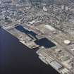
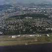
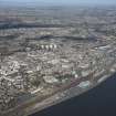
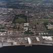
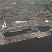
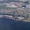
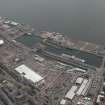
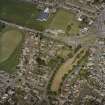
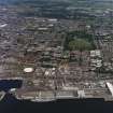
Scanned image showing general oblique aerial view of Dundee, the dock, gasworks and football stadiums, taken from the SE.
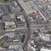
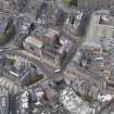
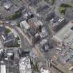
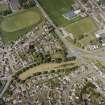
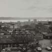
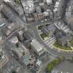
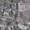
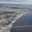
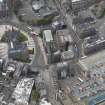
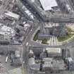
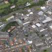
Scanned image showing general oblique aerial view of Dundee, the dock, gasworks and football stadiums, taken from the SE.Scanned image of lithograph showing general view of Dundee.General oblique aerial view of the City Square area, centred on the Caird Hall taken from the NNW.General oblique aerial view of the Albert Square area, centred on the Royal Exchange taken from the S.General oblique aerial view of the Albert Square area, centred on the Royal Exchange taken from the SE.General oblique aerial view of the Albert Square area, centred on the Royal Exchange taken from the ESE.General oblique aerial view of Dundee centred on the docks, taken from the ESE.General oblique aerial view of Dundee and the airport, taken from the S.General oblique aerial view of Dundee centred on the hospital with airport adjacent, taken from the S.General oblique aerial view of Dundee, the dock, gasworks and football stadiums, taken from the SE.General oblique aerial view of Dundee centred on the industrial estate, taken from the SSW.General oblique aerial view of Dundee centred on the works and castle with Claverhouse adjacent, taken from the SSW.General oblique aerial view of Dundee centred on Caird Park and Linlathen, taken from the S.General oblique aerial view of Dundee centred on the works with the cemetery adjacent, taken from the SSW.General oblique aerial view of Dundee centred on Reform Street, taken from the SE.General oblique aerial view of Dundee centred on the school and playing fields, taken from the SSE.General oblique aerial view of Dundee centred on the college, taken from the SSE.General view from the Law looking across the Tay.General oblique aerial view looking across the Firth of Tay, the road and rail bridges towards the city of Dundee, taken from the SW.Dundee from the West, 1803, by Daniel Orme
From 'Dundee, Its Quaint and Historic Buildings' by AC LambChurches in 1810
From 'Dundee, Its Quaint and Historic Buildings' by AC LambGeneral oblique aerial view of the city, centred on the Nethergate area taken from the SSE.General oblique aerial view of the Perth Road, centred on St Mark's Church taken from the SSE.General oblique aerial view of the Perth Road, centred on St Mark's Church taken from the SSE.General oblique aerial view of the Perth Road, centred on St Mark's Church taken from the NE.View of building exterior.
Titled: ' Powrie Lane 1873'.

General oblique aerial view of Dundee, looking E.General oblique aerial view of Dundee centred on Tay Bridge Railway Station, Hilltown and Hilltown Terrace tower blocks, looking NNE.Oblique aerial view of Dundee centred on the tower-house, taken from the E.General oblique aerial view of Dundee centred on Commercial Street, taken from the SSE.General oblique aerial view of Dundee centred on the park and pavilion with the oil refinery adjacent, taken from the SSE.General oblique aerial view of Dundee centred on the cemetery, taken from the SSE.General oblique aerial view of Dundee and Camperdown Park, taken from the S.General oblique aerial view of Dundee looking across Caird Park towards Claverhouse, taken from the SSW.General oblique aerial view of Dundee, taken from the W.General oblique aerial view of Dundee centred on Westport roundabout with the railway station adjacent, taken from the SE.General oblique aerial view of Dundee centred on Fairfield Road and Dawson Park, taken from the S.Oblique aerial view.General view looking South from 'outlook' room of 4 Somerville Place.Oblique aerial view looking across River Tay and railway bridge towards the City of Dundee and Grampian mountains, taken from the SE.General oblique aerial view looking across the Firth of Tay and the road bridge towards the city of Dundee, taken from the SE.General oblique aerial view of Dundee centred on the docks, taken from the SSE. Including Queen Elizabeth Wharf.General oblique aerial view of the city centre area, centred on the St. Paul's Cathedral taken from the NW.General oblique aerial view of the Albert Square area, centred on the Royal Exchange taken from the W.General oblique aerial view of the Albert Square area, centred on the Royal Exchange taken from the SSE.General oblique aerial view of the city, centred on the Dudhope area taken from the ENE.General oblique aerial view of the city, centred on the Marketgait area taken from the W.General oblique aerial view of the Perth Road, centred on St Mark's Church taken from the W.General oblique aerial view of the east end of Dundee centred on the waterfront, taken from the SSE.General oblique aerial view of Caledon East Wharf at Stannergate, Dundee, taken from the SSE.General oblique aerial view.General oblique aerial view of Dundee, taken from the S.General oblique aerial view of Dundee and the airport, taken from the SW.General view the Law looking South-East.General oblique aerial view of Dundee centred on the docks, taken from the WNW.General oblique aerial view of the rail bridge and the city, taken from the WSW.General oblique aerial view of the City Square area, centred on the Caird Hall taken from the NW.General oblique aerial view of the city centre area, centred on the St. Paul's Cathedral taken from the WNW.General oblique aerial view of the city, centred on the Marketgait area taken from the W.General oblique aerial view of the city, centred on the Marketgait area taken from the SW.General oblique aerial view of the City, centred on the Nethergate area taken from the SE.General oblique aerial view of the Perth Road, centred on St Mark's Church taken from the SSW.Oblique aerial view of Dundee centred on Dundee Law, looking SSE.General oblique aerial view of the Dundee waterfront showing Taybridge Railway Station and the site of the former Olympia Swimming Pool and Leisure Centre, looking E.General oblique aerial view of Dundee centred on Balgay Park and Airport, looking N.General oblique aerial view.General oblique aerial view of Dundee centred on the docks, taken from the SE.General oblique aerial view of Dundee centred on the hospital with the airport adjacent, taken from the S.General oblique aerial view of Dundee and the airport, taken from the SSW.General oblique aerial view of Dundee centred on the ice rink and sports centre, taken from the S.General oblique aerial view of Dundee centred on Baluniefield and Baldovie Industrial Estates, taken from the S.General oblique aerial view of Dundee centred on Westport roundabout with the railway station adjacent, taken from the ESE.Oblique aerial view looking across River Tay, road and railway bridges towards the City of Dundee and Grampian mountains, taken from the NE.General oblique aerial view looking across the Firth of Tay, the road and rail bridges towards the city of Dundee, taken from the SSW.General oblique aerial view looking across the Firth of Tay and the road bridge towards the city of Dundee, taken from the SSE.St Mary's Tower
From 'Dundee, Its Quaint and Historic Buildings' by AC LambGeneral oblique aerial view of the city centre area, centred on the St. Paul's Cathedral taken from the NE.General oblique aerial view of the city centre area, centred on the St. Paul's Cathedral taken from the NNW.General oblique aerial view of the Albert Square area, centred on the Royal Exchange taken from the E.General oblique aerial view of the city, centred on the Marketgait area taken from the SW.General oblique aerial view of the Perth Road, centred on St Mark's Church taken from the S.General oblique aerial view of the Perth Road, centred on St Mark's Church taken from the E.General oblique aerial view of the Perth Road, centred on St Mark's Church taken from the ENE.General oblique aerial view of the Perth Road, centred on St Mark's Church taken from the NW.General oblique aerial view of Dundee, looking E.General oblique aerial view of the Tay Estuary, looking NW.Oblique aerial view of Dundee centred on the tower-house, taken from the SE.General oblique aerial view of Dundee centred on the park and pavilion with the oil refinery adjacent, taken from the SSE.General oblique aerial view of Dundee centred on the cemetery, taken from the SSE.General oblique aerial view of Dundee centred on the football stadiums, taken from the SSE.General oblique aerial view of Dundee, taken from the WSW.General oblique aerial view of Dundee, the bridges and the airport, taken from the WSW.General oblique aerial view of Dundee centred on West Ferry, taken from the S.General view from the Law looking across the Tay.Methven's View of Dundee Harbour c.1780
From 'Dundee, Its Quaint and Historic Buildings' by AC LambGeneral oblique aerial view of the Albert Square area, centred on the Royal Exchange taken from the NW.General oblique aerial view of the city, centred on the Marketgait area taken from the S.General oblique aerial view of the city, centred on the Marketgait area taken from the SE.General oblique aerial view of the city, centred on the Marketgait area taken from the E.General oblique aerial view of the city, centred on the former Queen Victoria Works site area taken from the S.

First 100 images shown. See the Collections panel (below) for a link to all digital images.

Administrative Areas

  • Council Dundee, City Of
  • Parish Dundee (Dundee, City Of)
  • Former Region Tayside
  • Former District City Of Dundee
  • Former County Angus

Architecture Notes

NMRS REFERENCE

Villa for Prof Carnelly.

Architect: James H Langlands

Butterburn, School

Architect: David MacLaren & Ireland

Precise location uncertain at time of upgrade, 19/07/01

Dundee, Dryburgh - Camperdown Estate

David McKenzie - Feuar 1835

DUNDEE ALBUM

Photograph album with views of Dundee c. 1875 mainly by J Valentine but with a few amateur photographs.

EXTERNAL REFERENCE

Dundee District Council Archives and Record Centre.

Dundee City Engineer

Improvement Plans and Perspectives.

1910 -1914

TC/MP 37/1

City of Dundee scheme embracing reclamatin of foreshore - improvement of river front - construction of accesses to the reclaimed land and the provision of site for a civic centre.

October 1910

City Engineer: James Thomson

Site plan 90 feet to 1 inch scale: 85" x 23 1/2

ink and watercolour on paper (1plan)

TC/MP 37/2-5

Architectural perspectives of propsed civic centre between former Victioria Arch and fromer Dundee West Station, c. 1911

ink and watercolour on papaer

39 1/2 x 25 1/2 and 52 x 30 (4 perspective drawings)

TC/MP 37/6

Views illustrating proposals in City Engineer's supplementary report on Central Improvement Scheme, 1911 (see 37/2-5)

1 vol. containing 3 photographs.

EXTERNAL REFERENCE

Scottish Record Office

Dundee, Argyle Gate

'A great lodging or tenement with portico or gallery, inner close, well, garden, houses etc to be built by the late david hunter on the North Side of Argyle Gate.

Sasine in favour of James Fletcher'.

1697 GD 137/233

EXTERNAL REFERENCE

Scottish National Portrait Gallery

Scotland's Magazine November 1953 - article and photographs.

National Library, Edinburgh

Mastermason 1 p. 65 II - shaft of Cross by John Mylne 1586

NMRS REFERENCE

Dundee, Ark Lane.

AND/128/1 Plans, elevations & section of house to be built for Mr James Gray.

Precise location uncertain at time of upgrade, 24/07/01

Dundee, Ballfield Steading.

And/459/1 Recto: Plan, elevation & section, 1878.

Precise location uncertain at time of upgrade, 24/07/01

Dundee, Balgay Terrace, Villa.

Architect: J. Murray Robertson

Precise location uncertain at time of upgrade, 24/07/01

Dundee, National Assistance Board

PSA Photograph Collection Acc No 1993/85

G/1204/1-15 site 1966

Precise location uncertain at time of upgrade, 25/07/01

Dundee, Smithfield Road

House belonging to Mr Peter Bruce

AND/131/1 Plans, elevation & section.

Precise location uncertain at time of upgrade, 31/07/01

Dundee, S. M. T Garages

Architect: Gordon & Scrymgeour

Precise location uncertain at time of upgrade, 31/07/01

Dundee, Chapelshade, House for James Scot.

Precise location uncertain at time of upgrade, 31/07/01

See A 39011

Dundee, Constitution Road, Building for T. Nicholl.

Precise location uncertain at time of upgrade, 01/08/01

Dundee, Achitile

Precise location uncertain at time of upgrade, 07/08/01

Dundee, Fortifications

Architect: John Mylne (see Architect's File)

Dundee, Friarton Grove

Architect: C & L Ower - additions.

Precise location uncertain at time of upgrade, 14/08/01

Dundee, Friend's Meeting House

Architect: Malcolm Stark & Rowantree

Precise location uncertain at time of upgrade, 14/08/01

Dundee, Riverview.

Architect: Thomas S. Robertson - additions

Precise location uncertain at time of upgrade, 16/08/01

EXTERNAL REFERENCE

Dundee Nursery.

Dundee District Council Archives and Record Centre

GD/X9 ETHIEBEATON ESTATE

9/5 'Feuing plan of the little Nursery belonging to the Town of Dundee' - n.d, c. 1860

tracing 25 3/4 x 22 1/2 : 40 feet to 1 inch

1 plan.

EXTERNAL REFERENCE

Dundee District Council Archives and Records Centre

GD/X9 ETHIEBEATON ESTATE

9/2 'Turnpike and Statute Labour Roads in the District of Dundee, 1843

Surveyor: W byres

Ink and watercolour on paper

39" x 26 1.2 " : 3000' to 1 inch

1 map, lithograph, fragile

References

MyCanmore Image Contributions


Contribute an Image

MyCanmore Text Contributions