
Following the launch of trove.scot in February 2025 we are now planning the retiral of some of our webservices. Canmore will be switched off on 24th June 2025. Information about the closure can be found on the HES website: Retiral of HES web services | Historic Environment Scotland
Castle Hillock, Auchleven


Motte (Medieval)(Possible)
Site Name Castle Hillock, Auchleven
Classification Motte (Medieval)(Possible)
Alternative Name(s) Premnay
Canmore ID 18192
Site Number NJ62SW 11
NGR NJ 6229 2423
Datum OSGB36 - NGR
Permalink http://canmore.org.uk/site/18192


- Council Aberdeenshire
- Parish Premnay
- Former Region Grampian
- Former District Gordon
- Former County Aberdeenshire
NJ62SW 11 6229 2423
(NJ 6229 2423) Castle Hillock (NAT)
OS 6" map, Aberdeenshire, 1st ed., (1867)
A 'tumulus' 80' in diameter at base, which stood 18' high until about the end of the 18th century, 6' of the originally rounded top being subsequently removed by cultivation etc. It is steep-sided and generally similar in shape to the Bass of Inverurie (NJ72SE 13).
'On carrying a deep and wide cutting through the centre of the mound, there was found, exactly in the centre of the base, and apparently on the original surface of the ground, a deposit of ashes and charcoal, of the usual character, but merely inclosed by a few rough boulder stones heaped round and over it. These remains may have been, and probably were, originally inclosed in an urn; but if so it had entirely disappeared. The soil composing the lower part of the tumulus being of a very wet clay, would account for this......
At the bottom of the mound, at the outer edge, nearly due west from the centre, was found a chamber or grave, eight feet long, two feet deep, and two feet wide, the sides of which were built up of stones of different sizes and shapes, some being flat, like those which form the cists, others, again, merely small boulders, while two long-shaped boulders were placed across one end of the grave, so as partly to cover it in. The cavity itself was filled up with soil, and one or two stones, similar to the covering boulders, lay confusedly among it. At the bottom of the chamber, towards the west end, was found some ashes and charcoal, and a few horse's teeth of a small size. The impression conveyed by the appearance of the chamber was, that it had been opened at some former but remote period, when the stones covering it had been displaced and removed excepting those above mentioned, and the chamber itself filled up. No other remains of any kind were found.'
C E Dalrymple 1859.
A small, artificial mound traditionally said to have been a signal tower between the castles of Licklyhead (NJ62SW 22) and (NJ52 SE 1)-Leslie.
Name Book 1867.
'Castle Hillock' survives as a grassy mound c.31.0m E-W by 24.0m by 3.5m high, with a level top c.10.0m by 7.0m. There is no trace of the cutting through the centre, nor of the "grave" on the W, this arc being occupied by a sewage tank built in 1938 when nothing of interest was discovered. The mound is undoubtedly artificial, and is probably a mutilated motte. The marshy ground to the E, S and W would require no extra defence, but in the N where a ditch might be expected, there is only level cultivated ground.
Surveyed at 1/2500.
Visited by OS (ISS) 30 July 1973.
Generally as described in the previous field report, this is almost certainly a motte - it may be founded on a small glacial knoll to account for the alleged burials.
Surveyed at 1:2500.
Visited by OS (JM) 18 August 1976.
Low truncated motte with level summit 11m by 7m, providing only enough space for a watchtower.
P Yeoman 1987.
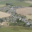
This grass-grown mound, which has previously been classified as a motte, is situated on the right (N) bank of the Gadie Burn on the W edge of Auchleven. It measures 28m from ESE to WNW by 25m transversely and up to 5.5m in height above the ground immediately to the S, but only 2.5m above that to the N. The summit measures 10m from ESE to WNW by 6.5m transversely. There is no evidence that there was ever a ditch around the foot of the mound, and its identification as a motte can only be established by excavation.
Visited by RCAHMS (ATW), 23 July 1999.

