Pricing Change
New pricing for orders of material from this site will come into place shortly. Charges for supply of digital images, digitisation on demand, prints and licensing will be altered.
Hill Of Christ's Kirk
Palisaded Enclosure (Period Unassigned), Rig And Furrow (Medieval) - (Post Medieval)
Site Name Hill Of Christ's Kirk
Classification Palisaded Enclosure (Period Unassigned), Rig And Furrow (Medieval) - (Post Medieval)
Canmore ID 18141
Site Number NJ62NW 21
NGR NJ 6018 2742
Datum OSGB36 - NGR
Permalink http://canmore.org.uk/site/18141
- Council Aberdeenshire
- Parish Kennethmont
- Former Region Grampian
- Former District Gordon
- Former County Aberdeenshire
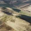
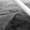
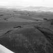
Opposite Dunnideer is the gently rounded Hill of Christ's Kirk, crowned by a small prehistoric fort, which name refers to the pre-Reformation Christ's Kirk on the Green, reputedly the scene of King James I's poem of that name. (The parish also bore the evocative name Rathmuriel or the Haugh of Moreal.)
Taken from "Aberdeenshire: Donside and Strathbogie - An Illustrated Architectural Guide", by Ian Shepherd, 2006. Published by the Rutland Press http://www.rias.org.uk
NJ62NW 21 6018 2742
(NJ 601 274) Unfinished fort, on Hill of Christ's Kirk, discovered and surveyed during survey of marginal lands 1956-8.
RCAHMS 1963; Information from RCAHMS MS plan.
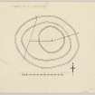
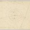
This unfinished fort consists of a sub-circular, well defined trench, enclosing the hill top, with a gap in the W probably denoting an entrance. It is in turn surrounded by the scant remains of two oval marker trenches, about 10 metres apart, with the remains of another outside these apparent in the W only. The outer pair of marker trenches are impossible to trace fully in the S through whins, possibly due to soil creep, but it might be that they were never completed, as is probably the case on the steep N slope where the inner pair of marker trenches stop very abruptly.
It may be that the innermost trench is of an earlier period than the other works because of its shape and much sharper definition, and it possibly represents a palisaded homestead which was about to be succeeded by the fort.
Surveyed at 1/2500.
Visited by OS (AA) 27 March 1969.
Fort [NR] (unfinished) [NAT]
OS 1:10,000 map, 1982.
Palisaded enclosure reported.
NMRS, MS/712/17.
GRC/AAS ground and air photography listed.
NMRS, MS/712/19, MS/712/21 and MS/712/36.
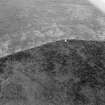
Hill enclosure. Air photographs: AAS/00/02/G3/1.
NMRS, MS/712/100.
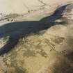
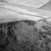
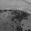
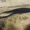
(Reclassified as Palisaded Enclosure; Rig). This palisaded enclosure, which was formerly classified as an unfinished fort, is situated on the summit of the Hill of Christ's Kirk. Three lines of palisade trench are visible, though these are difficult to follow in the scrub vegetation that has grown up since the summit of the hill was incorporated into a new plantation. The trenches are most clearly defined on the NE, where each comprises a shallow groove or ditch some 1.2m in breadth, flanked externally by a low bank of upcast.
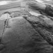
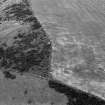
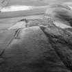
An area of rig-and-furrow cultivation is situated immediately E of the palisaded enclosure. Now partly obscured by the recently planted trees and rough grass, the rig is most clearly visible on vertical aerial photographs (58/RAF/1512 F21, 0116-7), taken in 1954. The rigs are aligned NNW and SSE, and probably once extended into the arable field to the S and E, which is now also planted with trees.
Visited by RCAHMS (JRS, IF), 4 April 1996.
Scheduled as 'Hill of Christ's Kirk, fort... visible as slight field remains and cropmarks on oblique aerial photographs'.
Information from Historic Scotland, scheduling document dated 13 December 2006.
Field Visit (4 August 1956)
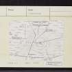
This site was included within the RCAHMS Marginal Land Survey (1950-1962), an unpublished rescue project. Site descriptions, organised by county, are available to view online - see the searchable PDF in 'Digital Items'. These vary from short notes, to lengthy and full descriptions. Contemporary plane-table surveys and inked drawings, where available, can be viewed online in most cases - see 'Digital Images'. The original typecripts, notebooks and drawings can also be viewed in the RCAHMS search room.
Information from RCAHMS (GFG) 19 July 2013.
Reference (1963)
This site is noted in the ‘List of monuments discovered during the survey of marginal land (1956-8)’, published in Vol. 1 of the RCAHMS Inventory of Stirlingshire. The 26 monuments were listed by their name, classification, parish and county, and the list also includes an indication of whether they had been planned (P), whether they were visible only as a cropmark (C), and whether they were worthy of preservation (*).
Information from RCAHMS (GFG) 30 October 2012.
Note (17 April 2015 - 18 May 2016)
This enclosure occupies the summit Hill of Christ's Kirk and has variously been interpreted as the remains of at least three marker trenches for an unfinished fort, or a palisaded perimeter. On balance the latter is to be preferred, though RCAHMS investigators who first noted it could detect no trace of a trench in an exposed section of the outermost line on the SW, but in its hilltop position it should nevertheless by considered to be a fortification. Oval on plan, the two outer trenches, each of which is about 0.6m broad and has traces of an upcast bank on its outer lip, are set between 10m and 12m apart and enclose an oval area measuring 85m from E to W by 64m transversely (0.43ha), and there are possible traces of yet another trench placed concentrically about 8m beyond them round the W quarter. Eccentrically within the interior, which is otherwise featureless, an inner enclosure measuring about 43m in internal diameter (0.15ha) can also be seen; it probably represents a separate phase of construction, though whether earlier or later is unknown. The courses of the various perimeters are difficult to track in the long grass and whins, and the position of the entrance is unknown.
Information from An Atlas of Hillforts of Great Britain and Ireland – 18 May 2016. Atlas of Hillforts SC2960
Excavation (7 November 2016 - 11 November 2016)
NJ 6018 2742 (NJ62NW 21) As part of the Northern Picts project surveys and excavations have been undertaken on a number of enclosed settlements in Moray and Aberdeenshire to help construct regional datasets on the dating of fortified settlement.
A five-day evaluation, 7–11 November 2016, targeted a series of palisaded enclosures at Hill of Christ’s Kirk. The site consists of three circuits of a palisaded enclosure with the interior enclosure measuring c21m in diameter and the outer c55m. The inner enclosure is offset from the outer two suggesting it could have been later in date.
Scheduled monument consent was obtained to open four trenches – one in the interior and three across the three lines of palisade. The 5 x 5m interior trench located a possible floor layer of a building and a small pit or posthole. Trench 2 over the inner palisade identified a shallow palisade slot
c0.4m wide and 0.3m deep. Trench 3 over the middle palisade identified a palisade foundation cut c0.6m wide by 0.5m deep. Large stone packing was evident in the fill. Trench 4 over the exterior palisade again found a palisade cut 0.3m wide and c0.4 m deep. Radiocarbon dates suggests the outer palisade is the earliest dating to the Early Iron Age. Determinations
from the two inner palisade slots were broadly contemporary with the inner floor layer and dated to around 400 cal BC.
Archive: University of Aberdeen
Funder: University of Aberdeen
Gordon Noble and Oskar Sveinbjarnarson – University of Aberdeen
(Source: DES, Volume 18)


