Cothiemuir Wood
Recumbent Stone Circle (Neolithic) - (Bronze Age)
Site Name Cothiemuir Wood
Classification Recumbent Stone Circle (Neolithic) - (Bronze Age)
Alternative Name(s) Castle Forbes; Cothiemuir Hill
Canmore ID 18055
Site Number NJ61NW 1
NGR NJ 61711 19809
Datum OSGB36 - NGR
Permalink http://canmore.org.uk/site/18055
- Council Aberdeenshire
- Parish Keig
- Former Region Grampian
- Former District Gordon
- Former County Aberdeenshire
NJ61NW 1 61711 19809.
(NJ 6171 1980) Stone Circle (NR)
OS 6" map, (1959)
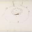
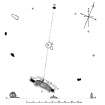
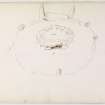
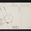
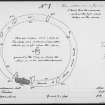
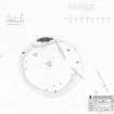
The remains of a recumbent stone circle, 70'6" east-west by 62' SW-NE, which was probably complete in 1842 since Low (1845) mentions twelve stones, which Coles (1901) reckons was the original number.
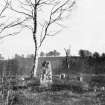
Of the twelve stones extent in 1842 two were fallen, four were broken and five were erect. Low also notes a quantity of loose stones near middle of the circle 'and near the centre a slab of 4' or 5' square, covering a small pit open to south side'. This is presumably the displaced central cist-cover mentioned by Coles, at the time of whose visit seven stones were in position, one had fallen and four were missing.
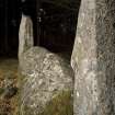
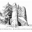
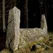
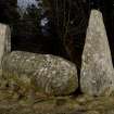
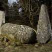
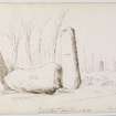
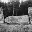
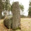
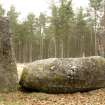
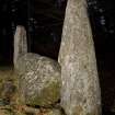
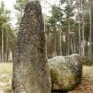
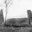
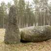
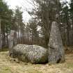
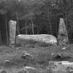
A feature of the circle is the height of pillars flanking the recumbant stone, 9' and 9'2", in comparison with the rounded bulk of that stone which weighs about 20 tons.
The circle is a popular attraction in the neighbourhood.
F R Coles 1901; New Statistical Account (NSA) 1845.
The remains of a recumbent stone circle evidently in the same state of preservation as when seen by both Coles (1901) and Low (1845), except that there is now no trace of the four broken stones noted by Low. Coles' section is incorrect; the stones stand around the perimeter of an overgrown stony platform 0.7m high, in the centre of which the "cist" slab still survives. The pit which the slab covers is choked with stones.
Revised at 1/2500.
Visited by OS (ISS) 8 August 1973.
Listed as a recumbent stone circle by Burl (1973).
H A W Burl 1973.
No change to previous field report.
Revised at 1/2500.
Visited by OS (NKB) 20 August 1976.
(Name cited as Cothiemuir Hill).
NMRS, MS/712/56.
Scheduled as Cothiemuir Hill, stone circle.
Information from Historic Scotland, scheduling document dated 2 August 2001.
NJ 6171 1980 In a third season of excavations following on from the work on the Tomnaverie stone circle in the Howe of Cromar, Deeside (DES 2000, 9), three small trenches were excavated at the Cothiemuir Wood stone circle, Donside. The trenches were designed to assess the structural sequence of the monument and compare this with the results from the Tomnaverie excavations.
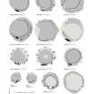
The sequence is similar to that observed at Tomnaverie. A low cairn, or platform of rubble, was constructed on a flat hilltop, which may have been scarped level. The platform was open at the centre and revetted on the exterior with an exterior buttress of rubble, and on the interior by a bank of massive boulders. There may have been a cist in the middle of the site where the filling of an unrecorded excavation contains a number of burnt stones. The recumbent stone circle was a later addition to the monument and the sockets of two of the monoliths could be seen to cut through the structure of the cairn. The only artefacts recovered are a few worked flints and worked and unworked quartz.
Sponsor: Historic Scotland
R Bradley 2001
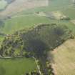
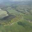
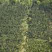
NJ 617 198 A desk-based assessment and field survey were carried out in May 2005 in advance of the creation of a natural burial site. A recumbent stone circle is located on the top of the hill (NJ61NW 1), while remains of rig and furrow are visible on the N and E flanks.
Report to be lodged with Aberdeenshire SMR and NMRS.
Sponsor: Native Woodlands Ltd
Field Visit (14 April 1998)
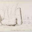
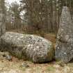
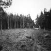
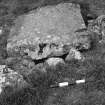
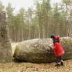
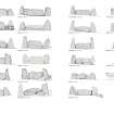
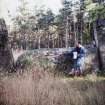
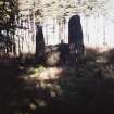
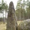
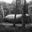
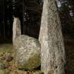
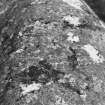
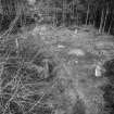
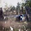
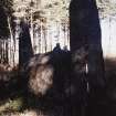
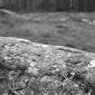
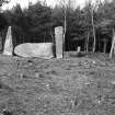
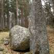
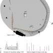
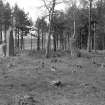
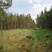
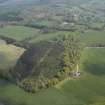
The recumbent setting of this stone circle is one of the most impressive, standing in a ride cutting through the coniferous plantation that cloaks the broad summit of a low hill. Measuring about 20m in diameter, the circle encloses a well-preserved cairn and originally comprised up to thirteen stones, though only eight now remain. Of these the recumbent setting (1–3) and those on the SE (4), NNE (5) and WSW (8) are upright, one on the WNW (7) leans steeply outwards, and another on the NW (6) has fallen. The recumbent boulder (2) is situated on the SSW of the ring and measures 4.15m in length and 1.25m in height. Its summit is relatively even, rising gently towards the E, and on the outer face there are at least two possible cupmarks, situated to the W of the natural indentations known as The Devil’s Hoofmarks (see below). The two flankers, which are the tallest stones in the ring, are of roughly the same height, standing up to 2.7m high, but whereas the eastern is a slender square-sectioned pillar splaying from its foot to a flat top, the western tapers upwards to a blunt point (Bradley 2005, 67). This contrast in their shapes is repeated in the way they are placed, for while both are set back from the leading edge of the recumbent, the western projects the long axis of the setting, and the eastern, which is also fitted so tightly to the end of the recumbent that it leans inwards, is turned slightly as if to trace the arc of the circle. The circle appears to have been graded to reduce in height and spacing from the flankers on the SSW round to the NNE, each of the surviving orthostats stand within the margin of a flat-topped cairn. The latter measures up to 22m in diameter and 0.8m in height; around the eastern half the edge of the mound forms a fairly sharply defined scarp, but this has been flattened out on the W by the passage of an old track. A single kerbstone protrudes through the body of the mound on the NE, while a roughly rectangular slab lies at the centre.
Visited by RCAHMS (JRS, ATW, IGP and KHJM) 14 April 1998


