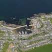
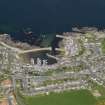
Findochty Harbour
Harbour (Period Unassigned)
Site Name Findochty Harbour
Classification Harbour (Period Unassigned)
Alternative Name(s) Broad Hythe; Moray Firth
Canmore ID 17401
Site Number NJ46NE 25
NGR NJ 46158 67952
NGR Description Centred NJ 46158 67952
Datum OSGB36 - NGR
Permalink http://canmore.org.uk/site/17401
- Council Moray
- Parish Rathven
- Former Region Grampian
- Former District Moray
- Former County Banffshire
NJ46NE 25.00 centred 46158 67952
NJ46NE 25.01 NJ 46197 68036 Lighthouse (West Breakwater).
Location formerly entered as NJ 461 679.
(Location cited as NJ 462 280). Findochty Harbour, rebuilt 1883. Formed by an L-plan pier and a straight pier, with a stilling basin created by a second straight pier. All the works are concrete.
J R Hume 1977.
(NJ 461 679). In 1794 the parish of Rathven contained four 'fisher-towns' - Buckie, Findochty, Portnockie and Portessie - of which only the first two were regarded as possible sites for piers or quays. Findochty is marked by Pont on one of his MS plans and a harbour had in fact been projected in 1602 when the proprietor had applied for help in its construction to the Convention of Royal Burghs; but the Convention had 'continued' the business and no decision appears to have been taken. There was still no harbour at Findochty in 1847.
With the forgoing record, which implies the existence of a sea-going community at the beginning of the 17th century, it is difficult to reconcile the tradition that the first settlement was made in 1716 by a group of fishermen from Fraserburgh; but however that may be - and it is possible that the colony was so formed, but has been given too late a date - it is clear that until the later 19th century the boats must have worked off the open beach, with no better shelter than was given by the natural inlet, at the cost of much hardship and danger. A block of early fishermen's houses beside the harbour deserves notice as an example of vernacular building; they are set in close parallel rows, separated by narrow footways and with their gable-ends turned seawards, with the object in both respects of countering northerly gales.
A Graham 1979, visited 1973.
Air photographs: AAS/97/12/G27/3 and AAS/97/12/CT.
NMRS, MS/712/29.
Location cited as NJ 4620 6800: air photographic imagery listed.
NMRS, MS/712/35.


