
Glasgow, Cathcart, Holmlea Road, New Bridge


Road Bridge (Period Unassigned)
Site Name Glasgow, Cathcart, Holmlea Road, New Bridge
Classification Road Bridge (Period Unassigned)
Alternative Name(s) Cart Bridge; Clarkston Road; White Cart Water
Canmore ID 172749
Site Number NS56SE 1167
NGR NS 58387 60626
Datum OSGB36 - NGR
Permalink http://canmore.org.uk/site/172749


- Council Glasgow, City Of
- Parish Cathcart (City Of Glasgow)
- Former Region Strathclyde
- Former District City Of Glasgow
- Former County Lanarkshire
New Bridge, Holmlea Road, 1901
Flat segmental-arched masonry road bridge, with polished red granite balustrades and voussoirs and cast-iron lamp brackets on piers. Replacement for 1800 humpback bridge.
Taken from "Greater Glasgow: An Illustrated Architectural Guide", by Sam Small, 2008. Published by the Rutland Press http://www.rias.org.uk

NS56SE 1167 58387 60626
Not to be confused with Cathcart, Snuff Mill Road, Old Bridge (NS 58527 60141), for which see NS56SE 39.
New Br [NAT]
OS 1:10,000 map, 1989.
Cart Bridge, Clarkston Rd: built 1901-2 when the tramway was extended to Netherlee. This flat segmental-arched masonry bridge over the River Cart [White Cart Water], with granite balustrades, replaced a hump-backed bridge of c 1800.
J R Hume 1974.
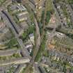
This bridge carries Holmlea Road (a SW-wards continuation of Clarkston Road) over the White Cart Water within the Cathcart area of SW suburban Glasgow.
Information from RCAHMS (RJCM), 10 February 2006.
Photographic Survey (25 February 2009 - 17 March 2009)
Three Level 2 Building Surveys were undertaken by Headland Archaeology Ltd as part of archaeological works within the Flood Prevention Scheme, by Volker Stevin.
These surveys were carried out along the proposed development route, within work sections 6, 8 and 9. This focus is part of the Cathcart & Langside area of Glasgow, located within the south side of the River Clyde.
The surveys included two bridges named Devlin Road Bridge and Holmlea Bridge, and also the Flood Retaining Wall located on the River Cart at Spean Street.
Headland Archaeology 2009

