|
Digital Files (Non-image) |
GV 006793 |
Historic Environment Scotland |
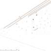
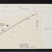
HES Survey and Recording Illustration: Plan of Garran Burn stone circle |
21/5/2018 |
Item Level |
|
 |
On-line Digital Images |
SC 1661975 |
Historic Environment Scotland |
HES Survey and Recording Illustration: Plan of Garran Burn stone circle. |
21/5/2018 |
Item Level |
|
|
Digital Files (Non-image) |
TM 000335 |
Historic Environment Scotland |
GNSS data relating to HES survey of Garran Burn |
15/2/2018 |
Item Level |
|
 |
On-line Digital Images |
SC 2372049 |
Records of the Ordnance Survey, Southampton, Hampshire, England |
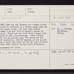
Garran Burn, NJ43NE 5, Ordnance Survey index card, Recto |
c. 1958 |
Item Level |
|
 |
On-line Digital Images |
SC 2372050 |
Records of the Ordnance Survey, Southampton, Hampshire, England |
Garran Burn, NJ43NE 5, Ordnance Survey index card, Recto |
c. 1958 |
Item Level |
|
 |
On-line Digital Images |
SC 2372051 |
Records of the Ordnance Survey, Southampton, Hampshire, England |
Garran Burn, NJ43NE 5, Ordnance Survey index card, Recto |
c. 1958 |
Item Level |
|
|
All Other |
551 166/1/1 |
Records of the Ordnance Survey, Southampton, Hampshire, England |
Archaeological site card index ('495' cards) |
1947 |
Sub-Group Level |
|
|
All Other |
551 500/1/15/4/15 |
Historic Environment Scotland |
Stone circle, Garran Burn |
11/2018 |
Sub-Group Level |
|


