|
Photographs and Off-line Digital Images |
D 16524 CN |
RCAHMS Aerial Photography |
Oblique aerial view of the Ring of Brodgar, henge and stone circle, taken from the W. Also visible are cairns and the 'Comet Stone' |
1997 |
Item Level |
|
|
Photographs and Off-line Digital Images |
D 16522 CN |
RCAHMS Aerial Photography |
Aerial view of Orkney, Ring of Brodgar, henge and stone circle, taken from the N. Also visible are cairns and the 'Comet Stone'. |
1997 |
Item Level |
|
|
Photographs and Off-line Digital Images |
D 16523 CN |
RCAHMS Aerial Photography |
Aerial view of Orkney, Ring of Brodgar, henge and stone circle, taken from the NW. Also visible are cairns and the 'Comet Stone'. |
1997 |
Item Level |
|
|
Photographs and Off-line Digital Images |
D 16525 CN |
RCAHMS Aerial Photography |
Aerial view of the Ring of Brodgar, henge and stone circle, taken from the SW. Also visible are some of the surrounding cairns. |
1997 |
Item Level |
|
|
Photographs and Off-line Digital Images |
D 16526 CN |
RCAHMS Aerial Photography |
Aerial view of Orkney, Ring of Brodgar, henge and stone circle, taken from the SE. Also visible are cairns and the 'Comet Stone'. |
1997 |
Item Level |
|
|
Manuscripts |
MS 7092 |
Orkney Research Centre for Archaeology (ORCA) |
Report: 'Ness of Brodgar, Stenness, Orkney.' |
7/2011 |
Item Level |
|
 |
On-line Digital Images |
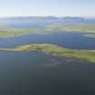
DP 243847 |
Historic Environment Scotland |
Oblique aerial view. |
16/8/2016 |
Item Level |
|
 |
On-line Digital Images |
DP 273460 |
Historic Environment Scotland |
Oblique aerial view. |
24/3/2018 |
Item Level |
|
 |
On-line Digital Images |
DP 273461 |
Historic Environment Scotland |
Oblique aerial view. |
24/3/2018 |
Item Level |
|
 |
On-line Digital Images |
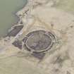
DP 273462 |
Historic Environment Scotland |
Oblique aerial view. |
24/3/2018 |
Item Level |
|
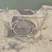 |
On-line Digital Images |
DP 273463 |
Historic Environment Scotland |
Oblique aerial view. |
24/3/2018 |
Item Level |
|
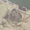 |
On-line Digital Images |
DP 273464 |
Historic Environment Scotland |
Oblique aerial view. |
24/3/2018 |
Item Level |
|
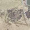 |
On-line Digital Images |
DP 273465 |
Historic Environment Scotland |
Oblique aerial view. |
24/3/2018 |
Item Level |
|
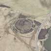 |
On-line Digital Images |
DP 273466 |
Historic Environment Scotland |
Oblique aerial view. |
24/3/2018 |
Item Level |
|
 |
On-line Digital Images |
SC 1691566 |
RCAHMS Aerial Photography |
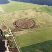
Aerial view of Orkney, Ring of Brodgar, henge and stone circle, taken from the N. Also visible are cairns and the 'Comet Stone'. |
1997 |
Item Level |
|
 |
On-line Digital Images |
SC 1691567 |
RCAHMS Aerial Photography |
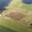
Aerial view of Orkney, Ring of Brodgar, henge and stone circle, taken from the NW. Also visible are cairns and the 'Comet Stone'. |
1997 |
Item Level |
|
 |
On-line Digital Images |
SC 1691568 |
RCAHMS Aerial Photography |
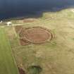
Oblique aerial view of the Ring of Brodgar, henge and stone circle, taken from the W. Also visible are cairns and the 'Comet Stone' |
1997 |
Item Level |
|
 |
On-line Digital Images |
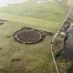
SC 1691569 |
RCAHMS Aerial Photography |
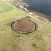
Aerial view of the Ring of Brodgar, henge and stone circle, taken from the SW. Also visible are some of the surrounding cairns. |
1997 |
Item Level |
|
 |
On-line Digital Images |
SC 1691570 |
RCAHMS Aerial Photography |
Aerial view of Orkney, Ring of Brodgar, henge and stone circle, taken from the SE. Also visible are cairns and the 'Comet Stone'. |
1997 |
Item Level |
|
 |
On-line Digital Images |
SC 2339736 |
Records of the Ordnance Survey, Southampton, Hampshire, England |
Ness Of Brodgar, HY21SE 21, Ordnance Survey index card, Recto |
c. 1958 |
Item Level |
|
 |
On-line Digital Images |
SC 2339737 |
Records of the Ordnance Survey, Southampton, Hampshire, England |
Ness Of Brodgar, HY21SE 21, Ordnance Survey index card, Recto |
c. 1958 |
Item Level |
|
 |
On-line Digital Images |
SC 2339738 |
Records of the Ordnance Survey, Southampton, Hampshire, England |
Ness Of Brodgar, HY21SE 21, Ordnance Survey index card, Recto |
c. 1958 |
Item Level |
|
|
All Other |
551 166/1/1 |
Records of the Ordnance Survey, Southampton, Hampshire, England |
Archaeological site card index ('495' cards) |
1947 |
Sub-Group Level |
|