Ness Of Brodgar
Cairn (Period Unassigned)(Possible)
Site Name Ness Of Brodgar
Classification Cairn (Period Unassigned)(Possible)
Canmore ID 1709
Site Number HY21SE 21
NGR HY 2946 1313
Datum OSGB36 - NGR
Permalink http://canmore.org.uk/site/1709
- Council Orkney Islands
- Parish Stenness
- Former Region Orkney Islands Area
- Former District Orkney
- Former County Orkney
HY21SE 21 2946 1313.
(HY 2946 1313) A 'small tumulus' is shown on Thomas's theodolite survey of 1849, immediately north of a 'stone or more probably an earth quarry'.
F W L Thomas 1852.
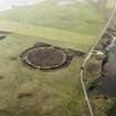
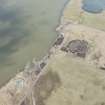
A small oval flat-topped mound of earth and stone measuring 9.0m. by 12.0 m., and 0.7m. high. It is similar to a group of cairns or tumuli nearby (HY21SE 16) and should probably be included in that complex.
Surveyed at 1/2500.
Visited by OS (RB) 24 April 1966.
Field Visit (1 May 1994)
This bowl-shaped mound was visited as part of the Orkney Barrows Project. Measuring 9.4m by 10.1m and 0.7m in height, it is fairly well preserved. It is not situated in a prominent position.
Information from the Orkney Barrows Project (JD), 1994
Field Visit (April 2012 - March 2013)
HY 387 141 and HY 294 131 (centred on) Work on Holocene sea level change in Orkney indicates that relative sea levels only reached their present position some 4000 years ago. This project which was set up in 2005 aims to: construct a sea level curve to provide detail of former changes in relative sea level around Orkney; investigate the possibility that remains of past human settlement might be preserved on the seabed.
The project combines different strands of work including sediment coring, remote sensing, seismic survey, diving, intertidal survey, palaeoenvironmental analysis on land, in the intertidal zone and from submerged surfaces, aerial photography, archive searches, and ethnoarchaeology.
In April 2012 – March 2013 work focused on coring and diving in the Bay of Firth with the following aims: Investigation of the Main Mound site in order to determine possible anthropogenic origin; trial of subsea vibrocore equipment in palaeo-landscape and archaeological contexts; recovery of detail relating to organic sediments below the present seabed, indicative of a lake prior to inundation by the sea; reconstruction of Early Holocene inundation sequence as it took place in the Bay of Firth and production of palaeogeographic reconstruction as inundation took place.
Preliminary results indicate that the Main Mound is natural in origin. Work in 2014–5 will focus on the recovery of short sediment cores from around the mound in order to ascertain whether any evidence such as charcoal or micro-artefacts exist, suggesting the possible human use of this prominent place in the ancient landscape.
Trials of the vibrocore equipment were successful and further work will be undertaken in 2014–5. Lake bed deposits rich in mollusc remains exist beneath the marine sands recording the flooding of the basin following sea level rise. The combination of the high resolution seismic and dated cores allows a more comprehensive framework for inundation of this part of the Bay of Firth. As we are now able to provide a dated framework for inundation in this part of the bay, current modelling of the inundation process should add further insight to the exact timing and mechanism of inundation.
Brief dives were made at Loch of Stenness on one of the anomalies identified in 2011, a long mound to the N of the Seatter embayment, to undertake a visual inspection. Results support the seismic report from 2012 in suggesting that the feature may be artificial in origin.
Archive: ADS, Orkney HER and RCAHMS (intended)
Funder: Historic Scotland and Carnegie Trust
CR Wickham-Jones, University of Aberdeen
S Dawson, University of Dundee
R Bates, University of St Andrews
M Bates, University of Wales Trinity Saint David
D Huws, University of Bangor
N Nayling, 2013
(Source: DES)


