
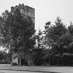
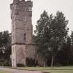
Gordon Castle, Tower


Country House (18th Century) - (19th Century), Tower House (Medieval)
Site Name Gordon Castle, Tower
Classification Country House (18th Century) - (19th Century), Tower House (Medieval)
Alternative Name(s) Bog O' Gight; Gordon Castle Policies
Canmore ID 16884
Site Number NJ35NW 10
NGR NJ 34986 59555
Datum OSGB36 - NGR
Permalink http://canmore.org.uk/site/16884


- Council Moray
- Parish Bellie
- Former Region Grampian
- Former District Moray
- Former County Morayshire
NJ35NW 10 34986 59555
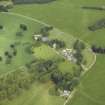
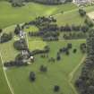
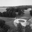
(NJ 3500 5956) Gordon Castle (NR)
OS 6" map, (1959)
For (present) Gordon Castle (NJ 3506 5956) and related monuments, see NJ35NE 7.00.
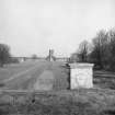
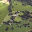
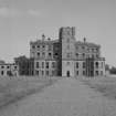
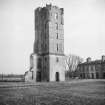
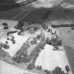
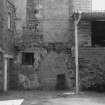
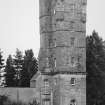
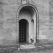
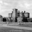
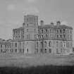
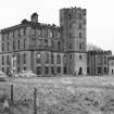
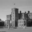
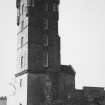
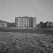
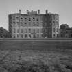
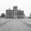
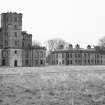
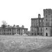
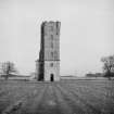
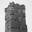
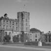
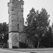
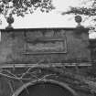
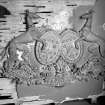
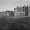
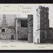
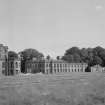
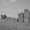
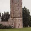
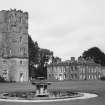
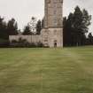
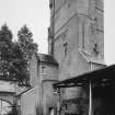
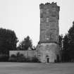
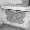
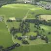
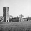
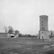
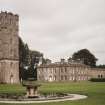
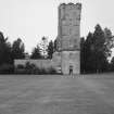
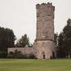
Gordon Castle, now demolished, included as a central feature a 15th century tower which was a relic of the famous 'Bog O' Gight'. The adjoining parts of the castle included 16th and 17th century work.
R G Cant 1948; Minstry of Works 1960.
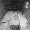
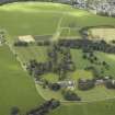
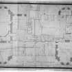
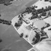
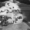
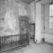
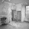
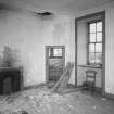
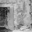
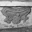
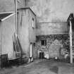
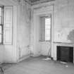
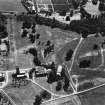
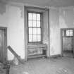
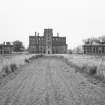
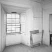
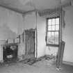
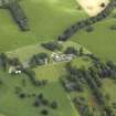
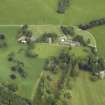
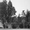
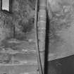
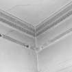
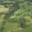
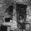
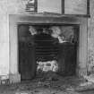
There has evidently been a stronghold in the Bog o' Gight, long drained and reclaimed, since at least the early 14th century but there is apparently no detailed information about it nor about the early history of Gordon Castle of which only fragments survive at NJ 3497 5955 partly reconstructed and incorporated in a modern work. Until recently it was the central piece of the huge 18th century mansion of Gordon Castle which is now split into three parts and only the E wing occupied. Barrel vaulting and traces of a circular stair can be seen in the N wall of the present building and according to local information the barrel vaulted kitchens survive intact.
Visited by OS (A A) 18 May 1971
L Shaw 1882; Information from 'The Gordon Book'.
Tower [NR]
OS 1:10,000 map, 1980.
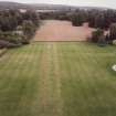
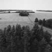
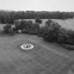
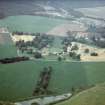
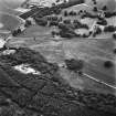
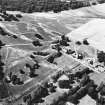
Air photographs: CUCAP GQ 46-9, dated 16 July 1951, and AAS/92/03/S7/7-9, dated 2 July 1992.
[Air photographic imagery and bibliographic references cited].
Information from Aberdeenshire Archaeological Service, June 1997.
NMRS, MS/712/19 and MS/712/36.
Present tower dates from 1540, incorporating remains of medieval castle.
See also: NJ35 NE 7.00 Gordon Castle, General
Archaeology Notes - for list of related sites
Architecture Notes - for Scottish Record Office references for all of Gordon Castle estate
Photographic Survey (1950)
Photographic survey of Gordon Castle, Morayshire, by the Scottish National Buildings Record
Photographic Survey (July 1952)
Photographic survey of Gordon Castle, Morayshire, by the Ministry of Works in July 1952.
Photographic Survey (4 November 1952)
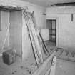
Photographic survey of Gordon Castle, Morayshire, by the Ministry of Works in November 1952 during demolition work.
Photographic Survey (March 1965)
Photographic survey of Gordon Castle, Morayshire by the Scottish National Buildings Record in 1965 during demolition.
Watching Brief (7 January 2019 - 14 March 2019)
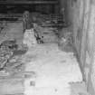
NJ 3497 5956 (centred) A watching brief was conducted between January & March 2019 for alterations to an existing barn adjacent to the Tower at Gordon Castle, Fochabers. The Tower dates from the 15th century (NRHE NJ35NW 10). The existing building was built in 1971, existing range of Country House was demolished in the early 1960's. Work revealed former house foundations and stub of tower wall but no other features, site in part very heavily disturbed by existing building, no deposits earlier than 19th century were revealed.
Full Report submitted to Moray HER and NRHE.
Archive: NRHE (intended), full report submitted to Moray HER and NRHE
Funder: Gordon Castle Estate
Stuart Farrell
(Source: DES Vol 20)

