|
Photographs and Off-line Digital Images |
A 1153/2 |
|
View from SE. |
13/4/1961 |
Item Level |
|
|
Photographs and Off-line Digital Images |
MO 709 |
Photographs by Mrs E M Booty, Clydemore, England |
Detail of Pans Port showing cathedral in distance from SE. |
1920 |
Item Level |
|
|
Photographs and Off-line Digital Images |
B 13929/2 P |
|
Photographic copy of drawing showing view of gate. |
23/9/1844 |
Item Level |
|
|
All Other |
G 91924 PC |
Records of Ian Gordon Lindsay and Partners, architects, Edinburgh, Scotland |
Postcard view from SE. |
|
Item Level |
|
 |
On-line Digital Images |
DP 188029 |
Records of the Royal Commission on the Ancient and Historical Monuments of Scotland (RCAHMS), Edinbu |
View from north east. |
18/3/2014 |
Item Level |
|
 |
On-line Digital Images |
DP 188030 |
Records of the Royal Commission on the Ancient and Historical Monuments of Scotland (RCAHMS), Edinbu |
View from east. |
18/3/2014 |
Item Level |
|
 |
On-line Digital Images |
SC 2370651 |
Records of the Ordnance Survey, Southampton, Hampshire, England |
Elgin, North College Street, Elgin Cathedral, Pans Port And Precinct Wall, NJ26SW 1.7, Ordnance Survey index card, Recto |
1958 |
Item Level |
|
 |
On-line Digital Images |
SC 2370652 |
Records of the Ordnance Survey, Southampton, Hampshire, England |
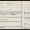
Elgin, North College Street, Elgin Cathedral, Pans Port And Precinct Wall, NJ26SW 1.7, Ordnance Survey index card, page number 1, Recto |
1958 |
Item Level |
|
 |
On-line Digital Images |
SC 2370653 |
Records of the Ordnance Survey, Southampton, Hampshire, England |
Elgin, North College Street, Elgin Cathedral, Pans Port And Precinct Wall, NJ26SW 1.7, Ordnance Survey index card, page number 2, Verso |
1958 |
Item Level |
|
 |
On-line Digital Images |
SC 2552613 |
|
View from SE. |
13/4/1961 |
Item Level |
|
|
Manuscripts |
MS 5481/4 |
Historic Scotland Archive Project |
Publication archive: Publication plan of Elgin excavation and Draft version of ‘A New Look at Old Elgin’. |
4/10/1995 |
Batch Level |
|
|
All Other |
551 166/1/1 |
Records of the Ordnance Survey, Southampton, Hampshire, England |
Archaeological site card index ('495' cards) |
1947 |
Sub-Group Level |
|


