Following the launch of trove.scot in February 2025 we are now planning the retiral of some of our webservices. Canmore will be switched off on 24th June 2025. Information about the closure can be found on the HES website: Retiral of HES web services | Historic Environment Scotland
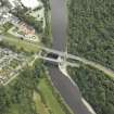
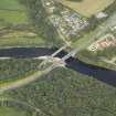
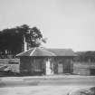
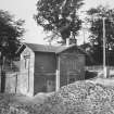
Fochabers Bridge, Tollhouse
Toll House (Post Medieval)
Site Name Fochabers Bridge, Tollhouse
Classification Toll House (Post Medieval)
Alternative Name(s) River Spey; Fochabers, Old Spey Bridge; Spey Bridge, Old Toll House
Canmore ID 162145
Site Number NJ35NW 24.01
NGR NJ 33984 59499
Datum OSGB36 - NGR
Permalink http://canmore.org.uk/site/162145
- Council Moray
- Parish Speymouth
- Former Region Grampian
- Former District Moray
- Former County Morayshire
NJ35NW 24.01 33984 59499
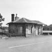
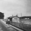
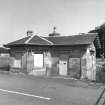
(Location [of bridge] cited as NJ 340 594 and cited [incorrectly] as in Urquhart parish). The tollhouse is an attractive one-storey and basement ashlar building with a semihexagonal bay and a low-pitched roof with eaves.
J R Hume 1977.
Toll House, Spey Bridge, c. 1830. Possibly designed by Archibald Simpson, who was involved with repairing the bridge (NJ35NW 24.00) after the Muckle Spate, it is delectably built in great blocks of polished stone, a bracketed architrave above the door and windows, and wide-eaved roof carrying ornamental brackets. Not quite a twin brother to the East Lodge to Gordon Castle (for which, see NJ35NW 57).
C McKean 1987.


