
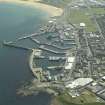
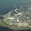
Fraserburgh Harbour, Balaclava Breakwater, Lighthouse


Beacon (Period Unassigned)
Site Name Fraserburgh Harbour, Balaclava Breakwater, Lighthouse
Classification Beacon (Period Unassigned)
Canmore ID 161717
Site Number NK06NW 3.03
NGR NK 00390 66891
Datum OSGB36 - NGR
Permalink http://canmore.org.uk/site/161717


- Council Aberdeenshire
- Parish Fraserburgh
- Former Region Grampian
- Former District Banff And Buchan
- Former County Aberdeenshire
NK06NW 3.03 00390 66891
Navigation Light (Fixed Green) [NAT]
OS 1:2500 map, 1964.
Lighthouse (flashing green) [NAT]
OS (GIS) AIB, April 2006.
Location formerly cited as NK 0038 6690.
(Fraserburgh: location cited as NK 004 669). At end of N pier (also cited as E breakwater): c. 1880. Tall tapering concrete tower, bellying out to support inward tapering base for railed gallery. Octagonal lantern, with domed top and ventilator. Round-headed doorway with 'Gibbs surround'.
J R Hume 1997.

