
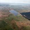
Islay, Mulreesh, Lead Mines, Office


Office (19th Century)
Site Name Islay, Mulreesh, Lead Mines, Office
Classification Office (19th Century)
Canmore ID 157886
Site Number NR46NW 7.02
NGR NR 4019 6823
Datum OSGB36 - NGR
Permalink http://canmore.org.uk/site/157886


- Council Argyll And Bute
- Parish Killarow And Kilmeny
- Former Region Strathclyde
- Former District Argyll And Bute
- Former County Argyll

