
Edinburgh, Holyrood Park, Hunter's Bog


Rig And Furrow (Medieval) - (Post Medieval)
Site Name Edinburgh, Holyrood Park, Hunter's Bog
Classification Rig And Furrow (Medieval) - (Post Medieval)
Alternative Name(s) Camstone Quarry; Queen's Park
Canmore ID 157302
Site Number NT27SE 3980
NGR NT 2720 7328
NGR Description NT 2720 7328 to NT 2730 7363
Datum OSGB36 - NGR
Permalink http://canmore.org.uk/site/157302


- Council Edinburgh, City Of
- Parish Edinburgh (Edinburgh, City Of)
- Former Region Lothian
- Former District City Of Edinburgh
- Former County Midlothian
Field Visit (15 December 1998)
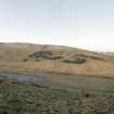
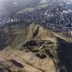
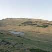
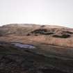
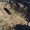
NT27SE 3980 2720 7328 to 2730 7363
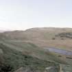
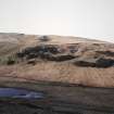
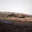
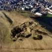
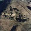
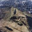
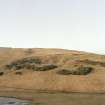
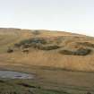
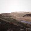
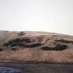
Traces of rig-and-furrow cultivation are visible on oblique aerial photographs below Camstone Quarry at the NW end of Hunter's Bog (D32892/cn-D32896/cn). The rigs are barely perceptible on the ground, but are between 6m and 8m in breadth.
Visited by RCAHMS (ARG), 15 December 1998

