
Pricing Change
New pricing for orders of material from this site will come into place shortly. Charges for supply of digital images, digitisation on demand, prints and licensing will be altered.
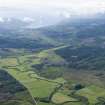
Dunamuck


Township (Post Medieval)
Site Name Dunamuck
Classification Township (Post Medieval)
Canmore ID 154426
Site Number NR89SW 58
NGR NR 84339 92255
NGR Description Centre
Datum OSGB36 - NGR
Permalink http://canmore.org.uk/site/154426

- Council Argyll And Bute
- Parish Kilmichael Glassary
- Former Region Strathclyde
- Former District Argyll And Bute
- Former County Argyll
Note (6 May 2020)
The location, classification and period of this site have been reviewed.
Note
A township, comprising eleven roofed buildings, one of which surrounds a courtyard, one unroofed building and three enclosures is depicted on the 1st edition of the OS 6-inch map (Argyllshire 1873, sheet clx). Two roofed, two unroofed buildings and three enclosures are shown on the current edition of the OS 1:10000 map (1989).
Information from RCAHMS (AKK) 18 May 1999.

