
Pricing Change
New pricing for orders of material from this site will come into place shortly. Charges for supply of digital images, digitisation on demand, prints and licensing will be altered.
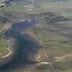
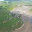
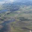
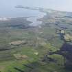
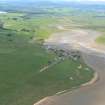
Inver, Harbour


Harbour (Period Unassigned)
Site Name Inver, Harbour
Classification Harbour (Period Unassigned)
Alternative Name(s) Inver Bay; Inver Channel; Dornoch Firth
Canmore ID 15317
Site Number NH88SE 8
NGR NH 8612 8280
Datum OSGB36 - NGR
Permalink http://canmore.org.uk/site/15317


- Council Highland
- Parish Tain
- Former Region Highland
- Former District Ross And Cromarty
- Former County Ross And Cromarty
NH88SE 8 8612 8280
See also NH88SE 24.

