Pricing Change
New pricing for orders of material from this site will come into place shortly. Charges for supply of digital images, digitisation on demand, prints and licensing will be altered.
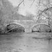
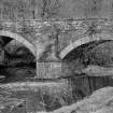
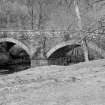
Inveraray, Kilblaan Bridge
Road Bridge (18th Century)
Site Name Inveraray, Kilblaan Bridge
Classification Road Bridge (18th Century)
Alternative Name(s) River Shira
Canmore ID 151627
Site Number NN11SW 21
NGR NN 12581 13465
Datum OSGB36 - NGR
Permalink http://canmore.org.uk/site/151627
- Council Argyll And Bute
- Parish Inveraray
- Former Region Strathclyde
- Former District Argyll And Bute
- Former County Argyll
Photographic Survey (1962)
Photographic survey of buildings on the Inveraray Castle Estate and in and around Inveraray, Argyll by the Scottish National Buildings Record in 1962
Field Visit (April 1984)
This two-arched bridge carries an Argyll Estate road across the River Shira 300m WNW of Kilblaan farm. It was begun in 1760 by the Dumbarton master-mason John Brown (see Nos. 255, 266), and was completed in 1768 (en.1).
The bridge measures 26.5m from E to W, including the abutments, and carries a level roadway 3.9m in width within 0.4m parapet-walls. Its masonry is of lime-mortared rubble, but the central and abutment-piers, up to springing-level, are of schist ashlar with channelled tooling. In all three piers the springing is marked by a projecting ashlar band 0.13m high, and similar bands enclose the narrow schist voussoirs of the arches, which are 0.71m in depth. The triangular cutwaters of the central pier are extended upwards as flat-fronted buttresses which die into the wall-faces 1.5m below the slab-copings of the parapet.
The two segmental arches are of almost identical dimensions, each having a span of about 10.6m and a height to the soffit of 4.5m above water-level. The springing of the W arch, however, is set 0.4m higher than the other. The height to the parapet is 6.7m above water-level.
RCAHMS 1992, visited April 1984


