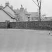
Inveraray, Church Square, General
General View (Period Unassigned)
Site Name Inveraray, Church Square, General
Classification General View (Period Unassigned)
Canmore ID 151585
Site Number NN00NE 61
NGR NN 0959 0843
NGR Description Centred NN 0959 0843
Datum OSGB36 - NGR
Permalink http://canmore.org.uk/site/151585
- Council Argyll And Bute
- Parish Inveraray
- Former Region Strathclyde
- Former District Argyll And Bute
- Former County Argyll
Photographic Survey (May 1962)
Photographic survey of buildings and sites in Inveraray and surrounding area, Argyll, by the Scottish National Buildings Record in 1962.
Field Visit (April 1989)
CHURCH SQUARE
At the time of Reid's survey in 1807 (en.9), the area W of the parish church (No. 37), between the avenue wall and the gable-ends of the corner houses in North Main Street and Arkland, was an open space, 73m from N to S by 46m, used as a market-place. The portico proposed by Mylne for this side-wall of the church was intended to shelter some of the market-produce, and a 'pump well' was situated about 10m S of the SE angle of North Main Street. Extending along the avenue wall directly W of the church there was a block measuring about 21m by 7m over all, whose N part was somewhat narrower, and probably an addition. Without this, the building corresponded closely to the 'House of 60 feet (18.3m) longe & 2 storrys High', whose site was marked out by the 5th Duke in 1771 for use as a temporary Lowland church. An early photograph shows it two-storeyed and gabled, with two groups of three window-bays, and an added porch. Lofts and seats from the old parish church were installed, but in 1783 the temporary church was moved to the house now occupied by the George Hotel (supra) and the building was used as a school from the early 19th century until 1907, when it was replaced by a larger building, now a community centre (en.10). In 1865 the NW part of the square was occupied by a two-storeyed bank and its outbuildings.
To the E of the church, two high symmetrical garden-walls. running obliquely for 29m from the wangles of Relief Land and the George Hotel, and associated respectively with a house SW of the court-house, and with the hotel, form the entrance of an E-W street 18m wide (en.11). This now extends about 28m to the W front of the court-house of 1816-20 (No. 205) but there was formerly at least one further house on each side, which was removed to make way for the court-house. On the N of the street, built after 181S on part of the garden attached to the George Hotel, there is a single-storeyed hiproofed building, now a shop, at the angle of a back lane which gives access to several stables and outbuildings on each side. The house forming the N side of the street, between the back lane and a passage leading to Factory Land (No. 206), is a gabled two-storeyed building of three bays, 9.8m by 5m, with a lean-to, probably added before 1807, against the E gable. The ground-level in this area was lowered during the construction of the court-house, and the central doorway is now enclosed in a hip-roofed porch with a forestair to the W, while the addition has a forestair against its E wall. This building was formerly separated by a narrow alleyway from another measuring about 13m from E to W by 6.7m, probably the house built by the Argyll estate for William Ross, shoemaker, in 1774, the same year as the nearby Factory Land (No. 206). Ross's property extended E to fill what is now the NW re-entrant of the court-house and its enclosure, but was demolished in 1816 although an outbuilding extending N survives.
It is not known whether there were any buildings on the site of the court-house itself, and the building that in 1807 stood opposite Ross's house, on the S of the street, appears to have been aligned N-S and may have been a mere outhouse. The principal house fronting the street on the S, with a three-bay12.8m frontage, is set opposite that on the N, and likewise has a flight of steps to the central doorway. It had received considerable additions at the rear before 1807 and was heightened, with dormers extending below the wall-head, in the second half of the 19th century. A single-storeyed bank building continuing the line of the house-front was erected before 1868 on part of the enclosed garden to the w, which until 1983 also contained the Campbell Monument of 1754 (No. 188) (en.12). In the entrance to the street, 12m E of the church, there is a granite drinking-fountain carved by Mossman, Glasgow, and erected in 1893 (en.13).
RCAHMS 1992, visited c. April 1989


