
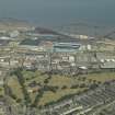
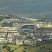
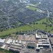
Edinburgh, Leith Links, General


General View (Period Unassigned), Linear Feature (Period Unassigned)
Site Name Edinburgh, Leith Links, General
Classification General View (Period Unassigned), Linear Feature (Period Unassigned)
Alternative Name(s) Old Golf House
Canmore ID 150052
Site Number NT27NE 516
NGR NT 27426 75957
Datum OSGB36 - NGR
Permalink http://canmore.org.uk/site/150052


- Council Edinburgh, City Of
- Parish Edinburgh (Edinburgh, City Of)
- Former Region Lothian
- Former District City Of Edinburgh
- Former County Midlothian
NT27NE 516 274 760
Geophysical survey in Pilrig Park and Leith Links revealed a complex series of anomalies, some of which may be associated with siege works dating to the investment of the French citadel of Leith in 1560. Further anomalies may relate to the gardens associated with Pilrig House and a Second World War air raid shelter, which cuts through the earlier remains of an artillery fort in Pilrig Park.
Following on from this, a programme of trial trenching was carried out in November 2006 in Pilrig Park in order to 'ground-truth' geophysical anomalies and to investigate topographic features. Five trenches were opened, four of which were found to contain archaeological features and deposits beneath a substantial layer of garden soil.
Trench 1 contained a wall related to a building associated with nearby Pilrig House, which was built in the 1630s. This building appears to have been demolished some time in the 19th century. Also within the trench was a road made of various deposits of recycled stone and various midden deposits which included 18th-century bottles and ceramics, again probably related to the house.
Trench 2 contained probable remains of Somerset's Mount, an artillery fort constructed by the English besiegers of the French citadel of Leith in 1560. The remnants of a slighted ditch contained a number of features, including what appears to be a blacksmith's forge and a linear slot which may relate to a building. Sherds of 16th-century pottery were recovered from both features and also from various mixed contexts above them.
Trench 3 contained evidence for a WWII air-raid shelter which showed up very clearly in the magnetometer survey. The shelter had been demolished, and the concrete uprights and roof supports now lie against one another like toppled dominoes. Local people had no knowledge of this feature, though there was reputedly an air-raid shelter elsewhere in the park (evidenced by a photograph taken in the 1950s/60s).
Archive to be deposited in NMRS. Report lodged with CECAS SMR and NMRS.
Sponsor: City Development, City of Edinburgh Council.
T Pollard, 2006.
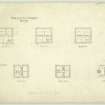
Edinburgh, Leith Links, Mr Hay's Villa.
NMRS REFERENCE.
PLANS:
Dick Peddie 7 MacKay, Edinburgh, adds & alts.
Attic 2, Bin 34, Bag 1.
Peddie & Kinnear, 1864.
EXTERNAL REFERENCE:
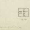
Sources: Dean of Guild. Bundle 1807. June-December 25.6.1807
Pet. John Russell jun. Mason in Leith.
Leith Links bounded by on:
S.W Leith Links.
S.E Property of James Jameson.
N.W Mutual road.
Plan and elevation missing.
On front - "3 Feb. 1810 Borrowed op plan...John Russell".
(PO Directory, 1807. Russell John Sen and Junior. Builder. Lawrie's St.).
Robert Burn.
Edinburgh. Feuing plan for grounds South of Leith Links, East of Lochend Road laid out as 2 streets, 1800.
(Edinburgh Evening Courant, Nov. 13, 1800).
Sources: Dean of Guild. Bundle 1812. January-June 28.5.1812
Pet. John Hay, Leith Links.
Quay or Harbour of Leith, North East of Burgess Close.
Alterations?
Plans and elevations. Simple.
Sources: Dean of Guild. Bundle 1812. 23.7.1812
Pet. John Saunders, merchant in Leith.
Citadel of Leith towards east end.
To build warehouses.
Plans ans elevations encl. Unsigned.
Trial Trench (November 2006)
NT 264 758 (Pilrig Park); NT 274 760 (Leith Links) Trial trenches.
Archive to be deposited in NMRS. Report lodged with CECAS SMR and NMRS.
Sponsor: City Development, City of Edinburgh Council.
T Pollard 2006
Magnetometry (November 2006)
NT 264 758 (Pilrig Park); NT 274 760 (Leith Links) Magnetometry survey.
Archive to be deposited in NMRS. Report lodged with CECAS SMR and NMRS.
Sponsor: City Development, City of Edinburgh Council.
T Pollard 2006
Project (2006)
NT 264 758 (Pilrig Park); NT 274 760 (Leith Links) Geophysical survey in Pilrig Park and Leith Links revealed a complex series of anomalies, some of which may be associated with siege works dating to the investment of the French citadel of Leith in 1560. Further anomalies may relate to the gardens associated with Pilrig House and a Second World War air raid shelter, which cuts through the earlier remains of an artillery fort in Pilrig Park.
Following on from this, a programme of trial trenching was carried out in November 2006 in Pilrig Park in order to 'ground-truth' geophysical anomalies and to investigate topographic features. Five trenches were opened, four of which were found to contain archaeological features and deposits beneath a substantial layer of garden soil.
Trench 1 contained a wall related to a building associated with nearby Pilrig House, which was built in the 1630s. This building appears to have been demolished some time in the 19th century. Also within the trench was a road made of various deposits of recycled stone and various midden deposits which included 18th-century bottles and ceramics, again probably related to the house.
Trench 2 contained probable remains of Somerset's Mount, an artillery fort constructed by the English besiegers of the French citadel of Leith in 1560. The remnants of a slighted ditch contained a number of features, including what appears to be a blacksmith's forge and a linear slot which may relate to a building. Sherds of 16th-century pottery were recovered from both features and also from various mixed contexts above them.
Trench 3 contained evidence for a WWII air-raid shelter which showed up very clearly in the magnetometer survey. The shelter had been demolished, and the concrete uprights and roof supports now lie against one another like toppled dominoes. Local people had no knowledge of this feature, though there was reputedly an air-raid shelter elsewhere in the park (evidenced by a photograph taken in the 1950s/60s).
Archive to be deposited in NMRS. Report lodged with CECAS SMR and NMRS.
Sponsor: City Development, City of Edinburgh Council.
T Pollard 2006
Trial Trench (23 April 2007 - 27 April 2007)
NT 2724 7595 A small-scale trial trench evaluation was carried out between 23-7 April 2007 on anomalies identified in a previous geophysical survey. The survey and evaluation was geared toward features identified from a contemporary map (the Petworth map) of the 1560 siege of Leith which was conducted by a combined Scottish and English protestant force against the French garrison of Leith.
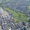
The Links are traditionally associated with the siege through the presence of two mounds, which since the 19th century have been identified as the platforms for siege guns directed against the eastern face of the French citadel. The mounds, known as Giant's Brae and Lady Fife's Brae are protected as scheduled
ancient monuments.
Trenches 1-3 exposed ephemeral anomalies related to the twentieth century use of the Links. Trenches 4 and 5 revealed a linear, banked feature which in places had been truncated by earth-moving operations in the 19th century. This feature appears to correspond to a linear feature shown on the Petworth map and possibly connected to the mound known as Giant's Brae. The bank was constructed from heaped sand and a negative
feature, possibly a posthole, was cut into the edge facing the former citadel. The remains of a shallow ditch were located to the rear of the low bank and may represent a borrow pit related to its construction. Questions still remain about the bank's function; it may be an earthwork related to the siege of 1560 or earlier military activity, or it may be a raised trackway crossing wet ground or some sort of land division.
Archive deposited with RCAHMS, Edinburgh City Council.
Funder: Edinburgh City Council.
Watching Brief (1 June 2015 - 29 June 2015)
Archaeological watching brief was carried out for the excavation of cable trenches for new street lights along the paths across the west end of Leith Links following the discovery of a human bone. Several bones were retrieved during the trenching. None of these bones were articulated burials, most of them appear to come from kernel pits, representing re-burial of bones from graves disturbed during construction work in this area.
A substantial stone wall, 1.3m wide, was uncovered in the trench some 12m to the east of Wellington Place. There are no records of any structure at this location on any maps and the structure may therefore pre-date the 19th century.
Funder: Crummock (Scotland) Ltd
Headland archaeology

