Carriblair
Cist (Bronze Age), Stone Circle (Bronze Age), Stone Circle (Bronze Age)(Possible), Food Vessel (Bronze Age)
Site Name Carriblair
Classification Cist (Bronze Age), Stone Circle (Bronze Age), Stone Circle (Bronze Age)(Possible), Food Vessel (Bronze Age)
Alternative Name(s) Carrieblair
Canmore ID 14642
Site Number NH78NW 1
NGR NH 70897 85118
Datum OSGB36 - NGR
Permalink http://canmore.org.uk/site/14642
- Council Highland
- Parish Edderton
- Former Region Highland
- Former District Ross And Cromarty
- Former County Ross And Cromarty
NH78NW 1 7090 8511.
(NH 7090 8511) Stone Circle (NR) (Remains of) Stone Cist found AD 1866 (NAT)
OS 6" map, Ross-shire, 2nd ed., (1907)
This stone circle consisted originally of ten stones of which five remain. Its diameter is 36ft, the whole interior at 6ins below the present surface is closely paved with round stones, and immediately under these, in the centre, was found a short cist with double cover containing fragments of a highly ornamental urn food vessel (PSAS 1931), pieces of burnt bone and bits of charcoal.
J M Joass 1870; Proc Soc Antiq Scot 1931.
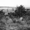
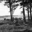
The remains of the stone circle lie in an area of cleared woodland. The circle has a probable diameter of some 13m. Five stones, all on the NW half, remain, no stones being visible in the SE half of the circle. The largest stone, on the NE perimeter, is 1.3m high and 2.8m in circumference. The other roundish boulders have an average height of 0.6m except for one, only 0.2m high. In the centre of the circle is a rectangular cavity in the bottom of which are two thin slab stones set on edge but only 0.4m apart. These stones, and possible remains of a cist, are possibly all that is left of a robbed cairn.
Resurveyed at 1:2500.
Visited by OS (W D J) 17 May 1963.
(NH 7090 8511) Cairn Circle (NR)
OS 25" map, (1969)
The remains of this cairn circle are in moderate to poor condition and as described by the previous field investigator. The interior has been disturbed by tree stumps and the SE side has been somewhat obscured by vegetation. The slab on the N side of the cist has possibly been displaced inwards.
Visited by OS (J B) 27 February 1981.
Field Visit (9 September 1943)
This site was included within the RCAHMS Emergency Survey (1942-3), an unpublished rescue project. Site descriptions, organised by county, vary from short notes to lengthy and full descriptions and are available to view online with contemporary sketches and photographs. The original typescripts, manuscripts, notebooks and photographs can also be consulted in the RCAHMS Search Room.
Information from RCAHMS (GFG) 10 December 2014.
Aerial Photography (1969)
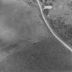
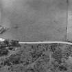
Oblique aerial photographs of Clach Chairidh Pictish symbol stone, Ederton and the site of Carriblair stone circle, photographed by John Dewar in 1969.
Field Visit (November 1977)
Carriblair NH 709 851 NH78NW 1
Four stones visible in dense vegetation are all that remain of what may have been a stone circle measuring 12m in diameter. A central cist containing a Food Vessel and a cremation was excavated in 1866.
RCAHMS 1979, November 1977
(Joass 1868, 269; PSAS, lxv 1930-1, 258)


