
Shoretown


Enclosure (Period Unassigned), Pit(S) (Period Unassigned)
Site Name Shoretown
Classification Enclosure (Period Unassigned), Pit(S) (Period Unassigned)
Canmore ID 146143
Site Number NH55NE 151
NGR NH 5965 5996
NGR Description centred on NH 5965 5996
Datum OSGB36 - NGR
Permalink http://canmore.org.uk/site/146143


- Council Highland
- Parish Urquhart And Logie Wester
- Former Region Highland
- Former District Ross And Cromarty
- Former County Ross And Cromarty
NH55NE 151 5965 5996 centred on NH 5965 5996
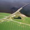
Oblique aerial photographs (RCAHMSAP 1995) have revealed the cropmarks of an enclosure and a possible pit-circle, 1km NE of Shoretown farmsteading. The enclosure (NH c.5965 5996) is circular in shape and has an internal diameter of about 30-40m. The SW side of a possible pit-circle (NH c.5963 6007) is visible approximately 70m to the NNW, and it measures about 30-40m in diameter. A number of pits, linear features and other indeterminate cropmarks are scattered across the field.
Information from RCAHMS (KJ) 21 June 1999.
Aerial Photographic Interpretation (19 March 2014)
Following a review of the aerial photographs, the pit circle recorded previously was not identified and has been removed as a classification. The cropmarks appear to be no more than a scatter of pits.
Information from RCAHMS (KMM) 19 March 2014

